Bouc-Bel-Air elevation
Bouc-Bel-Air (Provence-Alpes-Côte d'Azur, Département des Bouches-du-Rhône), France elevation is 253 meters and Bouc-Bel-Air elevation in feet is 830 ft above sea level [src 1]. Bouc-Bel-Air is a populated place (feature code) with elevation that is 79 meters (259 ft) bigger than average city elevation in France.
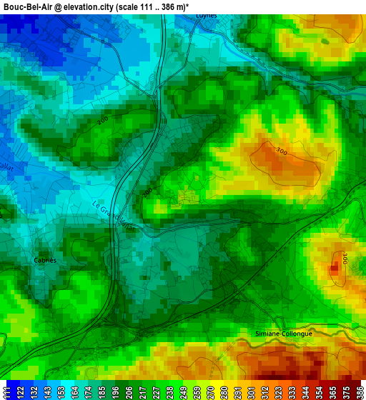
Below is the Elevation map of Bouc-Bel-Air, which displays elevation range with different colors. Scale of the first map is from 111 to 386 m (364 to 1266 ft) with average elevation of 214.6 meters (=704 ft) [note 1]
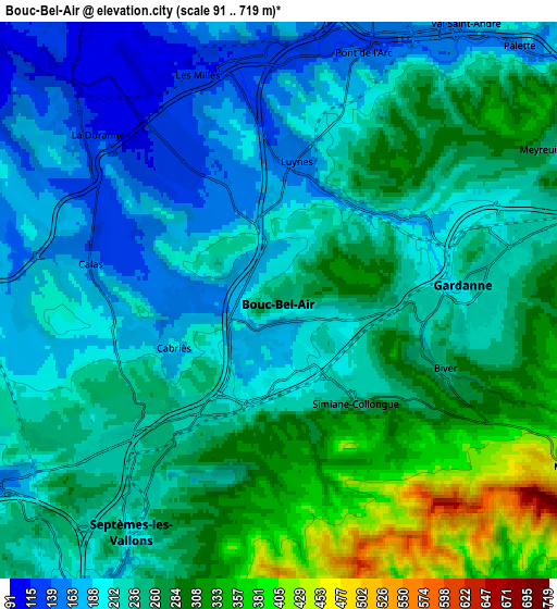
These maps also provides idea of topography and contour of this city, they are displayed at different zoom levels. More info about maps, scale and edge coordinates you can find below images.
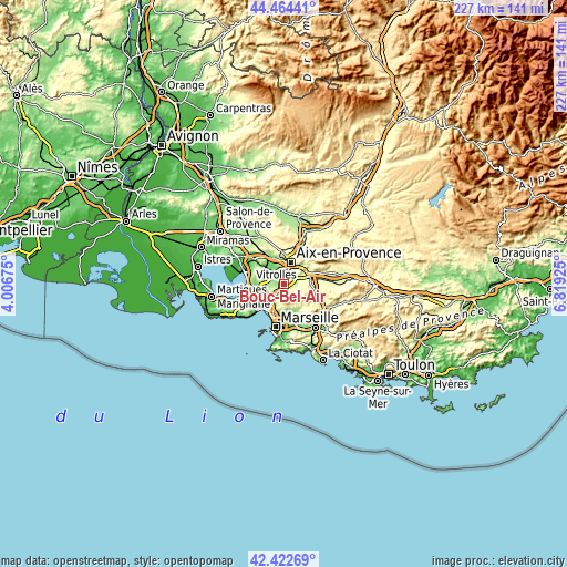
| \ | Map #1 | Map #2 | Topo.Map |
| Scale [m] | 111..386 m | 91..719 m | × |
| Scale [ft] | 364..1266 ft | 299..2359 ft | × |
| Average | 214.6 m = 704 ft | 240.4 m = 789 ft | × |
| Width | 7.09 km = 4.4 mi | 14.19 km = 8.8 mi | 227 km = 141.1 mi |
| Height | 7.09 km = 4.4 mi | 14.19 km = 8.8 mi | 227 km = 141.1 mi |
| ↑Max Latitude | 43.484064° | 43.51594° | 44.46441° |
| Latitude at center | 43.45217° | 43.45217° | 43.45217° |
| ↓Min Latitude | 43.42026° | 43.388332° | 42.42269° |
| ← Min Longitude | 5.369055° | 5.325109° | 4.00675° |
| Longitude center | 5.413° | 5.413° | 5.413° |
| →Max Longitude | 5.456945° | 5.500891° | 6.81925° |
Nearby cities:
Cities around Bouc-Bel-Air sort by population:
• Aix-en-Provence elevation 205 m
9 km,  19°
19°
• Marseille 15 153 m
10.1 km,  208°
208°
• Gardanne 216 m
4.5 km,  86°
86°
• Les Pennes-Mirabeau 159 m
9.7 km,  241°
241°
• Notre-Dame Limite 183 m
8.8 km, 207°
• Septèmes-les-Vallons 196 m
7.1 km, 212°
• Cabriès 203 m
3 km,  246°
246°
• Saint-Antoine 135 m
10 km, 205°
• Simiane-Collongue 229 m
3 km,  143°
143°
• Meyreuil 256 m
7.8 km,  59°
59°
• Mimet 497 m
8.6 km,  119°
119°
• Palama 239 m
9.9 km,  165°
165°
Multilingual:
 En español:
Bouc-Bel-Air elevación 253 m.
 En France:
Bouc-Bel-Air élévation 253 m.
 Auf Deutsch:
Bouc-Bel-Air höhe über dem Meeresspiegel ist 253 m.

Sources and notes:
- [note 1] Map square and city borders are not equal. Map elevation data is calculated only from area inside that square.
- [src 1] Elevation data from geonames database provided with same terms of usage.
- [src 2] The elevation map of Bouc-Bel-Air is generated using elevation data from NASA's 3 arcsec (90m) resolution SRTM data.
- [src 3] Base (background) map © OpenStreetMap contributors tiles are generated by Geofabrik and OpenTopoMap.
Copyright & License:
This Bouc-Bel-Air Elevation Map is licensed under CC BY-SA. You may reuse any part from this page, if you give a proper credit by linking to this URL:
 More info on terms of use page.