Bruz elevation
Bruz (Brittany, Département d'Ille-et-Vilaine), France elevation is 42 meters and Bruz elevation in feet is 138 ft above sea level [src 1]. Bruz is a populated place (feature code) with elevation that is 132 meters (433 ft) smaller than average city elevation in France.
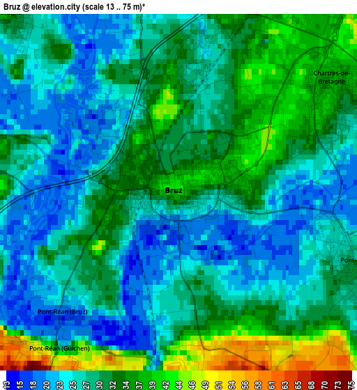
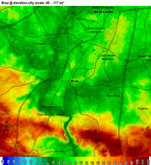
Below is the Elevation map of Bruz, which displays elevation range with different colors. Scale of the first map is from 13 to 75 m (43 to 246 ft) with average elevation of 29.5 meters (=97 ft) [note 1]
These maps also provides idea of topography and contour of this city, they are displayed at different zoom levels. More info about maps, scale and edge coordinates you can find below images.
| \ | Map #1 | Map #2 | Topo.Map |
| Scale [m] | 13..75 m | -40..117 m | × |
| Scale [ft] | 43..246 ft | -131..384 ft | × |
| Average | 29.5 m = 97 ft | 43.3 m = 142 ft | × |
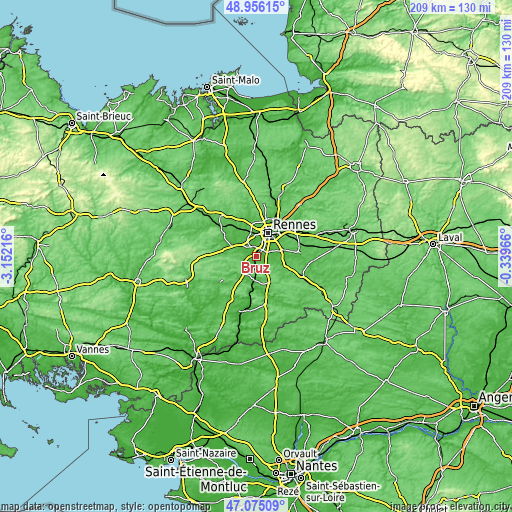
| Width | 6.54 km = 4.1 mi | 13.07 km = 8.1 mi | 209.2 km = 130 mi |
| Height | 6.54 km = 4.1 mi | 13.07 km = 8.1 mi | 209.1 km = 129.9 mi |
| ↑Max Latitude | 48.053583° | 48.082949° | 48.95615° |
| Latitude at center | 48.0242° | 48.0242° | 48.0242° |
| ↓Min Latitude | 47.9948° | 47.965384° | 47.07509° |
| ← Min Longitude | -1.789855° | -1.833801° | -3.15216° |
| Longitude center | -1.74591° | -1.74591° | -1.74591° |
| →Max Longitude | -1.701965° | -1.658019° | -0.33966° |
Nearby cities:
Cities around Bruz sort by population:
• Saint-Jacques-de-la-Lande elevation 38 m
4.9 km,  22°
22°
• Guichen 81 m
7.3 km,  210°
210°
• Chartres-de-Bretagne 32 m
3.4 km,  61°
61°
• Le Rheu 36 m
9.5 km,  336°
336°
• Mordelles 34 m
9.2 km,  308°
308°
• Châtillon-sur-Seiche 23 m
5.7 km,  78°
78°
• Bréal-sous-Montfort 56 m
9.2 km,  287°
287°
• Laillé 103 m
5.5 km,  156°
156°
• Chavagne 32 m
4.5 km,  318°
318°
• Goven 102 m
7.7 km,  255°
255°
• Orgères 47 m
6.5 km,  115°
115°
• Saint-Erblon 37 m
7 km,  94°
94°
Multilingual:
 En español:
Bruz elevación 42 m.
 En France:
Bruz élévation 42 m.


Sources and notes:
- [note 1] Map square and city borders are not equal. Map elevation data is calculated only from area inside that square.
- [src 1] Elevation data from geonames database provided with same terms of usage.
- [src 2] The elevation map of Bruz is generated using elevation data from NASA's 3 arcsec (90m) resolution SRTM data.
- [src 3] Base (background) map © OpenStreetMap contributors tiles are generated by Geofabrik and OpenTopoMap.
Copyright & License:
This Bruz Elevation Map is licensed under CC BY-SA. You may reuse any part from this page, if you give a proper credit by linking to this URL:
 More info on terms of use page.