Guichen elevation
Guichen (Brittany, Département d'Ille-et-Vilaine), France elevation is 81 meters and Guichen elevation in feet is 266 ft above sea level [src 1]. Guichen is a populated place (feature code) with elevation that is 93 meters (305 ft) smaller than average city elevation in France.
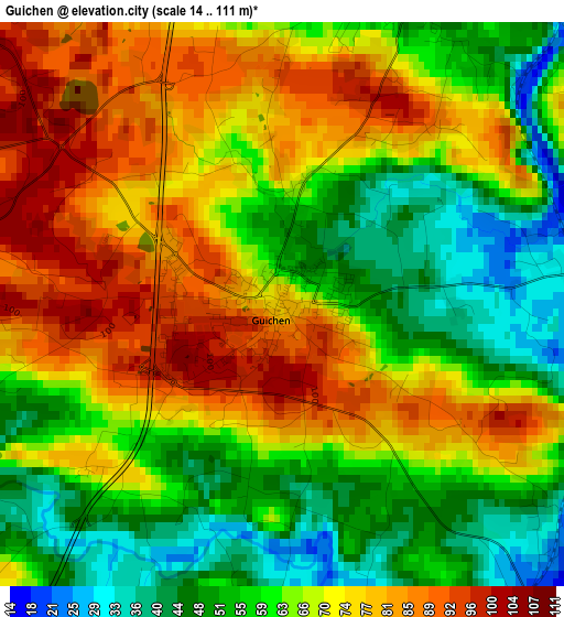
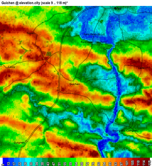
Below is the Elevation map of Guichen, which displays elevation range with different colors. Scale of the first map is from 14 to 111 m (46 to 364 ft) with average elevation of 66.4 meters (=218 ft) [note 1]
These maps also provides idea of topography and contour of this city, they are displayed at different zoom levels. More info about maps, scale and edge coordinates you can find below images.
| \ | Map #1 | Map #2 | Topo.Map |
| Scale [m] | 14..111 m | 9..118 m | × |
| Scale [ft] | 46..364 ft | 30..387 ft | × |
| Average | 66.4 m = 218 ft | 61.5 m = 202 ft | × |
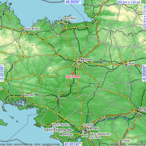
| Width | 6.54 km = 4.1 mi | 13.09 km = 8.1 mi | 209.4 km = 130.1 mi |
| Height | 6.54 km = 4.1 mi | 13.09 km = 8.1 mi | 209.4 km = 130.1 mi |
| ↑Max Latitude | 47.997035° | 48.026434° | 48.9006° |
| Latitude at center | 47.96762° | 47.96762° | 47.96762° |
| ↓Min Latitude | 47.938188° | 47.908739° | 47.01747° |
| ← Min Longitude | -1.839285° | -1.883231° | -3.20159° |
| Longitude center | -1.79534° | -1.79534° | -1.79534° |
| →Max Longitude | -1.751395° | -1.707449° | -0.38909° |
Nearby cities:
Cities around Guichen sort by population:
• Bruz elevation 42 m
7.3 km,  30°
30°
• Laillé 103 m
6 km,  78°
78°
• Chavagne 32 m
9.7 km,  4°
4°
• Goven 102 m
5.7 km,  318°
318°
• Orgères 47 m
10.1 km,  69°
69°
• Guignen 72 m
7.2 km,  223°
223°
• Bourg-des-Comptes 36 m
5.7 km,  138°
138°
• Pléchâtel 72 m
8.8 km,  156°
156°
• Crevin 76 m
10.3 km,  111°
111°
• Baulon 110 m
10.3 km,  281°
281°
• Lassy 85 m
5.8 km, 281°
• Saint-Senoux 60 m
6.9 km,  175°
175°
Multilingual:
 En español:
Guichen elevación 81 m.
 En France:
Guichen élévation 81 m.


Sources and notes:
- [note 1] Map square and city borders are not equal. Map elevation data is calculated only from area inside that square.
- [src 1] Elevation data from geonames database provided with same terms of usage.
- [src 2] The elevation map of Guichen is generated using elevation data from NASA's 3 arcsec (90m) resolution SRTM data.
- [src 3] Base (background) map © OpenStreetMap contributors tiles are generated by Geofabrik and OpenTopoMap.
Copyright & License:
This Guichen Elevation Map is licensed under CC BY-SA. You may reuse any part from this page, if you give a proper credit by linking to this URL:
 More info on terms of use page.