Le Rheu elevation
Le Rheu (Brittany, Département d'Ille-et-Vilaine), France elevation is 36 meters and Le Rheu elevation in feet is 118 ft above sea level [src 1]. Le Rheu is a populated place (feature code) with elevation that is 138 meters (453 ft) smaller than average city elevation in France.
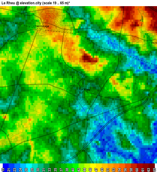
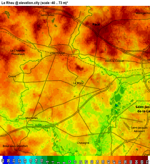
Below is the Elevation map of Le Rheu, which displays elevation range with different colors. Scale of the first map is from 19 to 65 m (62 to 213 ft) with average elevation of 37.7 meters (=124 ft) [note 1]
These maps also provides idea of topography and contour of this city, they are displayed at different zoom levels. More info about maps, scale and edge coordinates you can find below images.
| \ | Map #1 | Map #2 | Topo.Map |
| Scale [m] | 19..65 m | -40..73 m | × |
| Scale [ft] | 62..213 ft | -131..240 ft | × |
| Average | 37.7 m = 124 ft | 38.8 m = 127 ft | × |
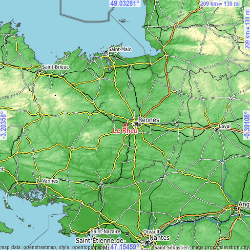
| Width | 6.53 km = 4.1 mi | 13.05 km = 8.1 mi | 208.8 km = 129.7 mi |
| Height | 6.53 km = 4.1 mi | 13.05 km = 8.1 mi | 208.8 km = 129.7 mi |
| ↑Max Latitude | 48.131618° | 48.16094° | 49.03281° |
| Latitude at center | 48.10228° | 48.10228° | 48.10228° |
| ↓Min Latitude | 48.072925° | 48.043553° | 47.15459° |
| ← Min Longitude | -1.841275° | -1.885221° | -3.20358° |
| Longitude center | -1.79733° | -1.79733° | -1.79733° |
| →Max Longitude | -1.753385° | -1.709439° | -0.39108° |
Nearby cities:
Cities around Le Rheu sort by population:
• Rennes elevation 39 m
9.2 km,  83°
83°
• Pacé 53 m
5.4 km,  19°
19°
• Saint-Jacques-de-la-Lande 38 m
7 km,  126°
126°
• Mordelles 34 m
4.5 km,  228°
228°
• Vezin-le-Coquet 50 m
3.6 km,  60°
60°
• Bréal-sous-Montfort 56 m
7.8 km,  219°
219°
• Saint-Gilles 52 m
6.1 km,  340°
340°
• Chavagne 32 m
5.4 km,  170°
170°
• Breteil 58 m
8.9 km,  302°
302°
• Montgermont 54 m
8.6 km,  45°
45°
• La Chapelle-Thouarault 50 m
5.7 km, 296°
• Cintré 39 m
5.5 km,  273°
273°
Multilingual:
 En español:
Le Rheu elevación 36 m.
 En France:
Le Rheu élévation 36 m.


Sources and notes:
- [note 1] Map square and city borders are not equal. Map elevation data is calculated only from area inside that square.
- [src 1] Elevation data from geonames database provided with same terms of usage.
- [src 2] The elevation map of Le Rheu is generated using elevation data from NASA's 3 arcsec (90m) resolution SRTM data.
- [src 3] Base (background) map © OpenStreetMap contributors tiles are generated by Geofabrik and OpenTopoMap.
Copyright & License:
This Le Rheu Elevation Map is licensed under CC BY-SA. You may reuse any part from this page, if you give a proper credit by linking to this URL:
 More info on terms of use page.