Carling elevation
Carling (Grand Est, Moselle), France elevation is 247 meters and Carling elevation in feet is 810 ft above sea level [src 1]. Carling is a populated place (feature code) with elevation that is 73 meters (240 ft) bigger than average city elevation in France.
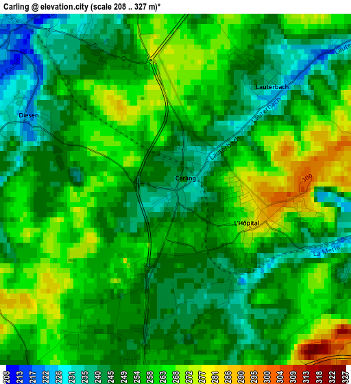
Below is the Elevation map of Carling, which displays elevation range with different colors. Scale of the first map is from 208 to 327 m (682 to 1073 ft) with average elevation of 254.6 meters (=835 ft) [note 1]
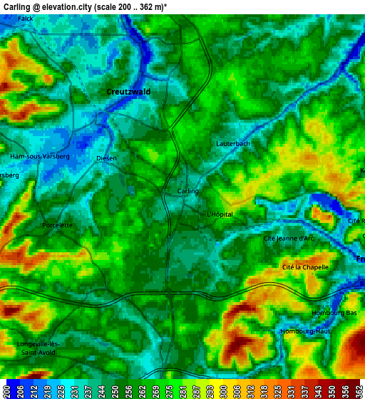
These maps also provides idea of topography and contour of this city, they are displayed at different zoom levels. More info about maps, scale and edge coordinates you can find below images.
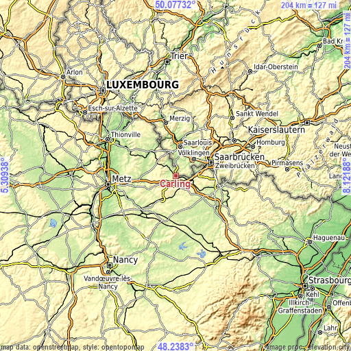
| \ | Map #1 | Map #2 | Topo.Map |
| Scale [m] | 208..327 m | 200..362 m | × |
| Scale [ft] | 682..1073 ft | 656..1188 ft | × |
| Average | 254.6 m = 835 ft | 258.3 m = 847 ft | × |
| Width | 6.39 km = 4 mi | 12.78 km = 7.9 mi | 204.5 km = 127.1 mi |
| Height | 6.39 km = 4 mi | 12.78 km = 7.9 mi | 204.5 km = 127.1 mi |
| ↑Max Latitude | 49.195076° | 49.223785° | 50.07732° |
| Latitude at center | 49.16635° | 49.16635° | 49.16635° |
| ↓Min Latitude | 49.137607° | 49.108848° | 48.2383° |
| ← Min Longitude | 6.671685° | 6.627739° | 5.30938° |
| Longitude center | 6.71563° | 6.71563° | 6.71563° |
| →Max Longitude | 6.759575° | 6.803521° | 8.12188° |
Nearby cities:
Cities around Carling sort by population:
• Saint-Avold elevation 251 m
6.9 km,  187°
187°
• Freyming-Merlebach 267 m
5.2 km,  110°
110°
• Creutzwald 238 m
4.5 km,  342°
342°
• Hombourg-Haut 249 m
5.8 km,  136°
136°
• Longeville-lès-Saint-Avold 247 m
7.6 km,  223°
223°
• Valmont 280 m
9.2 km, 188°
• Macheren 293 m
8.6 km,  148°
148°
• Ham-sous-Varsberg 224 m
5.2 km,  287°
287°
• Falck 247 m
9 km,  318°
318°
• Porcelette 259 m
4.5 km,  256°
256°
• Béning-lès-Saint-Avold 260 m
9.6 km, 111°
• Diesen 242 m
3 km,  295°
295°
Multilingual:
 En español:
Carling elevación 247 m.
 En France:
Carling élévation 247 m.


Sources and notes:
- [note 1] Map square and city borders are not equal. Map elevation data is calculated only from area inside that square.
- [src 1] Elevation data from geonames database provided with same terms of usage.
- [src 2] The elevation map of Carling is generated using elevation data from NASA's 3 arcsec (90m) resolution SRTM data.
- [src 3] Base (background) map © OpenStreetMap contributors tiles are generated by Geofabrik and OpenTopoMap.
Copyright & License:
This Carling Elevation Map is licensed under CC BY-SA. You may reuse any part from this page, if you give a proper credit by linking to this URL:
 More info on terms of use page.