Freyming-Merlebach elevation
Freyming-Merlebach (Grand Est, Moselle), France elevation is 267 meters and Freyming-Merlebach elevation in feet is 876 ft above sea level [src 1]. Freyming-Merlebach is a populated place (feature code) with elevation that is 93 meters (305 ft) bigger than average city elevation in France.
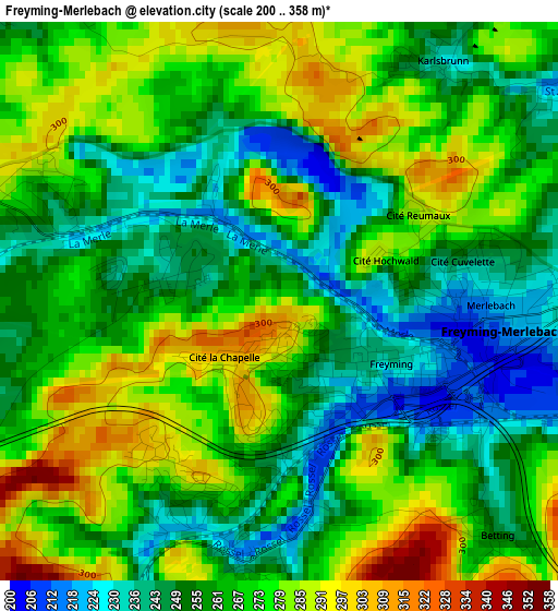
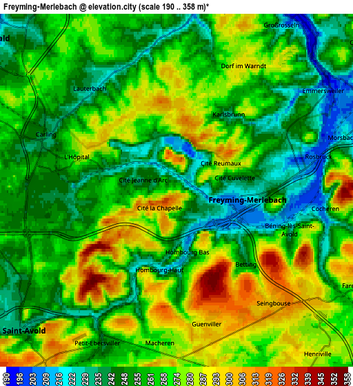
Below is the Elevation map of Freyming-Merlebach, which displays elevation range with different colors. Scale of the first map is from 200 to 358 m (656 to 1175 ft) with average elevation of 264.8 meters (=869 ft) [note 1]
These maps also provides idea of topography and contour of this city, they are displayed at different zoom levels. More info about maps, scale and edge coordinates you can find below images.
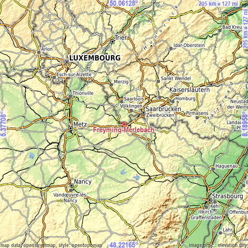
| \ | Map #1 | Map #2 | Topo.Map |
| Scale [m] | 200..358 m | 190..358 m | × |
| Scale [ft] | 656..1175 ft | 623..1175 ft | × |
| Average | 264.8 m = 869 ft | 263.5 m = 865 ft | × |
| Width | 6.39 km = 4 mi | 12.78 km = 7.9 mi | 204.5 km = 127.1 mi |
| Height | 6.39 km = 4 mi | 12.78 km = 7.9 mi | 204.5 km = 127.1 mi |
| ↑Max Latitude | 49.178735° | 49.207454° | 50.06128° |
| Latitude at center | 49.15° | 49.15° | 49.15° |
| ↓Min Latitude | 49.121248° | 49.092479° | 48.22165° |
| ← Min Longitude | 6.739385° | 6.695439° | 5.37708° |
| Longitude center | 6.78333° | 6.78333° | 6.78333° |
| →Max Longitude | 6.827275° | 6.871221° | 8.18958° |
Nearby cities:
Cities around Freyming-Merlebach sort by population:
• Saint-Avold elevation 251 m
7.7 km,  228°
228°
• Hombourg-Haut 249 m
2.6 km,  200°
200°
• Farébersviller 290 m
7.1 km,  118°
118°
• Carling 247 m
5.2 km,  290°
290°
• Cocheren 280 m
5.4 km,  97°
97°
• Macheren 293 m
5.6 km,  184°
184°
• Morsbach 221 m
6.7 km,  72°
72°
• Théding 310 m
8.3 km,  106°
106°
• Seingbouse 311 m
5.4 km,  139°
139°
• Folkling 294 m
8.1 km,  91°
91°
• Béning-lès-Saint-Avold 260 m
4.4 km, 112°
• Diesen 242 m
8.3 km, 292°
Multilingual:
 En español:
Freyming-Merlebach elevación 267 m.
 En France:
Freyming, Merlebach élévation 267 m.
 Auf Deutsch:
Freyming-Merlebach höhe über dem Meeresspiegel ist 267 m.
 На русском:
Freyming-Merlebach высота над уровнем моря 267 м
Sources and notes:
- [note 1] Map square and city borders are not equal. Map elevation data is calculated only from area inside that square.
- [src 1] Elevation data from geonames database provided with same terms of usage.
- [src 2] The elevation map of Freyming-Merlebach is generated using elevation data from NASA's 3 arcsec (90m) resolution SRTM data.
- [src 3] Base (background) map © OpenStreetMap contributors tiles are generated by Geofabrik and OpenTopoMap.
Copyright & License:
This Freyming-Merlebach Elevation Map is licensed under CC BY-SA. You may reuse any part from this page, if you give a proper credit by linking to this URL:
 More info on terms of use page.