Cérilly elevation
Cérilly (Auvergne-Rhône-Alpes, Département de l'Allier), France elevation is 333 meters and Cérilly elevation in feet is 1093 ft above sea level [src 1]. Cérilly is a populated place (feature code) with elevation that is 159 meters (522 ft) bigger than average city elevation in France.
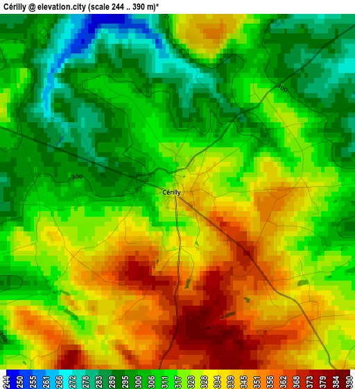
Below is the Elevation map of Cérilly, which displays elevation range with different colors. Scale of the first map is from 244 to 390 m (801 to 1280 ft) with average elevation of 319.2 meters (=1047 ft) [note 1]
These maps also provides idea of topography and contour of this city, they are displayed at different zoom levels. More info about maps, scale and edge coordinates you can find below images.
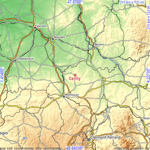
| \ | Map #1 | Topo.Map |
| Scale [m] | 244..390 m | × |
| Scale [ft] | 801..1280 ft | × |
| Average | 319.2 m = 1047 ft | × |
| Width | 6.71 km = 4.2 mi | 214.8 km = 133.5 mi |
| Height | 6.71 km = 4.2 mi | 214.8 km = 133.5 mi |
| ↑Max Latitude | 46.648086° | 47.5752° |
| Latitude at center | 46.61791° | 46.61791° |
| ↓Min Latitude | 46.587717° | 45.64339° |
| ← Min Longitude | 2.776855° | 1.41455° |
| Longitude center | 2.8208° | 2.8208° |
| →Max Longitude | 2.864745° | 4.22705° |
Nearby cities:
Cities around Cérilly sort by population:
• Saint-Amand-Montrond elevation 159 m
26.8 km,  295°
295°
• Sancoins 199 m
25.2 km,  17°
17°
• Bourbon-l’Archambault 266 m
18.4 km,  102°
102°
• Lurcy-Lévis 220 m
15.3 km,  35°
35°
• Orval 168 m
29.2 km,  294°
294°
• Saint-Victor 199 m
29.6 km,  213°
213°
• Vallon-en-Sully 183 m
18.6 km,  240°
240°
• Villefranche-d’Allier 278 m
24.8 km,  173°
173°
• Buxières-les-Mines 300 m
19.8 km,  147°
147°
• Ainay-le-Château 216 m
14.3 km,  316°
316°
• Charenton-du-Cher 180 m
18.3 km,  312°
312°
• Estivareilles 208 m
26.4 km,  215°
215°
Multilingual:
 En español:
Cérilly elevación 333 m.
 En France:
Cérilly élévation 333 m.


Sources and notes:
- [note 1] Map square and city borders are not equal. Map elevation data is calculated only from area inside that square.
- [src 1] Elevation data from geonames database provided with same terms of usage.
- [src 2] The elevation map of Cérilly is generated using elevation data from NASA's 3 arcsec (90m) resolution SRTM data.
- [src 3] Base (background) map © OpenStreetMap contributors tiles are generated by Geofabrik and OpenTopoMap.
Copyright & License:
This Cérilly Elevation Map is licensed under CC BY-SA. You may reuse any part from this page, if you give a proper credit by linking to this URL:
 More info on terms of use page.