Chalindrey elevation
Chalindrey (Grand Est, Haute-Marne), France elevation is 344 meters and Chalindrey elevation in feet is 1129 ft above sea level [src 1]. Chalindrey is a populated place (feature code) with elevation that is 170 meters (558 ft) bigger than average city elevation in France.
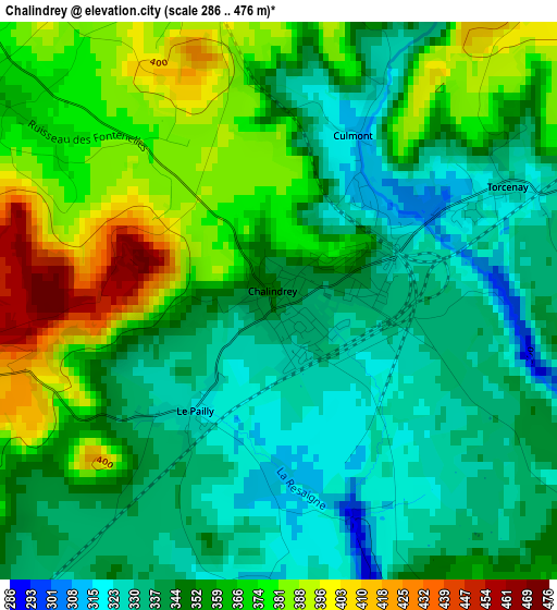
Below is the Elevation map of Chalindrey, which displays elevation range with different colors. Scale of the first map is from 286 to 476 m (938 to 1562 ft) with average elevation of 354 meters (=1161 ft) [note 1]
These maps also provides idea of topography and contour of this city, they are displayed at different zoom levels. More info about maps, scale and edge coordinates you can find below images.
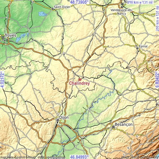
| \ | Map #1 | Topo.Map |
| Scale [m] | 286..476 m | × |
| Scale [ft] | 938..1562 ft | × |
| Average | 354 m = 1161 ft | × |
| Width | 6.56 km = 4.1 mi | 210.1 km = 130.5 mi |
| Height | 6.56 km = 4.1 mi | 210 km = 130.5 mi |
| ↑Max Latitude | 47.832589° | 48.73905° |
| Latitude at center | 47.80308° | 47.80308° |
| ↓Min Latitude | 47.773554° | 46.84993° |
| ← Min Longitude | 5.384025° | 4.02172° |
| Longitude center | 5.42797° | 5.42797° |
| →Max Longitude | 5.471915° | 6.83422° |
Nearby cities:
Cities around Chalindrey sort by population:
• Langres elevation 438 m
9.7 km,  313°
313°
• Nogent-le-Bas 327 m
25.1 km,  343°
343°
• Selongey 298 m
30 km,  217°
217°
• Bourbonne-les-Bains 273 m
29.1 km,  55°
55°
• Val-de-Meuse 390 m
22.5 km,  13°
13°
• Champlitte-la-Ville 220 m
22.5 km,  159°
159°
• Champlitte 221 m
21.8 km, 162°
• Jussey 224 m
35.5 km,  85°
85°
• Fayl-Billot 328 m
13 km,  100°
100°
• Rolampont 312 m
19.4 km,  326°
326°
• Biesles 389 m
33 km, 342°
• Dampierre-sur-Salon 203 m
33.2 km,  145°
145°
Multilingual:
 En español:
Chalindrey elevación 344 m.
 En France:
Chalindrey élévation 344 m.
 Auf Deutsch:
Chalindrey höhe über dem Meeresspiegel ist 344 m.

Sources and notes:
- [note 1] Map square and city borders are not equal. Map elevation data is calculated only from area inside that square.
- [src 1] Elevation data from geonames database provided with same terms of usage.
- [src 2] The elevation map of Chalindrey is generated using elevation data from NASA's 3 arcsec (90m) resolution SRTM data.
- [src 3] Base (background) map © OpenStreetMap contributors tiles are generated by Geofabrik and OpenTopoMap.
Copyright & License:
This Chalindrey Elevation Map is licensed under CC BY-SA. You may reuse any part from this page, if you give a proper credit by linking to this URL:
 More info on terms of use page.