Changé elevation
Changé (Pays de la Loire, Sarthe), France elevation is 57 meters and Changé elevation in feet is 187 ft above sea level [src 1]. Changé is a populated place (feature code) with elevation that is 117 meters (384 ft) smaller than average city elevation in France.
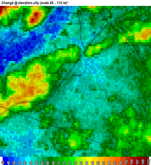
Below is the Elevation map of Changé, which displays elevation range with different colors. Scale of the first map is from 45 to 112 m (148 to 367 ft) with average elevation of 65.5 meters (=215 ft) [note 1]
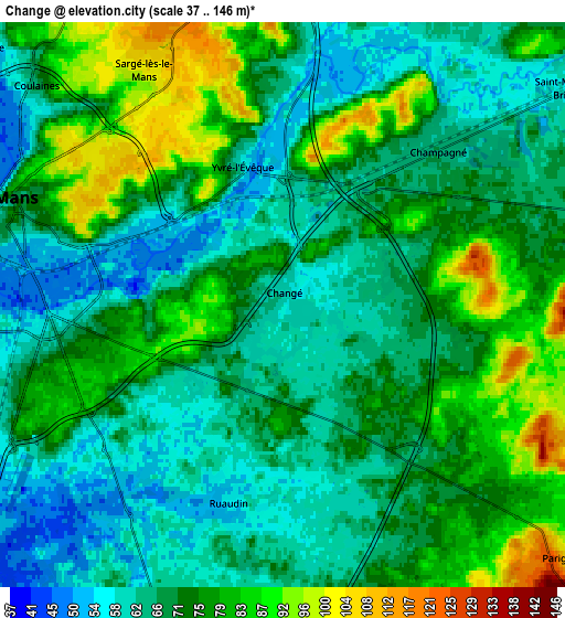
These maps also provides idea of topography and contour of this city, they are displayed at different zoom levels. More info about maps, scale and edge coordinates you can find below images.
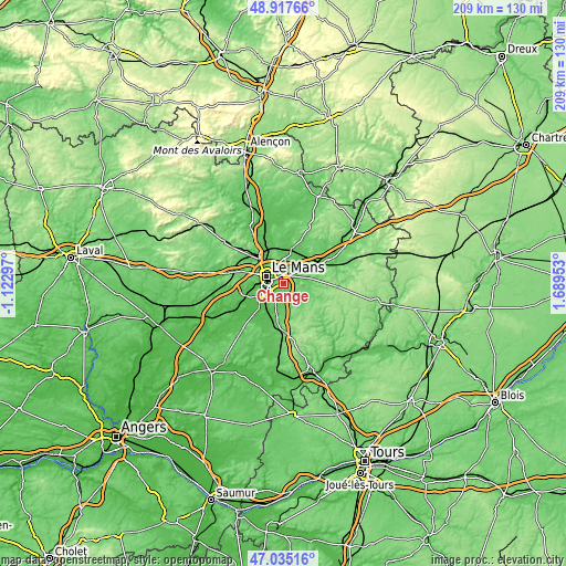
| \ | Map #1 | Map #2 | Topo.Map |
| Scale [m] | 45..112 m | 37..146 m | × |
| Scale [ft] | 148..367 ft | 121..479 ft | × |
| Average | 65.5 m = 215 ft | 71.1 m = 233 ft | × |
| Width | 6.54 km = 4.1 mi | 13.08 km = 8.1 mi | 209.3 km = 130.1 mi |
| Height | 6.54 km = 4.1 mi | 13.08 km = 8.1 mi | 209.3 km = 130.1 mi |
| ↑Max Latitude | 48.014395° | 48.043784° | 48.91766° |
| Latitude at center | 47.98499° | 47.98499° | 47.98499° |
| ↓Min Latitude | 47.955568° | 47.926129° | 47.03516° |
| ← Min Longitude | 0.239335° | 0.195389° | -1.12297° |
| Longitude center | 0.28328° | 0.28328° | 0.28328° |
| →Max Longitude | 0.327225° | 0.371171° | 1.68953° |
Nearby cities:
Cities around Changé sort by population:
• Le Mans elevation 76 m
6.1 km,  286°
286°
• Allonnes 49 m
9.5 km,  258°
258°
• Coulaines 55 m
7.3 km,  306°
306°
• Arnage 42 m
9.7 km,  227°
227°
• Mulsanne 67 m
8.5 km,  197°
197°
• Sargé-lès-le-Mans 98 m
6.5 km,  325°
325°
• Champagné 66 m
5.4 km,  40°
40°
• Ruaudin 56 m
4.6 km,  194°
194°
• Teloché 70 m
10.8 km,  184°
184°
• Saint-Mars-la-Brière 59 m
8.4 km,  52°
52°
• La Chapelle-Saint-Aubin 97 m
11 km,  300°
300°
• Brette-les-Pins 96 m
9.2 km,  154°
154°
Multilingual:
 En español:
Changé elevación 57 m.
 En France:
Changé élévation 57 m.


Sources and notes:
- [note 1] Map square and city borders are not equal. Map elevation data is calculated only from area inside that square.
- [src 1] Elevation data from geonames database provided with same terms of usage.
- [src 2] The elevation map of Changé is generated using elevation data from NASA's 3 arcsec (90m) resolution SRTM data.
- [src 3] Base (background) map © OpenStreetMap contributors tiles are generated by Geofabrik and OpenTopoMap.
Copyright & License:
This Changé Elevation Map is licensed under CC BY-SA. You may reuse any part from this page, if you give a proper credit by linking to this URL:
 More info on terms of use page.