Sargé-lès-le-Mans elevation
Sargé-lès-le-Mans (Pays de la Loire, Sarthe), France elevation is 98 meters and Sargé-lès-le-Mans elevation in feet is 322 ft above sea level [src 1]. Sargé-lès-le-Mans is a populated place (feature code) with elevation that is 76 meters (249 ft) smaller than average city elevation in France.
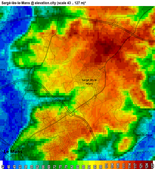
Below is the Elevation map of Sargé-lès-le-Mans, which displays elevation range with different colors. Scale of the first map is from 43 to 127 m (141 to 417 ft) with average elevation of 86.6 meters (=284 ft) [note 1]
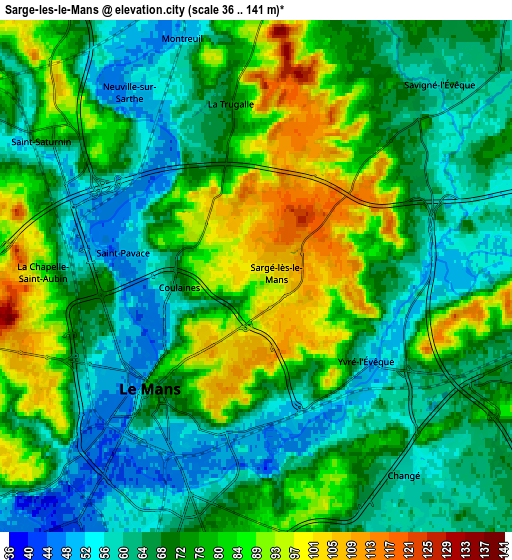
These maps also provides idea of topography and contour of this city, they are displayed at different zoom levels. More info about maps, scale and edge coordinates you can find below images.
| \ | Map #1 | Map #2 | Topo.Map |
| Scale [m] | 43..127 m | 36..141 m | × |
| Scale [ft] | 141..417 ft | 118..463 ft | × |
| Average | 86.6 m = 284 ft | 73.4 m = 241 ft | × |
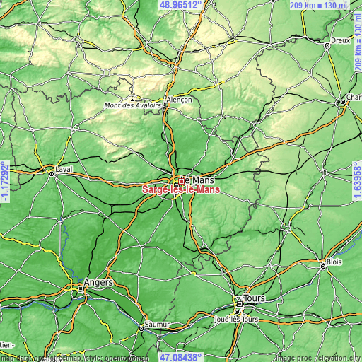
| Width | 6.53 km = 4.1 mi | 13.07 km = 8.1 mi | 209.1 km = 129.9 mi |
| Height | 6.53 km = 4.1 mi | 13.07 km = 8.1 mi | 209.1 km = 129.9 mi |
| ↑Max Latitude | 48.062708° | 48.092069° | 48.96512° |
| Latitude at center | 48.03333° | 48.03333° | 48.03333° |
| ↓Min Latitude | 48.003935° | 47.974524° | 47.08438° |
| ← Min Longitude | 0.189385° | 0.145439° | -1.17292° |
| Longitude center | 0.23333° | 0.23333° | 0.23333° |
| →Max Longitude | 0.277275° | 0.321221° | 1.63958° |
Nearby cities:
Cities around Sargé-lès-le-Mans sort by population:
• Le Mans elevation 76 m
4.2 km,  210°
210°
• Allonnes 49 m
9.2 km,  217°
217°
• Coulaines 55 m
2.4 km,  244°
244°
• Changé 57 m
6.5 km,  145°
145°
• Champagné 66 m
7.4 km,  99°
99°
• La Bazoge 98 m
9.1 km,  320°
320°
• Rouillon 98 m
7.9 km,  247°
247°
• La Milesse 58 m
8.1 km,  294°
294°
• Neuville-sur-Sarthe 51 m
5.6 km,  327°
327°
• Saint-Saturnin 68 m
6.6 km, 294°
• La Chapelle-Saint-Aubin 97 m
5.7 km,  272°
272°
• Trangé 110 m
9.2 km, 265°
Multilingual:
 En español:
Sargé-lès-le-Mans elevación 98 m.
 En France:
Sargé-lès-le-Mans élévation 98 m.
 Auf Deutsch:
Sargé-lès-le-Mans höhe über dem Meeresspiegel ist 98 m.

Sources and notes:
- [note 1] Map square and city borders are not equal. Map elevation data is calculated only from area inside that square.
- [src 1] Elevation data from geonames database provided with same terms of usage.
- [src 2] The elevation map of Sargé-lès-le-Mans is generated using elevation data from NASA's 3 arcsec (90m) resolution SRTM data.
- [src 3] Base (background) map © OpenStreetMap contributors tiles are generated by Geofabrik and OpenTopoMap.
Copyright & License:
This Sargé-lès-le-Mans Elevation Map is licensed under CC BY-SA. You may reuse any part from this page, if you give a proper credit by linking to this URL:
 More info on terms of use page.