Arnage elevation
Arnage (Pays de la Loire, Sarthe), France elevation is 42 meters and Arnage elevation in feet is 138 ft above sea level [src 1]. Arnage is a populated place (feature code) with elevation that is 132 meters (433 ft) smaller than average city elevation in France.
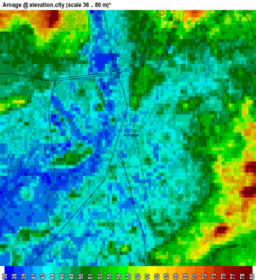
Below is the Elevation map of Arnage, which displays elevation range with different colors. Scale of the first map is from 36 to 80 m (118 to 262 ft) with average elevation of 48.4 meters (=159 ft) [note 1]
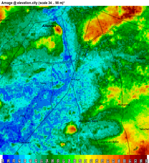
These maps also provides idea of topography and contour of this city, they are displayed at different zoom levels. More info about maps, scale and edge coordinates you can find below images.
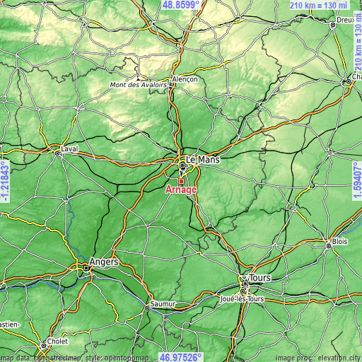
| \ | Map #1 | Map #2 | Topo.Map |
| Scale [m] | 36..80 m | 34..98 m | × |
| Scale [ft] | 118..262 ft | 112..322 ft | × |
| Average | 48.4 m = 159 ft | 54 m = 177 ft | × |
| Width | 6.55 km = 4.1 mi | 13.1 km = 8.1 mi | 209.6 km = 130.2 mi |
| Height | 6.55 km = 4.1 mi | 13.1 km = 8.1 mi | 209.5 km = 130.2 mi |
| ↑Max Latitude | 47.955599° | 47.985021° | 48.8599° |
| Latitude at center | 47.92616° | 47.92616° | 47.92616° |
| ↓Min Latitude | 47.896704° | 47.867232° | 46.97526° |
| ← Min Longitude | 0.143875° | 0.099929° | -1.21843° |
| Longitude center | 0.18782° | 0.18782° | 0.18782° |
| →Max Longitude | 0.231765° | 0.275711° | 1.59407° |
Nearby cities:
Cities around Arnage sort by population:
• Le Mans elevation 76 m
8.3 km,  8°
8°
• Allonnes 49 m
5.1 km,  334°
334°
• Mulsanne 67 m
4.9 km,  109°
109°
• Ruaudin 56 m
6.3 km,  70°
70°
• Teloché 70 m
7.5 km,  124°
124°
• Guécélard 40 m
6.9 km,  218°
218°
• Moncé-en-Belin 57 m
3.6 km,  167°
167°
• Spay 42 m
2.6 km,  264°
264°
• Étival-lès-le-Mans 55 m
8.2 km,  288°
288°
• Laigné-en-Belin 65 m
6.2 km,  151°
151°
• Saint-Gervais-en-Belin 62 m
5.9 km,  157°
157°
• Fillé 41 m
5.5 km,  238°
238°
Multilingual:
 En español:
Arnage elevación 42 m.
 En France:
Arnage élévation 42 m.


Sources and notes:
- [note 1] Map square and city borders are not equal. Map elevation data is calculated only from area inside that square.
- [src 1] Elevation data from geonames database provided with same terms of usage.
- [src 2] The elevation map of Arnage is generated using elevation data from NASA's 3 arcsec (90m) resolution SRTM data.
- [src 3] Base (background) map © OpenStreetMap contributors tiles are generated by Geofabrik and OpenTopoMap.
Copyright & License:
This Arnage Elevation Map is licensed under CC BY-SA. You may reuse any part from this page, if you give a proper credit by linking to this URL:
 More info on terms of use page.