Châtel-Guyon elevation
Châtel-Guyon (Auvergne-Rhône-Alpes, Département du Puy-de-Dôme), France elevation is 421 meters and Châtel-Guyon elevation in feet is 1381 ft above sea level [src 1]. Châtel-Guyon is a populated place (feature code) with elevation that is 247 meters (810 ft) bigger than average city elevation in France.
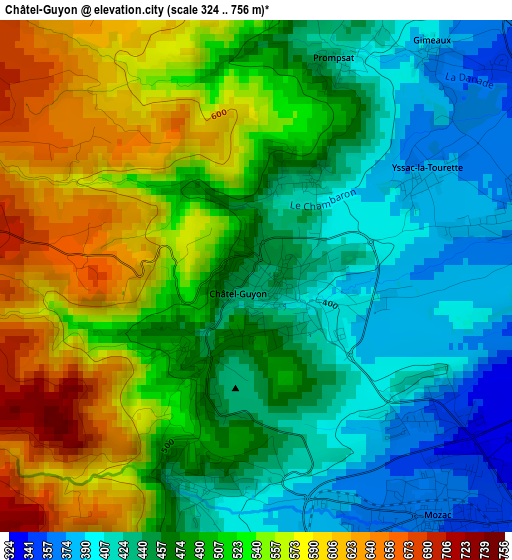
Below is the Elevation map of Châtel-Guyon, which displays elevation range with different colors. Scale of the first map is from 324 to 756 m (1063 to 2480 ft) with average elevation of 493.8 meters (=1620 ft) [note 1]
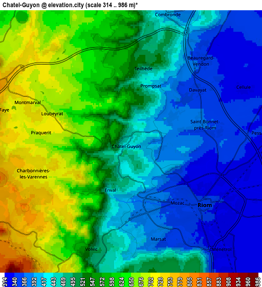
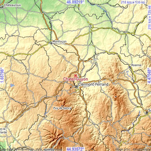
These maps also provides idea of topography and contour of this city, they are displayed at different zoom levels. More info about maps, scale and edge coordinates you can find below images.
| \ | Map #1 | Map #2 | Topo.Map |
| Scale [m] | 324..756 m | 314..986 m | × |
| Scale [ft] | 1063..2480 ft | 1030..3235 ft | × |
| Average | 493.8 m = 1620 ft | 514.6 m = 1688 ft | × |
| Width | 6.8 km = 4.2 mi | 13.6 km = 8.5 mi | 217.5 km = 135.1 mi |
| Height | 6.8 km = 4.2 mi | 13.6 km = 8.5 mi | 217.5 km = 135.1 mi |
| ↑Max Latitude | 45.953141° | 45.983686° | 46.89219° |
| Latitude at center | 45.92258° | 45.92258° | 45.92258° |
| ↓Min Latitude | 45.892002° | 45.861407° | 44.93572° |
| ← Min Longitude | 3.020285° | 2.976339° | 1.65798° |
| Longitude center | 3.06423° | 3.06423° | 3.06423° |
| →Max Longitude | 3.108175° | 3.152121° | 4.47048° |
Nearby cities:
Cities around Châtel-Guyon sort by population:
• Riom elevation 337 m
4.9 km,  130°
130°
• Volvic 502 m
6 km,  199°
199°
• Blanzat 372 m
10.4 km,  174°
174°
• Mozac 349 m
4 km,  143°
143°
• Châteaugay 419 m
8.1 km, 168°
• Combronde 400 m
6.8 km,  15°
15°
• Ménétrol 329 m
7.3 km, 140°
• Saint-Bonnet-près-Riom 368 m
3.9 km,  78°
78°
• Enval 445 m
2.8 km, 203°
• Manzat 632 m
10.4 km,  294°
294°
• Charbonnières-les-Varennes 719 m
5.2 km,  251°
251°
• Marsat 380 m
5.3 km, 165°
Multilingual:
 En español:
Châtel-Guyon elevación 421 m.
 En France:
Châtel-Guyon, Châtelguyon élévation 421 m.
 Auf Deutsch:
Châtel-Guyon höhe über dem Meeresspiegel ist 421 m.

Sources and notes:
- [note 1] Map square and city borders are not equal. Map elevation data is calculated only from area inside that square.
- [src 1] Elevation data from geonames database provided with same terms of usage.
- [src 2] The elevation map of Châtel-Guyon is generated using elevation data from NASA's 3 arcsec (90m) resolution SRTM data.
- [src 3] Base (background) map © OpenStreetMap contributors tiles are generated by Geofabrik and OpenTopoMap.
Copyright & License:
This Châtel-Guyon Elevation Map is licensed under CC BY-SA. You may reuse any part from this page, if you give a proper credit by linking to this URL:
 More info on terms of use page.