Blanzat elevation
Blanzat (Auvergne-Rhône-Alpes, Département du Puy-de-Dôme), France elevation is 372 meters and Blanzat elevation in feet is 1220 ft above sea level [src 1]. Blanzat is a populated place (feature code) with elevation that is 198 meters (650 ft) bigger than average city elevation in France.
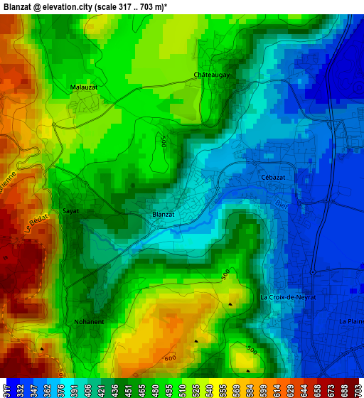
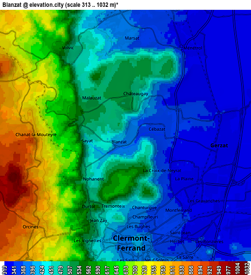
Below is the Elevation map of Blanzat, which displays elevation range with different colors. Scale of the first map is from 317 to 703 m (1040 to 2306 ft) with average elevation of 461.3 meters (=1513 ft) [note 1]
These maps also provides idea of topography and contour of this city, they are displayed at different zoom levels. More info about maps, scale and edge coordinates you can find below images.
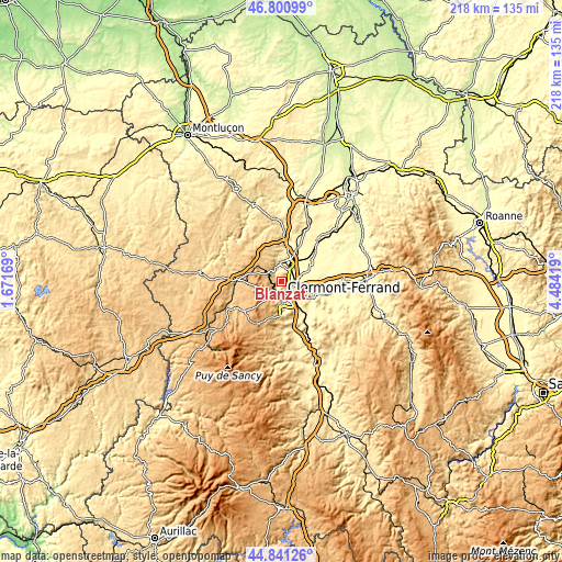
| \ | Map #1 | Map #2 | Topo.Map |
| Scale [m] | 317..703 m | 313..1032 m | × |
| Scale [ft] | 1040..2306 ft | 1027..3386 ft | × |
| Average | 461.3 m = 1513 ft | 503 m = 1650 ft | × |
| Width | 6.81 km = 4.2 mi | 13.62 km = 8.5 mi | 217.9 km = 135.4 mi |
| Height | 6.81 km = 4.2 mi | 13.62 km = 8.5 mi | 217.9 km = 135.4 mi |
| ↑Max Latitude | 45.860362° | 45.890958° | 46.80099° |
| Latitude at center | 45.82975° | 45.82975° | 45.82975° |
| ↓Min Latitude | 45.799121° | 45.768475° | 44.84126° |
| ← Min Longitude | 3.033995° | 2.990049° | 1.67169° |
| Longitude center | 3.07794° | 3.07794° | 3.07794° |
| →Max Longitude | 3.121885° | 3.165831° | 4.48419° |
Nearby cities:
Cities around Blanzat sort by population:
• Clermont-Ferrand elevation 406 m
5.6 km,  172°
172°
• Chamalières 381 m
6.3 km,  187°
187°
• Gerzat 320 m
5.2 km,  94°
94°
• Cébazat 348 m
1.7 km,  83°
83°
• Volvic 502 m
5.6 km,  326°
326°
• Mozac 349 m
7.3 km,  10°
10°
• Châteaugay 419 m
2.4 km, 12°
• Sayat 451 m
2 km,  259°
259°
• Durtol 517 m
4.3 km,  208°
208°
• Nohanent 542 m
3 km,  216°
216°
• Ménétrol 329 m
5.9 km,  37°
37°
• Marsat 380 m
5.2 km,  3°
3°
Multilingual:
 En español:
Blanzat elevación 372 m.
 En France:
Blanzat élévation 372 m.


Sources and notes:
- [note 1] Map square and city borders are not equal. Map elevation data is calculated only from area inside that square.
- [src 1] Elevation data from geonames database provided with same terms of usage.
- [src 2] The elevation map of Blanzat is generated using elevation data from NASA's 3 arcsec (90m) resolution SRTM data.
- [src 3] Base (background) map © OpenStreetMap contributors tiles are generated by Geofabrik and OpenTopoMap.
Copyright & License:
This Blanzat Elevation Map is licensed under CC BY-SA. You may reuse any part from this page, if you give a proper credit by linking to this URL:
 More info on terms of use page.