Chamalières elevation
Chamalières (Auvergne-Rhône-Alpes, Département du Puy-de-Dôme), France elevation is 381 meters and Chamalières elevation in feet is 1250 ft above sea level [src 1]. Chamalières is a populated place (feature code) with elevation that is 207 meters (679 ft) bigger than average city elevation in France.
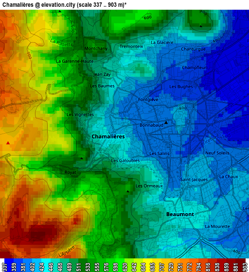
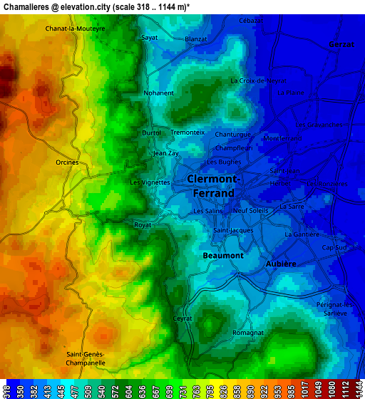
Below is the Elevation map of Chamalières, which displays elevation range with different colors. Scale of the first map is from 337 to 903 m (1106 to 2963 ft) with average elevation of 522.7 meters (=1715 ft) [note 1]
These maps also provides idea of topography and contour of this city, they are displayed at different zoom levels. More info about maps, scale and edge coordinates you can find below images.
| \ | Map #1 | Map #2 | Topo.Map |
| Scale [m] | 337..903 m | 318..1144 m | × |
| Scale [ft] | 1106..2963 ft | 1043..3753 ft | × |
| Average | 522.7 m = 1715 ft | 594.7 m = 1951 ft | × |
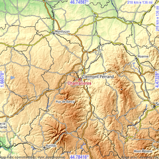
| Width | 6.82 km = 4.2 mi | 13.63 km = 8.5 mi | 218.1 km = 135.5 mi |
| Height | 6.82 km = 4.2 mi | 13.63 km = 8.5 mi | 218.1 km = 135.5 mi |
| ↑Max Latitude | 45.804283° | 45.83491° | 46.74587° |
| Latitude at center | 45.77364° | 45.77364° | 45.77364° |
| ↓Min Latitude | 45.74298° | 45.712303° | 44.78416° |
| ← Min Longitude | 3.023085° | 2.979139° | 1.66078° |
| Longitude center | 3.06703° | 3.06703° | 3.06703° |
| →Max Longitude | 3.110975° | 3.154921° | 4.47328° |
Nearby cities:
Cities around Chamalières sort by population:
• Clermont-Ferrand elevation 406 m
1.7 km,  66°
66°
• Beaumont 444 m
2.7 km,  153°
153°
• Aubière 366 m
4.2 km,  126°
126°
• Romagnat 575 m
5.6 km, 152°
• Cébazat 348 m
6.9 km,  21°
21°
• Ceyrat 569 m
4.6 km,  183°
183°
• Royat 521 m
1.6 km,  233°
233°
• Blanzat 372 m
6.3 km,  7°
7°
• Orcines 773 m
4.4 km,  283°
283°
• Sayat 451 m
6 km,  349°
349°
• Durtol 517 m
2.8 km,  334°
334°
• Nohanent 542 m
3.9 km, 346°
Multilingual:
 En español:
Chamalières elevación 381 m.
 En France:
Chamalières élévation 381 m.
 Auf Deutsch:
Chamalières höhe über dem Meeresspiegel ist 381 m.

Sources and notes:
- [note 1] Map square and city borders are not equal. Map elevation data is calculated only from area inside that square.
- [src 1] Elevation data from geonames database provided with same terms of usage.
- [src 2] The elevation map of Chamalières is generated using elevation data from NASA's 3 arcsec (90m) resolution SRTM data.
- [src 3] Base (background) map © OpenStreetMap contributors tiles are generated by Geofabrik and OpenTopoMap.
Copyright & License:
This Chamalières Elevation Map is licensed under CC BY-SA. You may reuse any part from this page, if you give a proper credit by linking to this URL:
 More info on terms of use page.