Crémieu elevation
Crémieu (Auvergne-Rhône-Alpes, Département de l'Isère), France elevation is 222 meters and Crémieu elevation in feet is 728 ft above sea level [src 1]. Crémieu is a populated place (feature code) with elevation that is 48 meters (157 ft) bigger than average city elevation in France.
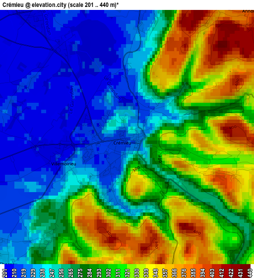
Below is the Elevation map of Crémieu, which displays elevation range with different colors. Scale of the first map is from 201 to 440 m (659 to 1444 ft) with average elevation of 280.9 meters (=922 ft) [note 1]
These maps also provides idea of topography and contour of this city, they are displayed at different zoom levels. More info about maps, scale and edge coordinates you can find below images.
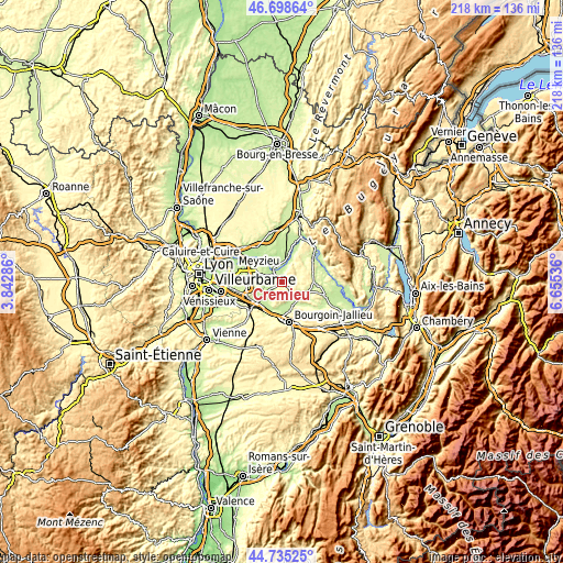
| \ | Map #1 | Topo.Map |
| Scale [m] | 201..440 m | × |
| Scale [ft] | 659..1444 ft | × |
| Average | 280.9 m = 922 ft | × |
| Width | 6.82 km = 4.2 mi | 218.3 km = 135.6 mi |
| Height | 6.82 km = 4.2 mi | 218.3 km = 135.6 mi |
| ↑Max Latitude | 45.75624° | 46.69864° |
| Latitude at center | 45.72557° | 45.72557° |
| ↓Min Latitude | 45.694884° | 44.73525° |
| ← Min Longitude | 5.205165° | 3.84286° |
| Longitude center | 5.24911° | 5.24911° |
| →Max Longitude | 5.293055° | 6.65536° |
Nearby cities:
Cities around Crémieu sort by population:
• Charvieu-Chavagneux elevation 226 m
8.2 km,  289°
289°
• Tignieu 205 m
5.5 km,  301°
301°
• Pont-de-Chéruy 202 m
6.7 km, 297°
• Chavanoz 196 m
6.7 km,  315°
315°
• Saint-Romain-de-Jalionas 210 m
4.3 km, 324°
• Loyettes 194 m
6.6 km,  330°
330°
• Frontonas 309 m
9.8 km,  204°
204°
• Satolas-et-Bonce 233 m
9.9 km,  248°
248°
• Trept 240 m
6.9 km,  128°
128°
• Villemoirieu 212 m
2 km, 247°
• Chamagnieu 294 m
7.8 km,  232°
232°
• Hières-sur-Amby 233 m
8.6 km,  23°
23°
Multilingual:
 En español:
Crémieu elevación 222 m.
 En France:
Crémieu élévation 222 m.


Sources and notes:
- [note 1] Map square and city borders are not equal. Map elevation data is calculated only from area inside that square.
- [src 1] Elevation data from geonames database provided with same terms of usage.
- [src 2] The elevation map of Crémieu is generated using elevation data from NASA's 3 arcsec (90m) resolution SRTM data.
- [src 3] Base (background) map © OpenStreetMap contributors tiles are generated by Geofabrik and OpenTopoMap.
Copyright & License:
This Crémieu Elevation Map is licensed under CC BY-SA. You may reuse any part from this page, if you give a proper credit by linking to this URL:
 More info on terms of use page.