Croisilles elevation
Croisilles (Hauts-de-France, Pas-de-Calais), France elevation is 81 meters and Croisilles elevation in feet is 266 ft above sea level [src 1]. Croisilles is a populated place (feature code) with elevation that is 93 meters (305 ft) smaller than average city elevation in France.
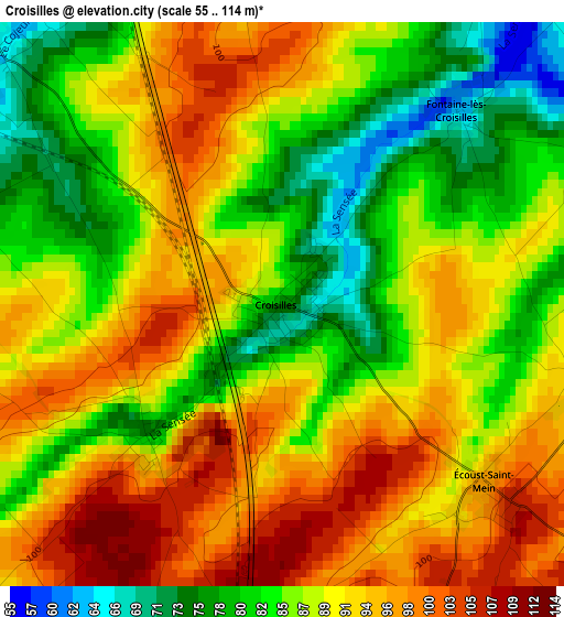
Below is the Elevation map of Croisilles, which displays elevation range with different colors. Scale of the first map is from 55 to 114 m (180 to 374 ft) with average elevation of 88.8 meters (=291 ft) [note 1]
These maps also provides idea of topography and contour of this city, they are displayed at different zoom levels. More info about maps, scale and edge coordinates you can find below images.
| \ | Map #1 | Topo.Map |
| Scale [m] | 55..114 m | × |
| Scale [ft] | 180..374 ft | × |
| Average | 88.8 m = 291 ft | × |
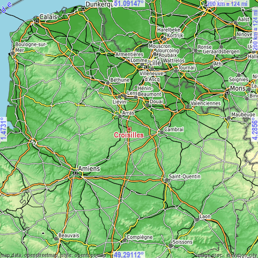
| Width | 6.26 km = 3.9 mi | 200.2 km = 124.4 mi |
| Height | 6.26 km = 3.9 mi | 200.2 km = 124.4 mi |
| ↑Max Latitude | 50.227902° | 51.09147° |
| Latitude at center | 50.19978° | 50.19978° |
| ↓Min Latitude | 50.171642° | 49.29112° |
| ← Min Longitude | 2.835405° | 1.4731° |
| Longitude center | 2.87935° | 2.87935° |
| →Max Longitude | 2.923295° | 4.2856° |
Nearby cities:
Cities around Croisilles sort by population:
• Arras elevation 73 m
12.5 km,  326°
326°
• Achicourt 64 m
12 km,  313°
313°
• Saint-Laurent-Blangy 71 m
11.7 km, 333°
• Beaurains 98 m
9.5 km,  320°
320°
• Bapaume 124 m
10.9 km,  191°
191°
• Agny 75 m
10.8 km, 307°
• Tilloy-lès-Mofflaines 82 m
9.6 km, 331°
• Rœux 48 m
10.7 km,  8°
8°
• Feuchy 56 m
10.8 km,  346°
346°
• Vaulx-Vraucourt 91 m
6 km,  159°
159°
• Fampoux 51 m
11.3 km,  357°
357°
• Achiet-le-Grand 120 m
10.4 km,  222°
222°
Multilingual:
 En español:
Croisilles elevación 81 m.
 En France:
Croisilles élévation 81 m.
 Auf Deutsch:
Croisilles höhe über dem Meeresspiegel ist 81 m.

Sources and notes:
- [note 1] Map square and city borders are not equal. Map elevation data is calculated only from area inside that square.
- [src 1] Elevation data from geonames database provided with same terms of usage.
- [src 2] The elevation map of Croisilles is generated using elevation data from NASA's 3 arcsec (90m) resolution SRTM data.
- [src 3] Base (background) map © OpenStreetMap contributors tiles are generated by Geofabrik and OpenTopoMap.
Copyright & License:
This Croisilles Elevation Map is licensed under CC BY-SA. You may reuse any part from this page, if you give a proper credit by linking to this URL:
 More info on terms of use page.