Achicourt elevation
Achicourt (Hauts-de-France, Pas-de-Calais), France elevation is 64 meters and Achicourt elevation in feet is 210 ft above sea level [src 1]. Achicourt is a populated place (feature code) with elevation that is 110 meters (361 ft) smaller than average city elevation in France.
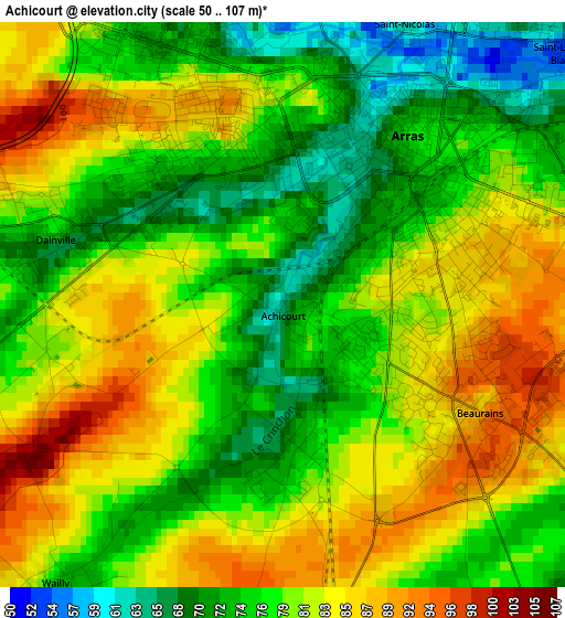
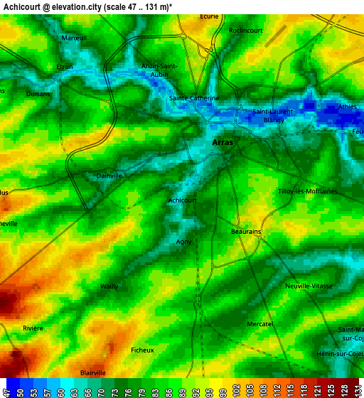
Below is the Elevation map of Achicourt, which displays elevation range with different colors. Scale of the first map is from 50 to 107 m (164 to 351 ft) with average elevation of 79.3 meters (=260 ft) [note 1]
These maps also provides idea of topography and contour of this city, they are displayed at different zoom levels. More info about maps, scale and edge coordinates you can find below images.
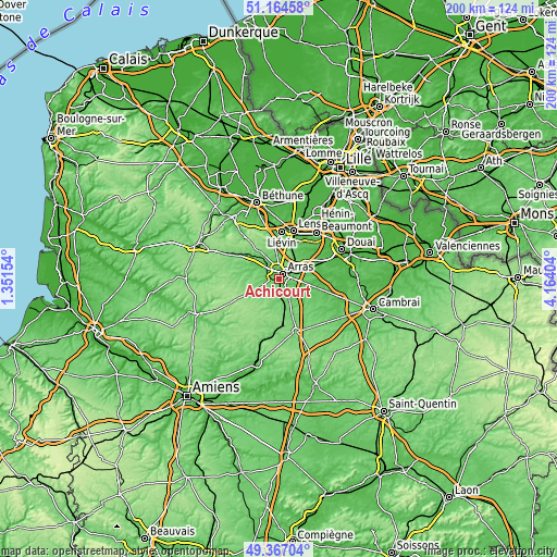
| \ | Map #1 | Map #2 | Topo.Map |
| Scale [m] | 50..107 m | 47..131 m | × |
| Scale [ft] | 164..351 ft | 154..430 ft | × |
| Average | 79.3 m = 260 ft | 83.5 m = 274 ft | × |
| Width | 6.25 km = 3.9 mi | 12.49 km = 7.8 mi | 199.9 km = 124.2 mi |
| Height | 6.25 km = 3.9 mi | 12.49 km = 7.8 mi | 199.9 km = 124.2 mi |
| ↑Max Latitude | 50.302368° | 50.330429° | 51.16458° |
| Latitude at center | 50.27429° | 50.27429° | 50.27429° |
| ↓Min Latitude | 50.246196° | 50.218085° | 49.36704° |
| ← Min Longitude | 2.713845° | 2.669899° | 1.35154° |
| Longitude center | 2.75779° | 2.75779° | 2.75779° |
| →Max Longitude | 2.801735° | 2.845681° | 4.16404° |
Nearby cities:
Cities around Achicourt sort by population:
• Arras elevation 73 m
2.7 km,  39°
39°
• Saint-Nicolas 73 m
3.7 km,  24°
24°
• Saint-Laurent-Blangy 71 m
4.2 km,  57°
57°
• Dainville 67 m
2.4 km,  288°
288°
• Beaurains 98 m
2.8 km,  109°
109°
• Sainte-Catherine 84 m
3.7 km,  6°
6°
• Anzin-Saint-Aubin 77 m
4.4 km,  350°
350°
• Agny 75 m
1.7 km,  174°
174°
• Tilloy-lès-Mofflaines 82 m
4 km,  88°
88°
• Duisans 69 m
6.2 km,  305°
305°
• Feuchy 56 m
6.5 km,  69°
69°
• Rivière 89 m
6.5 km,  225°
225°
Multilingual:
 En español:
Achicourt elevación 64 m.
 En France:
Achicourt élévation 64 m.
 Auf Deutsch:
Achicourt höhe über dem Meeresspiegel ist 64 m.

Sources and notes:
- [note 1] Map square and city borders are not equal. Map elevation data is calculated only from area inside that square.
- [src 1] Elevation data from geonames database provided with same terms of usage.
- [src 2] The elevation map of Achicourt is generated using elevation data from NASA's 3 arcsec (90m) resolution SRTM data.
- [src 3] Base (background) map © OpenStreetMap contributors tiles are generated by Geofabrik and OpenTopoMap.
Copyright & License:
This Achicourt Elevation Map is licensed under CC BY-SA. You may reuse any part from this page, if you give a proper credit by linking to this URL:
 More info on terms of use page.