Arras elevation
Arras (Hauts-de-France, Pas-de-Calais), France elevation is 73 meters and Arras elevation in feet is 240 ft above sea level [src 1]. Arras is a seat of a second-order administrative division (feature code) with elevation that is 101 meters (331 ft) smaller than average city elevation in France.
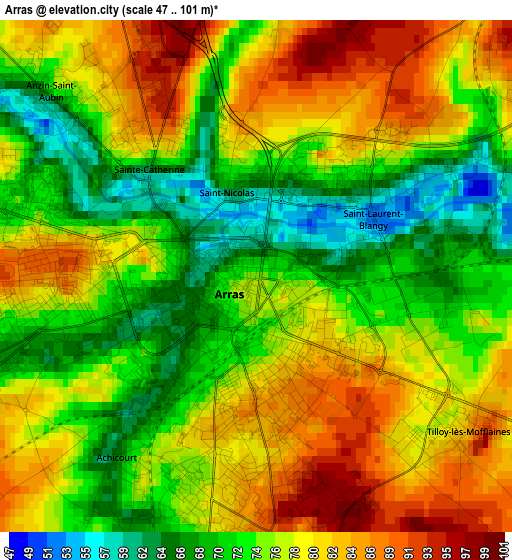
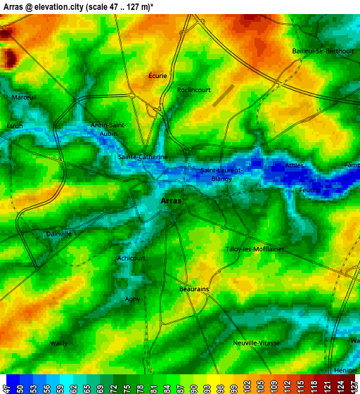
Below is the Elevation map of Arras, which displays elevation range with different colors. Scale of the first map is from 47 to 101 m (154 to 331 ft) with average elevation of 76.6 meters (=251 ft) [note 1]
These maps also provides idea of topography and contour of this city, they are displayed at different zoom levels. More info about maps, scale and edge coordinates you can find below images.
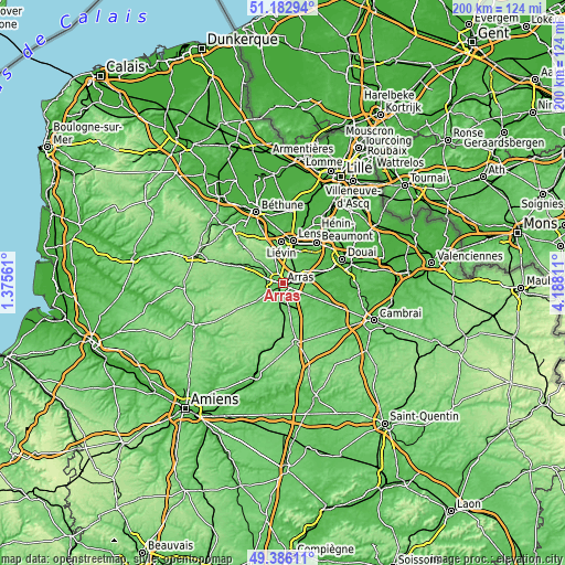
| \ | Map #1 | Map #2 | Topo.Map |
| Scale [m] | 47..101 m | 47..127 m | × |
| Scale [ft] | 154..331 ft | 154..417 ft | × |
| Average | 76.6 m = 251 ft | 82.6 m = 271 ft | × |
| Width | 6.24 km = 3.9 mi | 12.49 km = 7.8 mi | 199.8 km = 124.1 mi |
| Height | 6.24 km = 3.9 mi | 12.49 km = 7.8 mi | 199.8 km = 124.1 mi |
| ↑Max Latitude | 50.321077° | 50.349127° | 51.18294° |
| Latitude at center | 50.29301° | 50.29301° | 50.29301° |
| ↓Min Latitude | 50.264927° | 50.236827° | 49.38611° |
| ← Min Longitude | 2.737915° | 2.693969° | 1.37561° |
| Longitude center | 2.78186° | 2.78186° | 2.78186° |
| →Max Longitude | 2.825805° | 2.869751° | 4.18811° |
Nearby cities:
Cities around Arras sort by population:
• Achicourt elevation 64 m
2.7 km,  219°
219°
• Saint-Nicolas 73 m
1.2 km,  351°
351°
• Saint-Laurent-Blangy 71 m
1.8 km,  84°
84°
• Dainville 67 m
4.2 km,  251°
251°
• Beaurains 98 m
3.1 km,  163°
163°
• Sainte-Catherine 84 m
2.1 km,  321°
321°
• Marœuil 75 m
6.5 km,  303°
303°
• Anzin-Saint-Aubin 77 m
3.3 km,  312°
312°
• Agny 75 m
4.1 km,  202°
202°
• Tilloy-lès-Mofflaines 82 m
3.1 km,  130°
130°
• Feuchy 56 m
4.4 km,  87°
87°
• Fampoux 51 m
6.6 km, 81°
Multilingual:
 En español:
Arrás elevación 73 m.
 En France:
Arras élévation 73 m.


Sources and notes:
- [note 1] Map square and city borders are not equal. Map elevation data is calculated only from area inside that square.
- [src 1] Elevation data from geonames database provided with same terms of usage.
- [src 2] The elevation map of Arras is generated using elevation data from NASA's 3 arcsec (90m) resolution SRTM data.
- [src 3] Base (background) map © OpenStreetMap contributors tiles are generated by Geofabrik and OpenTopoMap.
Copyright & License:
This Arras Elevation Map is licensed under CC BY-SA. You may reuse any part from this page, if you give a proper credit by linking to this URL:
 More info on terms of use page.