Dabo elevation
Dabo (Grand Est, Moselle), France elevation is 470 meters and Dabo elevation in feet is 1542 ft above sea level [src 1]. Dabo is a populated place (feature code) with elevation that is 296 meters (971 ft) bigger than average city elevation in France.
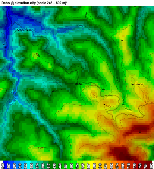
Below is the Elevation map of Dabo, which displays elevation range with different colors. Scale of the first map is from 246 to 802 m (807 to 2631 ft) with average elevation of 472 meters (=1549 ft) [note 1]
These maps also provides idea of topography and contour of this city, they are displayed at different zoom levels. More info about maps, scale and edge coordinates you can find below images.
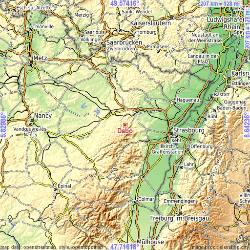
| \ | Map #1 | Topo.Map |
| Scale [m] | 246..802 m | × |
| Scale [ft] | 807..2631 ft | × |
| Average | 472 m = 1549 ft | × |
| Width | 6.46 km = 4 mi | 206.6 km = 128.4 mi |
| Height | 6.46 km = 4 mi | 206.6 km = 128.4 mi |
| ↑Max Latitude | 48.682752° | 49.57416° |
| Latitude at center | 48.65373° | 48.65373° |
| ↓Min Latitude | 48.624691° | 47.71618° |
| ← Min Longitude | 7.192165° | 5.82986° |
| Longitude center | 7.23611° | 7.23611° |
| →Max Longitude | 7.280055° | 8.64236° |
Nearby cities:
Cities around Dabo sort by population:
• Saverne elevation 200 m
13.5 km,  43°
43°
• Phalsbourg 329 m
12.8 km,  7°
7°
• Marmoutier 226 m
11.4 km,  69°
69°
• Réding 270 m
14.4 km,  319°
319°
• Walscheid 379 m
6.3 km,  269°
269°
• Oberhaslach 279 m
13.5 km,  148°
148°
• Abreschviller 335 m
10.5 km,  259°
259°
• Otterswiller 198 m
13.2 km,  52°
52°
• Romanswiller 227 m
12.6 km,  94°
94°
• Wangenbourg-Engenthal 434 m
5.8 km,  119°
119°
• Niederhaslach 250 m
14.6 km, 147°
• Niderviller 263 m
11.6 km,  304°
304°
Multilingual:
 En español:
Dabo elevación 470 m.
 En France:
Dabo élévation 470 m.
 Auf Deutsch:
Dagsburg höhe über dem Meeresspiegel ist 470 m.

Sources and notes:
- [note 1] Map square and city borders are not equal. Map elevation data is calculated only from area inside that square.
- [src 1] Elevation data from geonames database provided with same terms of usage.
- [src 2] The elevation map of Dabo is generated using elevation data from NASA's 3 arcsec (90m) resolution SRTM data.
- [src 3] Base (background) map © OpenStreetMap contributors tiles are generated by Geofabrik and OpenTopoMap.
Copyright & License:
This Dabo Elevation Map is licensed under CC BY-SA. You may reuse any part from this page, if you give a proper credit by linking to this URL:
 More info on terms of use page.