Otterswiller elevation
Otterswiller (Grand Est, Bas-Rhin), France elevation is 198 meters and Otterswiller elevation in feet is 650 ft above sea level [src 1]. Otterswiller is a populated place (feature code) with elevation that is 24 meters (79 ft) bigger than average city elevation in France.
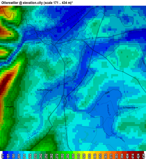
Below is the Elevation map of Otterswiller, which displays elevation range with different colors. Scale of the first map is from 171 to 434 m (561 to 1424 ft) with average elevation of 221.1 meters (=725 ft) [note 1]
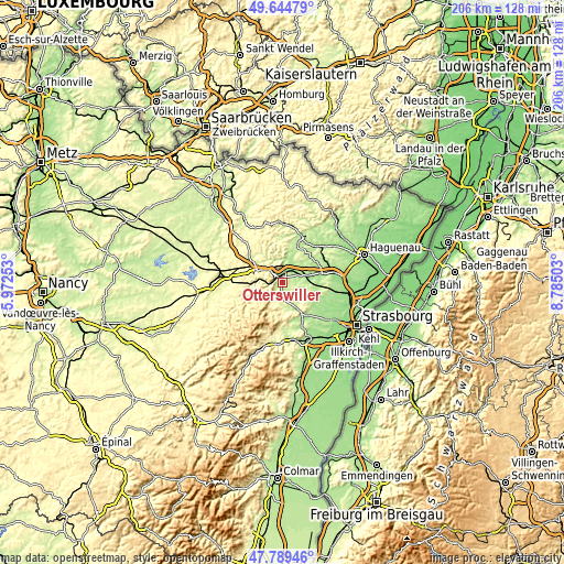
These maps also provides idea of topography and contour of this city, they are displayed at different zoom levels. More info about maps, scale and edge coordinates you can find below images.
| \ | Map #1 | Topo.Map |
| Scale [m] | 171..434 m | × |
| Scale [ft] | 561..1424 ft | × |
| Average | 221.1 m = 725 ft | × |
| Width | 6.45 km = 4 mi | 206.3 km = 128.2 mi |
| Height | 6.45 km = 4 mi | 206.3 km = 128.2 mi |
| ↑Max Latitude | 48.754661° | 49.64479° |
| Latitude at center | 48.72568° | 48.72568° |
| ↓Min Latitude | 48.696682° | 47.78946° |
| ← Min Longitude | 7.334835° | 5.97253° |
| Longitude center | 7.37878° | 7.37878° |
| →Max Longitude | 7.422725° | 8.78503° |
Nearby cities:
Cities around Otterswiller sort by population:
• Saverne elevation 200 m
2.2 km,  325°
325°
• Wasselonne 200 m
10.9 km,  153°
153°
• Phalsbourg 329 m
10 km,  297°
297°
• Dabo 470 m
13.2 km,  232°
232°
• Dettwiller 176 m
7.2 km,  63°
63°
• Marmoutier 226 m
4 km,  176°
176°
• Monswiller 179 m
3.3 km,  358°
358°
• Steinbourg 193 m
5.6 km,  27°
27°
• Romanswiller 227 m
9.2 km,  166°
166°
• Wangenbourg-Engenthal 434 m
12.1 km,  206°
206°
• Dossenheim-sur-Zinsel 192 m
9.1 km,  11°
11°
• Neuwiller-lès-Saverne 218 m
11.2 km, 9°
Multilingual:
 En español:
Otterswiller elevación 198 m.
 En France:
Otterswiller élévation 198 m.
 Auf Deutsch:
Otterswiller höhe über dem Meeresspiegel ist 198 m.

Sources and notes:
- [note 1] Map square and city borders are not equal. Map elevation data is calculated only from area inside that square.
- [src 1] Elevation data from geonames database provided with same terms of usage.
- [src 2] The elevation map of Otterswiller is generated using elevation data from NASA's 3 arcsec (90m) resolution SRTM data.
- [src 3] Base (background) map © OpenStreetMap contributors tiles are generated by Geofabrik and OpenTopoMap.
Copyright & License:
This Otterswiller Elevation Map is licensed under CC BY-SA. You may reuse any part from this page, if you give a proper credit by linking to this URL:
 More info on terms of use page.