Wasselonne elevation
Wasselonne (Grand Est, Bas-Rhin), France elevation is 200 meters and Wasselonne elevation in feet is 656 ft above sea level [src 1]. Wasselonne is a populated place (feature code) with elevation that is 26 meters (85 ft) bigger than average city elevation in France.
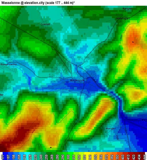
Below is the Elevation map of Wasselonne, which displays elevation range with different colors. Scale of the first map is from 177 to 444 m (581 to 1457 ft) with average elevation of 270.5 meters (=887 ft) [note 1]
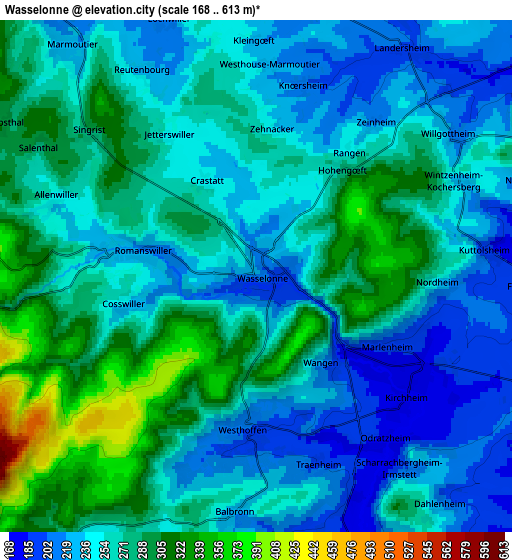
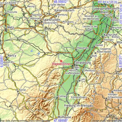
These maps also provides idea of topography and contour of this city, they are displayed at different zoom levels. More info about maps, scale and edge coordinates you can find below images.
| \ | Map #1 | Map #2 | Topo.Map |
| Scale [m] | 177..444 m | 168..613 m | × |
| Scale [ft] | 581..1457 ft | 551..2011 ft | × |
| Average | 270.5 m = 887 ft | 261.2 m = 857 ft | × |
| Width | 6.46 km = 4 mi | 12.92 km = 8 mi | 206.7 km = 128.4 mi |
| Height | 6.46 km = 4 mi | 12.92 km = 8 mi | 206.6 km = 128.4 mi |
| ↑Max Latitude | 48.666821° | 48.695836° | 49.55852° |
| Latitude at center | 48.63779° | 48.63779° | 48.63779° |
| ↓Min Latitude | 48.608742° | 48.579677° | 47.69995° |
| ← Min Longitude | 7.401115° | 7.357169° | 6.03881° |
| Longitude center | 7.44506° | 7.44506° | 7.44506° |
| →Max Longitude | 7.489005° | 7.532951° | 8.85131° |
Nearby cities:
Cities around Wasselonne sort by population:
• Mutzig elevation 195 m
10.9 km,  175°
175°
• Marlenheim 192 m
3.8 km,  118°
118°
• Marmoutier 226 m
7.4 km,  321°
321°
• Westhoffen 204 m
3.8 km, 182°
• Still 215 m
10.2 km,  196°
196°
• Dinsheim-sur-Bruche 202 m
10.7 km,  187°
187°
• Dachstein 166 m
10.7 km,  142°
142°
• Romanswiller 227 m
2.9 km,  287°
287°
• Wangenbourg-Engenthal 434 m
10.4 km,  264°
264°
• Irmstett 186 m
6.1 km,  156°
156°
• Furdenheim 180 m
9 km,  109°
109°
• Schnersheim 202 m
9.2 km,  76°
76°
Multilingual:
 En español:
Wasselonne elevación 200 m.
 En France:
Wasselonne élévation 200 m.
 Auf Deutsch:
Wasselnheim höhe über dem Meeresspiegel ist 200 m.

Sources and notes:
- [note 1] Map square and city borders are not equal. Map elevation data is calculated only from area inside that square.
- [src 1] Elevation data from geonames database provided with same terms of usage.
- [src 2] The elevation map of Wasselonne is generated using elevation data from NASA's 3 arcsec (90m) resolution SRTM data.
- [src 3] Base (background) map © OpenStreetMap contributors tiles are generated by Geofabrik and OpenTopoMap.
Copyright & License:
This Wasselonne Elevation Map is licensed under CC BY-SA. You may reuse any part from this page, if you give a proper credit by linking to this URL:
 More info on terms of use page.