Mutzig elevation
Mutzig (Grand Est, Bas-Rhin), France elevation is 195 meters and Mutzig elevation in feet is 640 ft above sea level [src 1]. Mutzig is a populated place (feature code) with elevation that is 21 meters (69 ft) bigger than average city elevation in France.
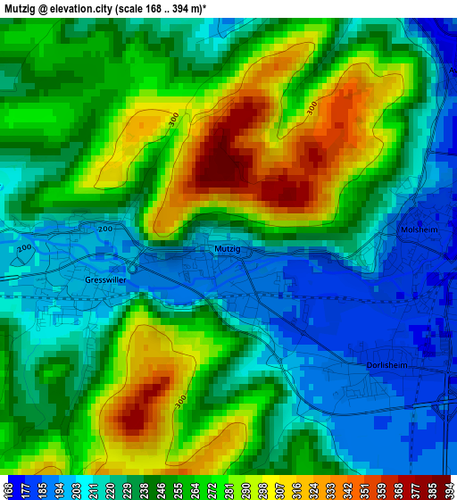
Below is the Elevation map of Mutzig, which displays elevation range with different colors. Scale of the first map is from 168 to 394 m (551 to 1293 ft) with average elevation of 246.7 meters (=809 ft) [note 1]
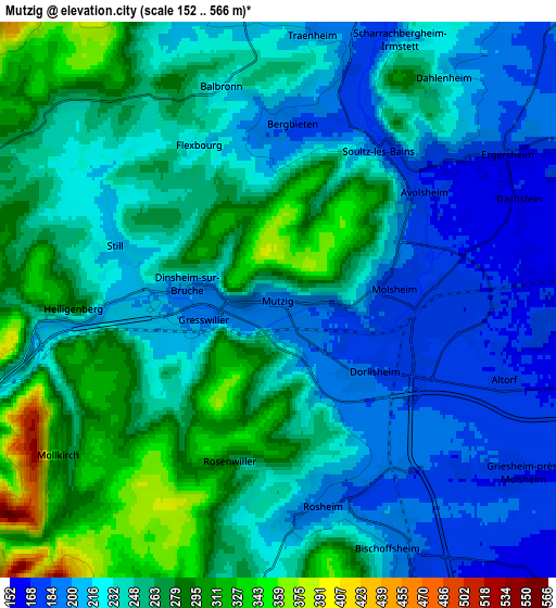
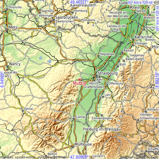
These maps also provides idea of topography and contour of this city, they are displayed at different zoom levels. More info about maps, scale and edge coordinates you can find below images.
| \ | Map #1 | Map #2 | Topo.Map |
| Scale [m] | 168..394 m | 152..566 m | × |
| Scale [ft] | 551..1293 ft | 499..1857 ft | × |
| Average | 246.7 m = 809 ft | 242.1 m = 794 ft | × |
| Width | 6.47 km = 4 mi | 12.94 km = 8 mi | 207.1 km = 128.7 mi |
| Height | 6.47 km = 4 mi | 12.94 km = 8 mi | 207 km = 128.6 mi |
| ↑Max Latitude | 48.568828° | 48.597899° | 49.46227° |
| Latitude at center | 48.53974° | 48.53974° | 48.53974° |
| ↓Min Latitude | 48.510635° | 48.481514° | 47.60009° |
| ← Min Longitude | 7.411995° | 7.368049° | 6.04969° |
| Longitude center | 7.45594° | 7.45594° | 7.45594° |
| →Max Longitude | 7.499885° | 7.543831° | 8.86219° |
Nearby cities:
Cities around Mutzig sort by population:
• Molsheim elevation 182 m
2.7 km,  88°
88°
• Rosheim 196 m
4.9 km,  166°
166°
• Bischoffsheim 206 m
6.4 km,  157°
157°
• Dorlisheim 183 m
2.8 km,  126°
126°
• Bœrsch 236 m
7.1 km,  189°
189°
• Griesheim-près-Molsheim 172 m
6.8 km, 126°
• Still 215 m
4 km,  286°
286°
• Gresswiller 195 m
1.8 km,  254°
254°
• Dinsheim-sur-Bruche 202 m
2.1 km,  278°
278°
• Dachstein 166 m
6.1 km,  66°
66°
• Altorf 172 m
5.7 km,  110°
110°
• Irmstett 186 m
5.6 km,  17°
17°
Multilingual:
 En español:
Mutzig elevación 195 m.
 En France:
Mutzig élévation 195 m.


Sources and notes:
- [note 1] Map square and city borders are not equal. Map elevation data is calculated only from area inside that square.
- [src 1] Elevation data from geonames database provided with same terms of usage.
- [src 2] The elevation map of Mutzig is generated using elevation data from NASA's 3 arcsec (90m) resolution SRTM data.
- [src 3] Base (background) map © OpenStreetMap contributors tiles are generated by Geofabrik and OpenTopoMap.
Copyright & License:
This Mutzig Elevation Map is licensed under CC BY-SA. You may reuse any part from this page, if you give a proper credit by linking to this URL:
 More info on terms of use page.