Écrouves elevation
Écrouves (Grand Est, Meurthe-et-Moselle), France elevation is 231 meters and Écrouves elevation in feet is 758 ft above sea level [src 1]. Écrouves is a populated place (feature code) with elevation that is 57 meters (187 ft) bigger than average city elevation in France.
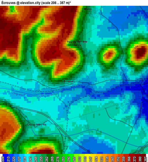
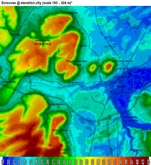
Below is the Elevation map of Écrouves, which displays elevation range with different colors. Scale of the first map is from 206 to 387 m (676 to 1270 ft) with average elevation of 269.1 meters (=883 ft) [note 1]
These maps also provides idea of topography and contour of this city, they are displayed at different zoom levels. More info about maps, scale and edge coordinates you can find below images.
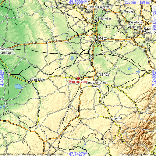
| \ | Map #1 | Map #2 | Topo.Map |
| Scale [m] | 206..387 m | 193..424 m | × |
| Scale [ft] | 676..1270 ft | 633..1391 ft | × |
| Average | 269.1 m = 883 ft | 270 m = 886 ft | × |
| Width | 6.45 km = 4 mi | 12.9 km = 8 mi | 206.5 km = 128.3 mi |
| Height | 6.45 km = 4 mi | 12.9 km = 8 mi | 206.5 km = 128.3 mi |
| ↑Max Latitude | 48.708867° | 48.737858° | 49.59981° |
| Latitude at center | 48.67986° | 48.67986° | 48.67986° |
| ↓Min Latitude | 48.650836° | 48.621795° | 47.74279° |
| ← Min Longitude | 5.798725° | 5.754779° | 4.43642° |
| Longitude center | 5.84267° | 5.84267° | 5.84267° |
| →Max Longitude | 5.886615° | 5.930561° | 7.24892° |
Nearby cities:
Cities around Écrouves sort by population:
• Toul elevation 206 m
3.6 km,  88°
88°
• Foug 256 m
4.1 km,  276°
276°
• Vaucouleurs 249 m
15.5 km,  236°
236°
• Gondreville 209 m
9.1 km,  80°
80°
• Dommartin-lès-Toul 220 m
5.1 km,  103°
103°
• Void-Vacon 241 m
16.6 km,  271°
271°
• Velaine-en-Haye 288 m
13.8 km, 80°
• Euville 234 m
17.7 km,  296°
296°
• Colombey-les-Belles 340 m
17.2 km,  167°
167°
• Domgermain 238 m
4.2 km,  193°
193°
• Villey-Saint-Étienne 231 m
11.6 km,  59°
59°
• Blénod-lès-Toul 263 m
9 km,  182°
182°
Multilingual:
 En español:
Écrouves elevación 231 m.
 En France:
Écrouves élévation 231 m.
 Auf Deutsch:
Écrouves höhe über dem Meeresspiegel ist 231 m.

Sources and notes:
- [note 1] Map square and city borders are not equal. Map elevation data is calculated only from area inside that square.
- [src 1] Elevation data from geonames database provided with same terms of usage.
- [src 2] The elevation map of Écrouves is generated using elevation data from NASA's 3 arcsec (90m) resolution SRTM data.
- [src 3] Base (background) map © OpenStreetMap contributors tiles are generated by Geofabrik and OpenTopoMap.
Copyright & License:
This Écrouves Elevation Map is licensed under CC BY-SA. You may reuse any part from this page, if you give a proper credit by linking to this URL:
 More info on terms of use page.