Edern elevation
Edern (Brittany, Département du Finistère), France elevation is 133 meters and Edern elevation in feet is 436 ft above sea level [src 1]. Edern is a populated place (feature code) with elevation that is 41 meters (135 ft) smaller than average city elevation in France.
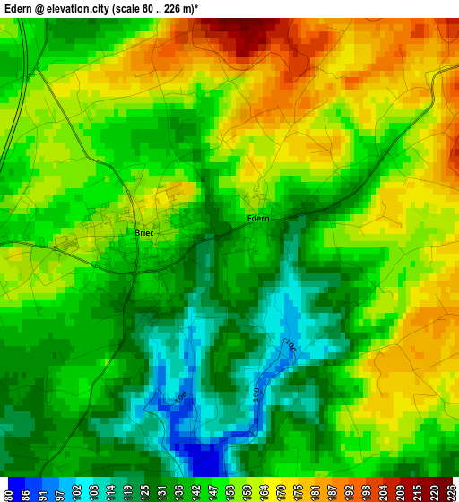
Below is the Elevation map of Edern, which displays elevation range with different colors. Scale of the first map is from 80 to 226 m (262 to 741 ft) with average elevation of 148.6 meters (=488 ft) [note 1]
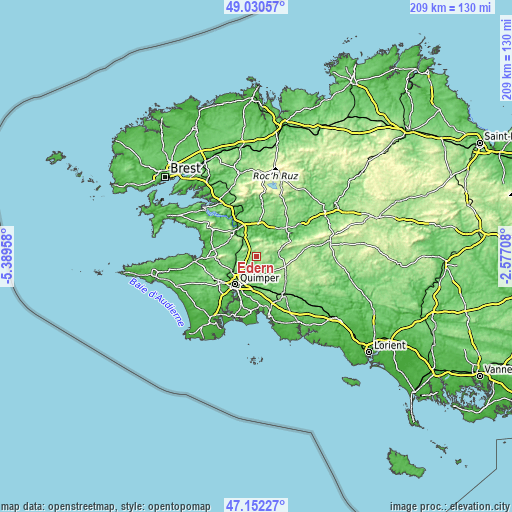
These maps also provides idea of topography and contour of this city, they are displayed at different zoom levels. More info about maps, scale and edge coordinates you can find below images.
| \ | Map #1 | Topo.Map |
| Scale [m] | 80..226 m | × |
| Scale [ft] | 262..741 ft | × |
| Average | 148.6 m = 488 ft | × |
| Width | 6.53 km = 4.1 mi | 208.8 km = 129.7 mi |
| Height | 6.53 km = 4.1 mi | 208.8 km = 129.7 mi |
| ↑Max Latitude | 48.12934° | 49.03057° |
| Latitude at center | 48.1° | 48.1° |
| ↓Min Latitude | 48.070644° | 47.15227° |
| ← Min Longitude | -4.027275° | -5.38958° |
| Longitude center | -3.98333° | -3.98333° |
| →Max Longitude | -3.939385° | -2.57708° |
Nearby cities:
Cities around Edern sort by population:
• Quimper elevation 36 m
14.1 km,  217°
217°
• Ergué-Gabéric 79 m
12 km,  193°
193°
• Châteaulin 30 m
13.4 km,  323°
323°
• Briec 157 m
1.1 km,  279°
279°
• Pleyben 94 m
14.9 km,  4°
4°
• Plogonnec 119 m
15 km,  262°
262°
• Elliant 103 m
13.7 km,  149°
149°
• Coray 221 m
12.2 km,  111°
111°
• Landrévarzec 97 m
5.8 km, 260°
• Cast 103 m
13.2 km,  298°
298°
• Quéménéven 87 m
10.1 km, 280°
• Gouézec 103 m
7.7 km,  5°
5°
Multilingual:
 En español:
Edern elevación 133 m.
 En France:
Edern élévation 133 m.


Sources and notes:
- [note 1] Map square and city borders are not equal. Map elevation data is calculated only from area inside that square.
- [src 1] Elevation data from geonames database provided with same terms of usage.
- [src 2] The elevation map of Edern is generated using elevation data from NASA's 3 arcsec (90m) resolution SRTM data.
- [src 3] Base (background) map © OpenStreetMap contributors tiles are generated by Geofabrik and OpenTopoMap.
Copyright & License:
This Edern Elevation Map is licensed under CC BY-SA. You may reuse any part from this page, if you give a proper credit by linking to this URL:
 More info on terms of use page.