Châteaulin elevation
Châteaulin (Brittany, Département du Finistère), France elevation is 30 meters and Châteaulin elevation in feet is 98 ft above sea level [src 1]. Châteaulin is a seat of a third-order administrative division (feature code) with elevation that is 144 meters (472 ft) smaller than average city elevation in France.
Below is the Elevation map of Châteaulin, which displays elevation range with different colors. Scale of the first map is from 0 to 231 m (0 to 758 ft) with average elevation of 84.9 meters (=279 ft) [note 1]
These maps also provides idea of topography and contour of this city, they are displayed at different zoom levels. More info about maps, scale and edge coordinates you can find below images.
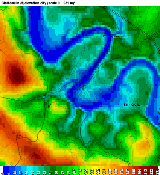
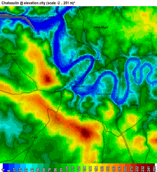
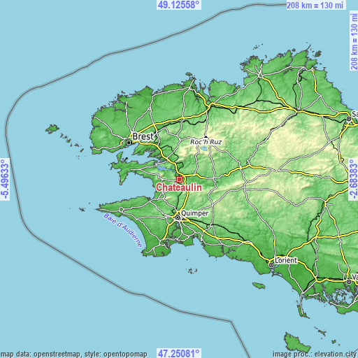
| \ | Map #1 | Map #2 | Topo.Map |
| Scale [m] | 0..231 m | -2..251 m | × |
| Scale [ft] | 0..758 ft | -7..823 ft | × |
| Average | 84.9 m = 279 ft | 94.8 m = 311 ft | × |
| Width | 6.51 km = 4 mi | 13.03 km = 8.1 mi | 208.5 km = 129.6 mi |
| Height | 6.51 km = 4 mi | 13.03 km = 8.1 mi | 208.4 km = 129.5 mi |
| ↑Max Latitude | 48.226054° | 48.255322° | 49.12558° |
| Latitude at center | 48.19677° | 48.19677° | 48.19677° |
| ↓Min Latitude | 48.167469° | 48.138151° | 47.25081° |
| ← Min Longitude | -4.134025° | -4.177971° | -5.49633° |
| Longitude center | -4.09008° | -4.09008° | -4.09008° |
| →Max Longitude | -4.046135° | -4.002189° | -2.68383° |
Nearby cities:
Cities around Châteaulin sort by population:
• Briec elevation 157 m
12.6 km,  147°
147°
• Pleyben 94 m
10 km,  66°
66°
• Plomodiern 82 m
10.7 km,  261°
261°
• Dinéault 103 m
6 km,  294°
294°
• Edern 133 m
13.4 km,  143°
143°
• Le Faou 12 m
12.7 km,  328°
328°
• Plonévez-Porzay 124 m
14.3 km,  221°
221°
• Landrévarzec 97 m
11.9 km,  169°
169°
• Cast 103 m
5.7 km, 219°
• Quéménéven 87 m
9.1 km,  192°
192°
• Lopérec 54 m
9.5 km,  19°
19°
• Gouézec 103 m
9.2 km,  109°
109°
Multilingual:
 En español:
Châteaulin elevación 30 m.
 En France:
Châteaulin élévation 30 m.
 Auf Deutsch:
Châteaulin höhe über dem Meeresspiegel ist 30 m.

Sources and notes:
- [note 1] Map square and city borders are not equal. Map elevation data is calculated only from area inside that square.
- [src 1] Elevation data from geonames database provided with same terms of usage.
- [src 2] The elevation map of Châteaulin is generated using elevation data from NASA's 3 arcsec (90m) resolution SRTM data.
- [src 3] Base (background) map © OpenStreetMap contributors tiles are generated by Geofabrik and OpenTopoMap.
Copyright & License:
This Châteaulin Elevation Map is licensed under CC BY-SA. You may reuse any part from this page, if you give a proper credit by linking to this URL:
 More info on terms of use page.