Ergué-Gabéric elevation
Ergué-Gabéric (Brittany, Département du Finistère), France elevation is 79 meters and Ergué-Gabéric elevation in feet is 259 ft above sea level [src 1]. Ergué-Gabéric is a populated place (feature code) with elevation that is 95 meters (312 ft) smaller than average city elevation in France.
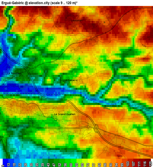
Below is the Elevation map of Ergué-Gabéric, which displays elevation range with different colors. Scale of the first map is from 9 to 120 m (30 to 394 ft) with average elevation of 69.5 meters (=228 ft) [note 1]
These maps also provides idea of topography and contour of this city, they are displayed at different zoom levels. More info about maps, scale and edge coordinates you can find below images.
| \ | Map #1 | Map #2 | Topo.Map |
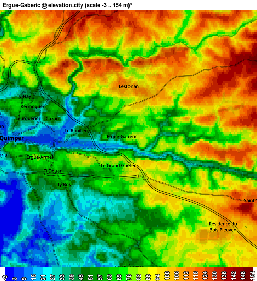
| Scale [m] | 9..120 m | -3..154 m | × |
| Scale [ft] | 30..394 ft | -10..505 ft | × |
| Average | 69.5 m = 228 ft | 74.9 m = 246 ft | × |
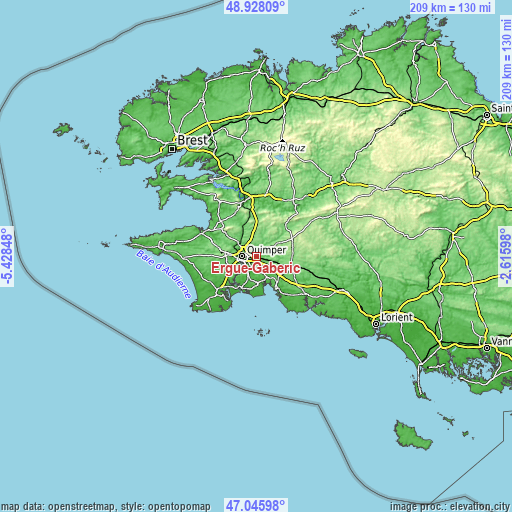
| Width | 6.54 km = 4.1 mi | 13.08 km = 8.1 mi | 209.3 km = 130.1 mi |
| Height | 6.54 km = 4.1 mi | 13.08 km = 8.1 mi | 209.3 km = 130.1 mi |
| ↑Max Latitude | 48.025019° | 48.054402° | 48.92809° |
| Latitude at center | 47.99562° | 47.99562° | 47.99562° |
| ↓Min Latitude | 47.966204° | 47.936771° | 47.04598° |
| ← Min Longitude | -4.066175° | -4.110121° | -5.42848° |
| Longitude center | -4.02223° | -4.02223° | -4.02223° |
| →Max Longitude | -3.978285° | -3.934339° | -2.61598° |
Nearby cities:
Cities around Ergué-Gabéric sort by population:
• Quimper elevation 36 m
5.8 km,  274°
274°
• Fouesnant 67 m
11.5 km,  177°
177°
• Briec 157 m
11.9 km,  8°
8°
• Plomelin 45 m
11.8 km,  233°
233°
• Saint-Évarzec 51 m
6.9 km, 176°
• La Forêt-Fouesnant 7 m
10 km,  161°
161°
• Elliant 103 m
9.9 km,  90°
90°
• Saint-Yvi 113 m
7.4 km,  115°
115°
• Pleuven 75 m
10.7 km, 184°
• Gouesnach 40 m
11.7 km,  215°
215°
• Clohars-Fouesnant 39 m
11.4 km,  195°
195°
• Landrévarzec 97 m
11.1 km,  345°
345°
Multilingual:
 En español:
Ergué-Gabéric elevación 79 m.
 En France:
Ergué-Gabéric élévation 79 m.
 Auf Deutsch:
Ergué-Gabéric höhe über dem Meeresspiegel ist 79 m.

Sources and notes:
- [note 1] Map square and city borders are not equal. Map elevation data is calculated only from area inside that square.
- [src 1] Elevation data from geonames database provided with same terms of usage.
- [src 2] The elevation map of Ergué-Gabéric is generated using elevation data from NASA's 3 arcsec (90m) resolution SRTM data.
- [src 3] Base (background) map © OpenStreetMap contributors tiles are generated by Geofabrik and OpenTopoMap.
Copyright & License:
This Ergué-Gabéric Elevation Map is licensed under CC BY-SA. You may reuse any part from this page, if you give a proper credit by linking to this URL:
 More info on terms of use page.