Étain elevation
Étain (Grand Est, Meuse), France elevation is 212 meters and Étain elevation in feet is 696 ft above sea level [src 1]. Étain is a populated place (feature code) with elevation that is 38 meters (125 ft) bigger than average city elevation in France.
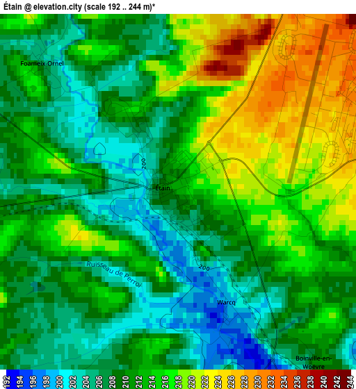
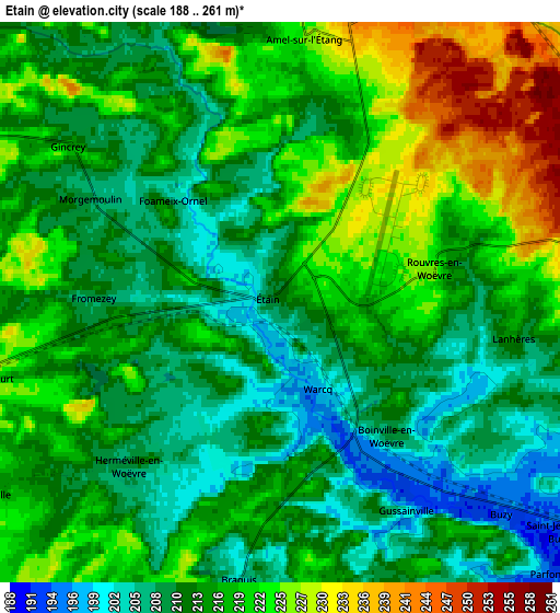
Below is the Elevation map of Étain, which displays elevation range with different colors. Scale of the first map is from 192 to 244 m (630 to 801 ft) with average elevation of 211.8 meters (=695 ft) [note 1]
These maps also provides idea of topography and contour of this city, they are displayed at different zoom levels. More info about maps, scale and edge coordinates you can find below images.
| \ | Map #1 | Map #2 | Topo.Map |
| Scale [m] | 192..244 m | 188..261 m | × |
| Scale [ft] | 630..801 ft | 617..856 ft | × |
| Average | 211.8 m = 695 ft | 215.5 m = 707 ft | × |
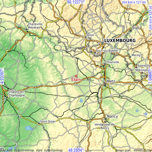
| Width | 6.38 km = 4 mi | 12.77 km = 7.9 mi | 204.3 km = 126.9 mi |
| Height | 6.38 km = 4 mi | 12.77 km = 7.9 mi | 204.3 km = 126.9 mi |
| ↑Max Latitude | 49.241289° | 49.269972° | 50.12271° |
| Latitude at center | 49.21259° | 49.21259° | 49.21259° |
| ↓Min Latitude | 49.183874° | 49.155142° | 48.2854° |
| ← Min Longitude | 5.596275° | 5.552329° | 4.23397° |
| Longitude center | 5.64022° | 5.64022° | 5.64022° |
| →Max Longitude | 5.684165° | 5.728111° | 7.04647° |
Nearby cities:
Cities around Étain sort by population:
• Verdun elevation 196 m
19.6 km,  252°
252°
• Jarny 198 m
18.2 km,  109°
109°
• Belleville-sur-Meuse 220 m
19.9 km,  259°
259°
• Bouligny 262 m
11.5 km,  40°
40°
• Conflans-en-Jarnisy 194 m
16.4 km, 107°
• Piennes 310 m
14.8 km, 43°
• Labry 193 m
18 km,  104°
104°
• Mancieulles 248 m
20.1 km,  67°
67°
• Mercy-le-Bas 300 m
21.4 km,  23°
23°
• Giraumont 217 m
20.5 km, 103°
• Joudreville 280 m
13.4 km,  48°
48°
• Landres 310 m
16.7 km, 44°
Multilingual:
 En español:
Étain elevación 212 m.
 En France:
Étain élévation 212 m.


Sources and notes:
- [note 1] Map square and city borders are not equal. Map elevation data is calculated only from area inside that square.
- [src 1] Elevation data from geonames database provided with same terms of usage.
- [src 2] The elevation map of Étain is generated using elevation data from NASA's 3 arcsec (90m) resolution SRTM data.
- [src 3] Base (background) map © OpenStreetMap contributors tiles are generated by Geofabrik and OpenTopoMap.
Copyright & License:
This Étain Elevation Map is licensed under CC BY-SA. You may reuse any part from this page, if you give a proper credit by linking to this URL:
 More info on terms of use page.