Landres elevation
Landres (Grand Est, Meurthe-et-Moselle), France elevation is 310 meters and Landres elevation in feet is 1017 ft above sea level [src 1]. Landres is a populated place (feature code) with elevation that is 136 meters (446 ft) bigger than average city elevation in France.
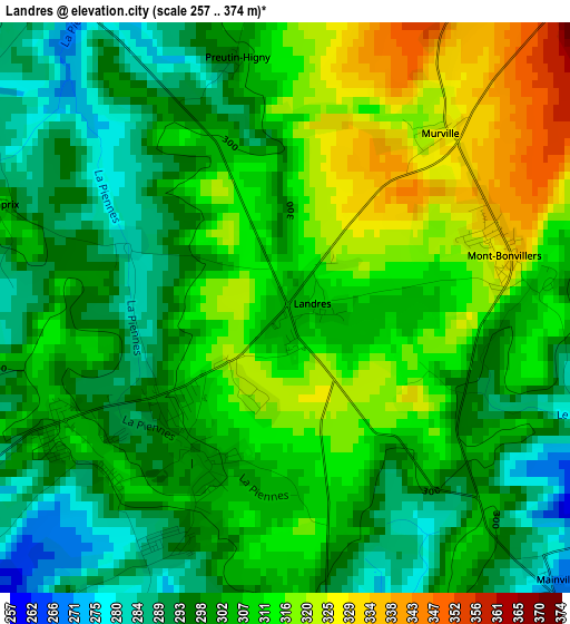
Below is the Elevation map of Landres, which displays elevation range with different colors. Scale of the first map is from 257 to 374 m (843 to 1227 ft) with average elevation of 304.4 meters (=999 ft) [note 1]
These maps also provides idea of topography and contour of this city, they are displayed at different zoom levels. More info about maps, scale and edge coordinates you can find below images.
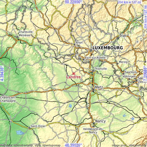
| \ | Map #1 | Topo.Map |
| Scale [m] | 257..374 m | × |
| Scale [ft] | 843..1227 ft | × |
| Average | 304.4 m = 999 ft | × |
| Width | 6.37 km = 4 mi | 203.8 km = 126.6 mi |
| Height | 6.37 km = 4 mi | 203.8 km = 126.6 mi |
| ↑Max Latitude | 49.349076° | 50.22856° |
| Latitude at center | 49.32044° | 49.32044° |
| ↓Min Latitude | 49.291787° | 48.39526° |
| ← Min Longitude | 5.756655° | 4.39435° |
| Longitude center | 5.8006° | 5.8006° |
| →Max Longitude | 5.844545° | 7.20685° |
Nearby cities:
Cities around Landres sort by population:
• Briey elevation 248 m
12.8 km,  128°
128°
• Fontoy 284 m
14.5 km,  74°
74°
• Tucquegnieux 281 m
6.9 km,  99°
99°
• Bouligny 262 m
5.3 km,  233°
233°
• Piennes 310 m
1.9 km, 231°
• Audun-le-Roman 353 m
8.8 km,  51°
51°
• Trieux 291 m
9.4 km,  87°
87°
• Boulange 318 m
12.8 km,  57°
57°
• Mancieulles 248 m
8.1 km,  121°
121°
• Mercy-le-Bas 300 m
8.3 km,  337°
337°
• Joudreville 280 m
3.6 km,  205°
205°
• Pierrepont 253 m
12.6 km,  328°
328°
Multilingual:
 En español:
Landres elevación 310 m.
 En France:
Landres élévation 310 m.


Sources and notes:
- [note 1] Map square and city borders are not equal. Map elevation data is calculated only from area inside that square.
- [src 1] Elevation data from geonames database provided with same terms of usage.
- [src 2] The elevation map of Landres is generated using elevation data from NASA's 3 arcsec (90m) resolution SRTM data.
- [src 3] Base (background) map © OpenStreetMap contributors tiles are generated by Geofabrik and OpenTopoMap.
Copyright & License:
This Landres Elevation Map is licensed under CC BY-SA. You may reuse any part from this page, if you give a proper credit by linking to this URL:
 More info on terms of use page.