Fayence elevation
Fayence (Provence-Alpes-Côte d'Azur, Var), France elevation is 375 meters and Fayence elevation in feet is 1230 ft above sea level [src 1]. Fayence is a populated place (feature code) with elevation that is 201 meters (659 ft) bigger than average city elevation in France.
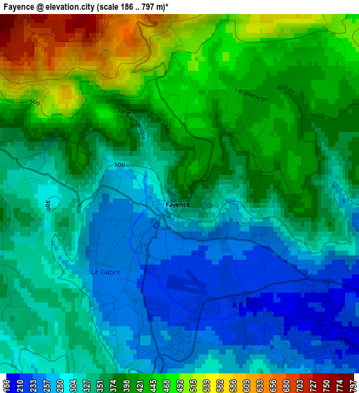
Below is the Elevation map of Fayence, which displays elevation range with different colors. Scale of the first map is from 186 to 797 m (610 to 2615 ft) with average elevation of 361.9 meters (=1187 ft) [note 1]
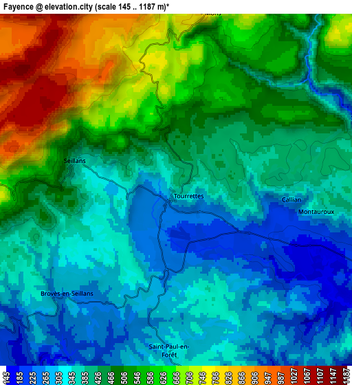
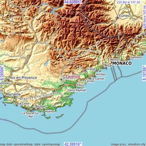
These maps also provides idea of topography and contour of this city, they are displayed at different zoom levels. More info about maps, scale and edge coordinates you can find below images.
| \ | Map #1 | Map #2 | Topo.Map |
| Scale [m] | 186..797 m | 145..1187 m | × |
| Scale [ft] | 610..2615 ft | 476..3894 ft | × |
| Average | 361.9 m = 1187 ft | 448 m = 1470 ft | × |
| Width | 7.07 km = 4.4 mi | 14.15 km = 8.8 mi | 226.4 km = 140.7 mi |
| Height | 7.07 km = 4.4 mi | 14.15 km = 8.8 mi | 226.4 km = 140.7 mi |
| ↑Max Latitude | 43.657502° | 43.689287° | 44.63501° |
| Latitude at center | 43.6257° | 43.6257° | 43.6257° |
| ↓Min Latitude | 43.593881° | 43.562046° | 42.59916° |
| ← Min Longitude | 6.651365° | 6.607419° | 5.28906° |
| Longitude center | 6.69531° | 6.69531° | 6.69531° |
| →Max Longitude | 6.739255° | 6.783201° | 8.10156° |
Nearby cities:
Cities around Fayence sort by population:
• Peymeinade elevation 213 m
14.6 km,  82°
82°
• Montauroux 380 m
5.7 km,  98°
98°
• Saint-Cézaire-sur-Siagne 448 m
8.3 km,  70°
70°
• Le Tignet 257 m
12.2 km, 82°
• Callian 310 m
4.6 km,  94°
94°
• Saint-Vallier-de-Thiey 720 m
14.7 km,  56°
56°
• Seillans 380 m
4.3 km,  285°
285°
• Bagnols-en-Forêt 293 m
9.8 km,  178°
178°
• Callas 385 m
13.2 km,  253°
253°
• Bargemon 465 m
11.8 km,  266°
266°
• Saint-Paul-en-Forêt 284 m
6.5 km, 182°
• Spéracèdes 240 m
13.4 km, 79°
Multilingual:
 En español:
Fayence elevación 375 m.
 En France:
Fayence élévation 375 m.


Sources and notes:
- [note 1] Map square and city borders are not equal. Map elevation data is calculated only from area inside that square.
- [src 1] Elevation data from geonames database provided with same terms of usage.
- [src 2] The elevation map of Fayence is generated using elevation data from NASA's 3 arcsec (90m) resolution SRTM data.
- [src 3] Base (background) map © OpenStreetMap contributors tiles are generated by Geofabrik and OpenTopoMap.
Copyright & License:
This Fayence Elevation Map is licensed under CC BY-SA. You may reuse any part from this page, if you give a proper credit by linking to this URL:
 More info on terms of use page.