Montauroux elevation
Montauroux (Provence-Alpes-Côte d'Azur, Var), France elevation is 380 meters and Montauroux elevation in feet is 1247 ft above sea level [src 1]. Montauroux is a populated place (feature code) with elevation that is 206 meters (676 ft) bigger than average city elevation in France.
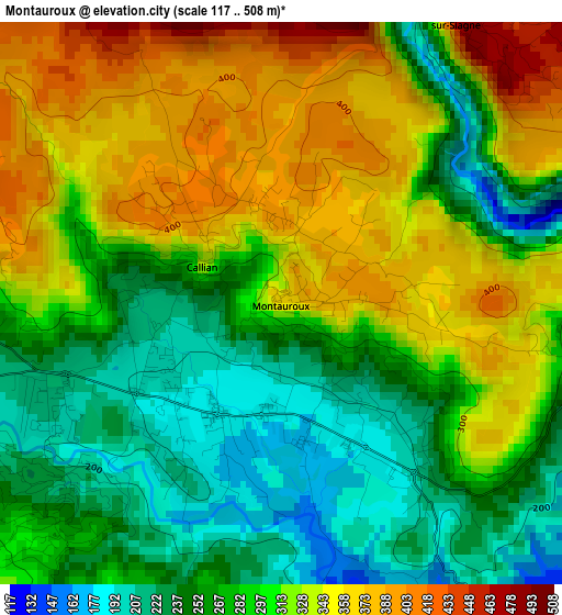
Below is the Elevation map of Montauroux, which displays elevation range with different colors. Scale of the first map is from 117 to 508 m (384 to 1667 ft) with average elevation of 299.3 meters (=982 ft) [note 1]
These maps also provides idea of topography and contour of this city, they are displayed at different zoom levels. More info about maps, scale and edge coordinates you can find below images.
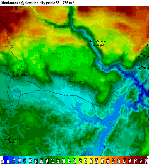
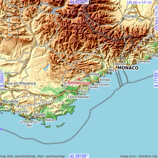
| \ | Map #1 | Map #2 | Topo.Map |
| Scale [m] | 117..508 m | 58..786 m | × |
| Scale [ft] | 384..1667 ft | 190..2579 ft | × |
| Average | 299.3 m = 982 ft | 346.7 m = 1137 ft | × |
| Width | 7.07 km = 4.4 mi | 14.15 km = 8.8 mi | 226.4 km = 140.7 mi |
| Height | 7.07 km = 4.4 mi | 14.15 km = 8.8 mi | 226.4 km = 140.7 mi |
| ↑Max Latitude | 43.650036° | 43.681825° | 44.62767° |
| Latitude at center | 43.61823° | 43.61823° | 43.61823° |
| ↓Min Latitude | 43.586407° | 43.554568° | 42.59156° |
| ← Min Longitude | 6.721335° | 6.677389° | 5.35903° |
| Longitude center | 6.76528° | 6.76528° | 6.76528° |
| →Max Longitude | 6.809225° | 6.853171° | 8.17153° |
Nearby cities:
Cities around Montauroux sort by population:
• Peymeinade elevation 213 m
9.3 km,  73°
73°
• Fayence 375 m
5.7 km,  278°
278°
• Saint-Cézaire-sur-Siagne 448 m
4.2 km,  31°
31°
• Le Tignet 257 m
6.9 km, 69°
• Callian 310 m
1.1 km,  293°
293°
• Saint-Vallier-de-Thiey 720 m
11.1 km,  36°
36°
• Seillans 380 m
10 km, 281°
• Bagnols-en-Forêt 293 m
10.5 km,  211°
211°
• Cabris 410 m
9.7 km,  64°
64°
• Tanneron 371 m
9.4 km,  109°
109°
• Saint-Paul-en-Forêt 284 m
8.2 km,  226°
226°
• Spéracèdes 240 m
8.3 km, 65°
Multilingual:
 En español:
Montauroux elevación 380 m.
 En France:
Montauroux élévation 380 m.
 Auf Deutsch:
Montauroux höhe über dem Meeresspiegel ist 380 m.

Sources and notes:
- [note 1] Map square and city borders are not equal. Map elevation data is calculated only from area inside that square.
- [src 1] Elevation data from geonames database provided with same terms of usage.
- [src 2] The elevation map of Montauroux is generated using elevation data from NASA's 3 arcsec (90m) resolution SRTM data.
- [src 3] Base (background) map © OpenStreetMap contributors tiles are generated by Geofabrik and OpenTopoMap.
Copyright & License:
This Montauroux Elevation Map is licensed under CC BY-SA. You may reuse any part from this page, if you give a proper credit by linking to this URL:
 More info on terms of use page.