Fismes elevation
Fismes (Grand Est, Marne), France elevation is 74 meters and Fismes elevation in feet is 243 ft above sea level [src 1]. Fismes is a populated place (feature code) with elevation that is 100 meters (328 ft) smaller than average city elevation in France.
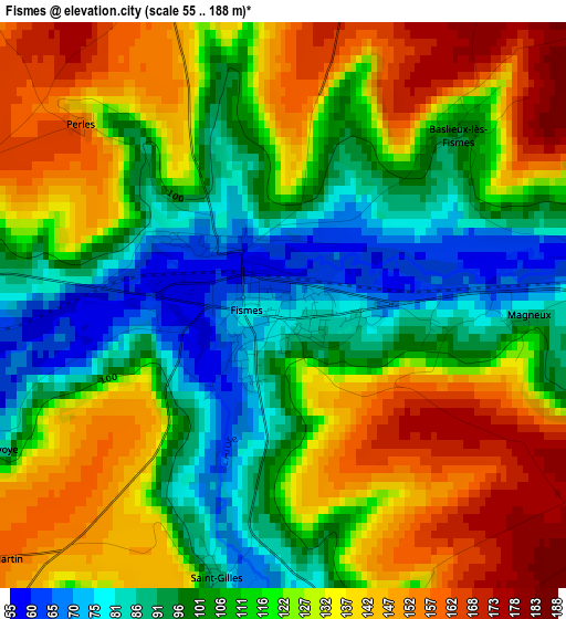
Below is the Elevation map of Fismes, which displays elevation range with different colors. Scale of the first map is from 55 to 188 m (180 to 617 ft) with average elevation of 118.5 meters (=389 ft) [note 1]
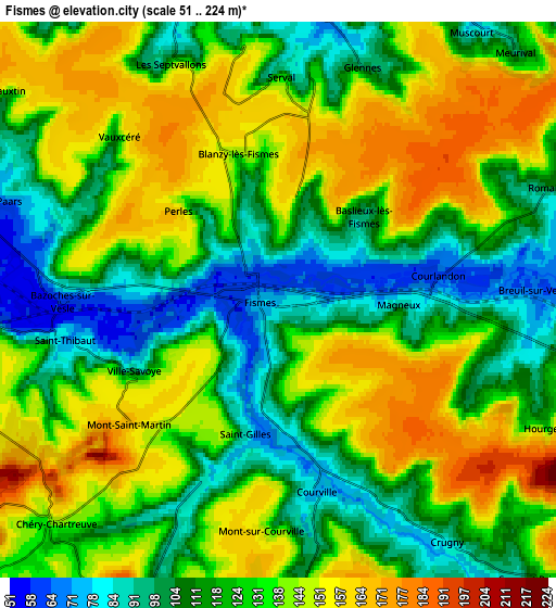
These maps also provides idea of topography and contour of this city, they are displayed at different zoom levels. More info about maps, scale and edge coordinates you can find below images.
| \ | Map #1 | Map #2 | Topo.Map |
| Scale [m] | 55..188 m | 51..224 m | × |
| Scale [ft] | 180..617 ft | 167..735 ft | × |
| Average | 118.5 m = 389 ft | 127.8 m = 419 ft | × |
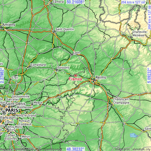
| Width | 6.37 km = 4 mi | 12.74 km = 7.9 mi | 203.9 km = 126.7 mi |
| Height | 6.37 km = 4 mi | 12.74 km = 7.9 mi | 203.9 km = 126.7 mi |
| ↑Max Latitude | 49.336374° | 49.365001° | 50.21608° |
| Latitude at center | 49.30773° | 49.30773° | 49.30773° |
| ↓Min Latitude | 49.279069° | 49.250392° | 48.38232° |
| ← Min Longitude | 3.642125° | 3.598179° | 2.27982° |
| Longitude center | 3.68607° | 3.68607° | 3.68607° |
| →Max Longitude | 3.730015° | 3.773961° | 5.09232° |
Nearby cities:
Cities around Fismes sort by population:
• Tinqueux elevation 90 m
22.5 km,  106°
106°
• Saint-Brice-Courcelles 73 m
22 km,  101°
101°
• Fère-en-Tardenois 123 m
17.2 km,  225°
225°
• Muizon 75 m
15.3 km, 103°
• Vailly-sur-Aisne 50 m
16.6 km,  312°
312°
• Braine 52 m
11.8 km,  289°
289°
• Jonchery-sur-Vesle 80 m
9.5 km, 102°
• Venizel 48 m
22.2 km, 286°
• Gueux 96 m
17.5 km, 111°
• Hermonville 106 m
16.6 km,  78°
78°
• Loivre 70 m
21.7 km, 78°
• Cormicy 86 m
16.7 km,  65°
65°
Multilingual:
 En español:
Fismes elevación 74 m.
 En France:
Fismes élévation 74 m.


Sources and notes:
- [note 1] Map square and city borders are not equal. Map elevation data is calculated only from area inside that square.
- [src 1] Elevation data from geonames database provided with same terms of usage.
- [src 2] The elevation map of Fismes is generated using elevation data from NASA's 3 arcsec (90m) resolution SRTM data.
- [src 3] Base (background) map © OpenStreetMap contributors tiles are generated by Geofabrik and OpenTopoMap.
Copyright & License:
This Fismes Elevation Map is licensed under CC BY-SA. You may reuse any part from this page, if you give a proper credit by linking to this URL:
 More info on terms of use page.