Tinqueux elevation
Tinqueux (Grand Est, Marne), France elevation is 90 meters and Tinqueux elevation in feet is 295 ft above sea level [src 1]. Tinqueux is a populated place (feature code) with elevation that is 84 meters (276 ft) smaller than average city elevation in France.
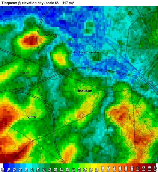
Below is the Elevation map of Tinqueux, which displays elevation range with different colors. Scale of the first map is from 68 to 117 m (223 to 384 ft) with average elevation of 85.6 meters (=281 ft) [note 1]
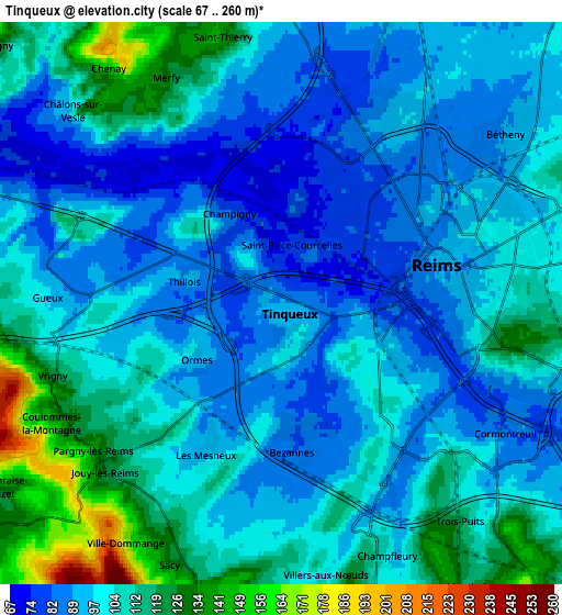
These maps also provides idea of topography and contour of this city, they are displayed at different zoom levels. More info about maps, scale and edge coordinates you can find below images.
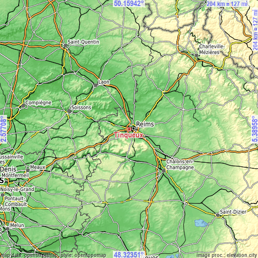
| \ | Map #1 | Map #2 | Topo.Map |
| Scale [m] | 68..117 m | 67..260 m | × |
| Scale [ft] | 223..384 ft | 220..853 ft | × |
| Average | 85.6 m = 281 ft | 101.4 m = 333 ft | × |
| Width | 6.38 km = 4 mi | 12.76 km = 7.9 mi | 204.1 km = 126.8 mi |
| Height | 6.38 km = 4 mi | 12.76 km = 7.9 mi | 204.1 km = 126.8 mi |
| ↑Max Latitude | 49.278677° | 49.307338° | 50.15942° |
| Latitude at center | 49.25° | 49.25° | 49.25° |
| ↓Min Latitude | 49.221306° | 49.192595° | 48.32351° |
| ← Min Longitude | 3.939385° | 3.895439° | 2.57708° |
| Longitude center | 3.98333° | 3.98333° | 3.98333° |
| →Max Longitude | 4.027275° | 4.071221° | 5.38958° |
Nearby cities:
Cities around Tinqueux sort by population:
• Reims elevation 90 m
3.7 km,  62°
62°
• Cormontreuil 91 m
6.1 km,  127°
127°
• Bétheny 91 m
6.5 km,  53°
53°
• Saint-Brice-Courcelles 73 m
1.9 km,  0°
0°
• Muizon 75 m
7.3 km,  292°
292°
• Taissy 82 m
8.9 km,  115°
115°
• Courcy 80 m
8.3 km,  9°
9°
• Gueux 96 m
5.3 km,  270°
270°
• Bezannes 81 m
3 km,  172°
172°
• Cernay-lès-Reims 128 m
8.8 km,  79°
79°
• Loivre 70 m
10.7 km,  358°
358°
• Rilly-la-Montagne 156 m
10.4 km,  154°
154°
Multilingual:
 En español:
Tinqueux elevación 90 m.
 En France:
Tinqueux élévation 90 m.


Sources and notes:
- [note 1] Map square and city borders are not equal. Map elevation data is calculated only from area inside that square.
- [src 1] Elevation data from geonames database provided with same terms of usage.
- [src 2] The elevation map of Tinqueux is generated using elevation data from NASA's 3 arcsec (90m) resolution SRTM data.
- [src 3] Base (background) map © OpenStreetMap contributors tiles are generated by Geofabrik and OpenTopoMap.
Copyright & License:
This Tinqueux Elevation Map is licensed under CC BY-SA. You may reuse any part from this page, if you give a proper credit by linking to this URL:
 More info on terms of use page.