Frangy elevation
Frangy (Auvergne-Rhône-Alpes, Haute-Savoie), France elevation is 379 meters and Frangy elevation in feet is 1243 ft above sea level [src 1]. Frangy is a populated place (feature code) with elevation that is 205 meters (673 ft) bigger than average city elevation in France.
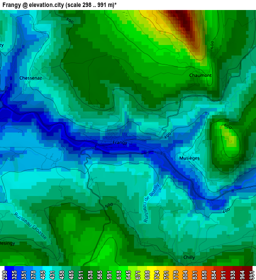
Below is the Elevation map of Frangy, which displays elevation range with different colors. Scale of the first map is from 298 to 991 m (978 to 3251 ft) with average elevation of 480 meters (=1575 ft) [note 1]
These maps also provides idea of topography and contour of this city, they are displayed at different zoom levels. More info about maps, scale and edge coordinates you can find below images.
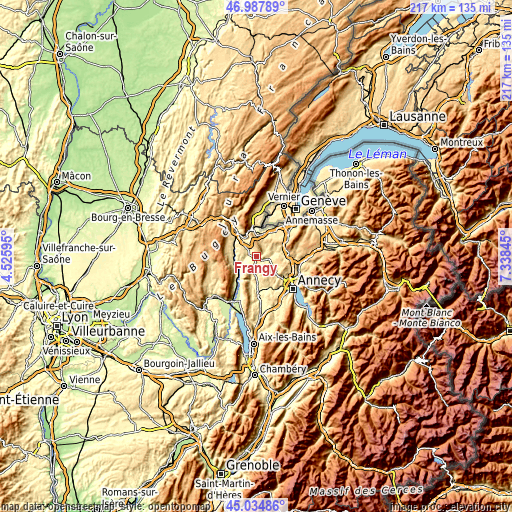
| \ | Map #1 | Topo.Map |
| Scale [m] | 298..991 m | × |
| Scale [ft] | 978..3251 ft | × |
| Average | 480 m = 1575 ft | × |
| Width | 6.79 km = 4.2 mi | 217.2 km = 135 mi |
| Height | 6.79 km = 4.2 mi | 217.1 km = 134.9 mi |
| ↑Max Latitude | 46.050508° | 46.98789° |
| Latitude at center | 46.02° | 46.02° |
| ↓Min Latitude | 45.989476° | 45.03486° |
| ← Min Longitude | 5.888255° | 4.52595° |
| Longitude center | 5.9322° | 5.9322° |
| →Max Longitude | 5.976145° | 7.33845° |
Nearby cities:
Cities around Frangy sort by population:
• Bellegarde-sur-Valserine elevation 361 m
12.8 km,  319°
319°
• La Balme-de-Sillingy 558 m
10.2 km,  123°
123°
• Cruseilles 810 m
13.6 km,  85°
85°
• Viry 535 m
13.2 km,  38°
38°
• Sillingy 481 m
11.8 km,  132°
132°
• Valleiry 469 m
10.5 km,  16°
16°
• Versonnex 404 m
10.1 km,  182°
182°
• Choisy 720 m
10.2 km,  106°
106°
• Vallières 381 m
13.3 km, 177°
• Collonges 450 m
13.3 km,  350°
350°
• Chilly 470 m
3.6 km,  150°
150°
• Lancrans 503 m
14.2 km,  327°
327°
Multilingual:
 En español:
Frangy elevación 379 m.
 En France:
Frangy élévation 379 m.


Sources and notes:
- [note 1] Map square and city borders are not equal. Map elevation data is calculated only from area inside that square.
- [src 1] Elevation data from geonames database provided with same terms of usage.
- [src 2] The elevation map of Frangy is generated using elevation data from NASA's 3 arcsec (90m) resolution SRTM data.
- [src 3] Base (background) map © OpenStreetMap contributors tiles are generated by Geofabrik and OpenTopoMap.
Copyright & License:
This Frangy Elevation Map is licensed under CC BY-SA. You may reuse any part from this page, if you give a proper credit by linking to this URL:
 More info on terms of use page.