La Balme-de-Sillingy elevation
La Balme-de-Sillingy (Auvergne-Rhône-Alpes, Haute-Savoie), France elevation is 558 meters and La Balme-de-Sillingy elevation in feet is 1831 ft above sea level [src 1]. La Balme-de-Sillingy is a populated place (feature code) with elevation that is 384 meters (1260 ft) bigger than average city elevation in France.
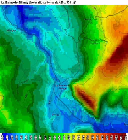
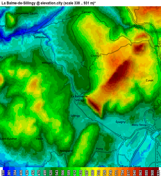
Below is the Elevation map of La Balme-de-Sillingy, which displays elevation range with different colors. Scale of the first map is from 420 to 931 m (1378 to 3054 ft) with average elevation of 592.2 meters (=1943 ft) [note 1]
These maps also provides idea of topography and contour of this city, they are displayed at different zoom levels. More info about maps, scale and edge coordinates you can find below images.
| \ | Map #1 | Map #2 | Topo.Map |
| Scale [m] | 420..931 m | 338..931 m | × |
| Scale [ft] | 1378..3054 ft | 1109..3054 ft | × |
| Average | 592.2 m = 1943 ft | 569.4 m = 1868 ft | × |
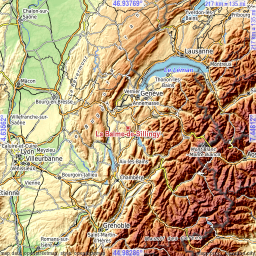
| Width | 6.79 km = 4.2 mi | 13.58 km = 8.4 mi | 217.4 km = 135.1 mi |
| Height | 6.79 km = 4.2 mi | 13.58 km = 8.4 mi | 217.3 km = 135 mi |
| ↑Max Latitude | 45.999436° | 46.029955° | 46.93769° |
| Latitude at center | 45.9689° | 45.9689° | 45.9689° |
| ↓Min Latitude | 45.938347° | 45.907778° | 44.98286° |
| ← Min Longitude | 5.997925° | 5.953979° | 4.63562° |
| Longitude center | 6.04187° | 6.04187° | 6.04187° |
| →Max Longitude | 6.085815° | 6.129761° | 7.44812° |
Nearby cities:
Cities around La Balme-de-Sillingy sort by population:
• Meythet elevation 451 m
6.9 km,  144°
144°
• Poisy 516 m
5.5 km,  162°
162°
• Cruseilles 810 m
8.5 km,  37°
37°
• Épagny 456 m
4.9 km, 139°
• Sillingy 481 m
2.4 km,  175°
175°
• Pringy 508 m
7 km,  111°
111°
• Metz 468 m
6.6 km,  126°
126°
• Chavanod 510 m
8.8 km, 181°
• Choisy 720 m
3 km,  25°
25°
• Allonzier-la-Caille 648 m
6.9 km,  58°
58°
• Chilly 470 m
7.2 km,  290°
290°
• Lovagny 530 m
7.3 km,  185°
185°
Multilingual:
 En español:
La Balme-de-Sillingy elevación 558 m.
 En France:
La Balme-de-Sillingy élévation 558 m.
 Auf Deutsch:
La Balme-de-Sillingy höhe über dem Meeresspiegel ist 558 m.
 На русском:
La Balme-de-Sillingy высота над уровнем моря 558 м
Sources and notes:
- [note 1] Map square and city borders are not equal. Map elevation data is calculated only from area inside that square.
- [src 1] Elevation data from geonames database provided with same terms of usage.
- [src 2] The elevation map of La Balme-de-Sillingy is generated using elevation data from NASA's 3 arcsec (90m) resolution SRTM data.
- [src 3] Base (background) map © OpenStreetMap contributors tiles are generated by Geofabrik and OpenTopoMap.
Copyright & License:
This La Balme-de-Sillingy Elevation Map is licensed under CC BY-SA. You may reuse any part from this page, if you give a proper credit by linking to this URL:
 More info on terms of use page.