Froncles elevation
Froncles (Grand Est, Haute-Marne), France elevation is 223 meters and Froncles elevation in feet is 732 ft above sea level [src 1]. Froncles is a populated place (feature code) with elevation that is 49 meters (161 ft) bigger than average city elevation in France.
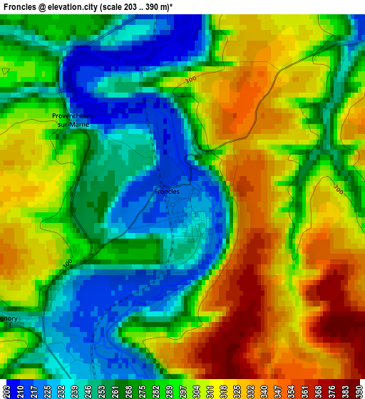
Below is the Elevation map of Froncles, which displays elevation range with different colors. Scale of the first map is from 203 to 390 m (666 to 1280 ft) with average elevation of 286.7 meters (=941 ft) [note 1]
These maps also provides idea of topography and contour of this city, they are displayed at different zoom levels. More info about maps, scale and edge coordinates you can find below images.
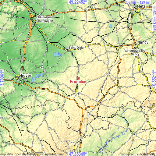
| \ | Map #1 | Topo.Map |
| Scale [m] | 203..390 m | × |
| Scale [ft] | 666..1280 ft | × |
| Average | 286.7 m = 941 ft | × |
| Width | 6.5 km = 4 mi | 208 km = 129.2 mi |
| Height | 6.5 km = 4 mi | 208 km = 129.2 mi |
| ↑Max Latitude | 48.326787° | 49.22452° |
| Latitude at center | 48.29756° | 48.29756° |
| ↓Min Latitude | 48.268316° | 47.35345° |
| ← Min Longitude | 5.101915° | 3.73961° |
| Longitude center | 5.14586° | 5.14586° |
| →Max Longitude | 5.189805° | 6.55211° |
Nearby cities:
Cities around Froncles sort by population:
• Chaumont elevation 322 m
20.7 km,  180°
180°
• Joinville 186 m
16.2 km,  358°
358°
• Wassy 164 m
26.7 km,  326°
326°
• Liffol-le-Grand 310 m
32.3 km,  86°
86°
• Eurville-Bienville 180 m
32.8 km,  345°
345°
• Bienville 163 m
31.8 km, 346°
• Bologne 250 m
10.8 km, 181°
• Bayard-sur-Marne 169 m
29 km, 349°
• Chevillon 186 m
25.7 km, 357°
• Biesles 389 m
26 km,  154°
154°
• Chamarandes-Choignes 339 m
23.8 km, 179°
• Doulaincourt-Saucourt 256 m
4.5 km,  62°
62°
Multilingual:
 En español:
Froncles elevación 223 m.
 En France:
Froncles élévation 223 m.
 Auf Deutsch:
Froncles höhe über dem Meeresspiegel ist 223 m.

Sources and notes:
- [note 1] Map square and city borders are not equal. Map elevation data is calculated only from area inside that square.
- [src 1] Elevation data from geonames database provided with same terms of usage.
- [src 2] The elevation map of Froncles is generated using elevation data from NASA's 3 arcsec (90m) resolution SRTM data.
- [src 3] Base (background) map © OpenStreetMap contributors tiles are generated by Geofabrik and OpenTopoMap.
Copyright & License:
This Froncles Elevation Map is licensed under CC BY-SA. You may reuse any part from this page, if you give a proper credit by linking to this URL:
 More info on terms of use page.