Eurville-Bienville elevation
Eurville-Bienville (Grand Est, Haute-Marne), France elevation is 180 meters and Eurville-Bienville elevation in feet is 591 ft above sea level [src 1]. Eurville-Bienville is a populated place (feature code) with elevation that is 6 meters (20 ft) bigger than average city elevation in France.
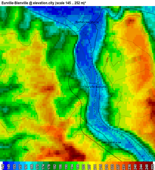
Below is the Elevation map of Eurville-Bienville, which displays elevation range with different colors. Scale of the first map is from 145 to 252 m (476 to 827 ft) with average elevation of 194.3 meters (=637 ft) [note 1]
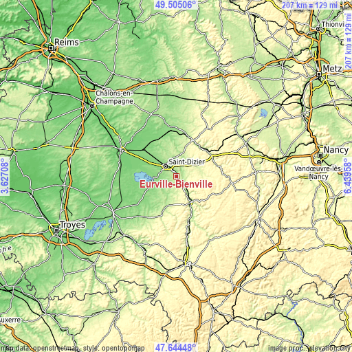
These maps also provides idea of topography and contour of this city, they are displayed at different zoom levels. More info about maps, scale and edge coordinates you can find below images.
| \ | Map #1 | Topo.Map |
| Scale [m] | 145..252 m | × |
| Scale [ft] | 476..827 ft | × |
| Average | 194.3 m = 637 ft | × |
| Width | 6.46 km = 4 mi | 206.9 km = 128.6 mi |
| Height | 6.46 km = 4 mi | 206.9 km = 128.6 mi |
| ↑Max Latitude | 48.612393° | 49.50506° |
| Latitude at center | 48.58333° | 48.58333° |
| ↓Min Latitude | 48.55425° | 47.64448° |
| ← Min Longitude | 4.989385° | 3.62708° |
| Longitude center | 5.03333° | 5.03333° |
| →Max Longitude | 5.077275° | 6.43958° |
Nearby cities:
Cities around Eurville-Bienville sort by population:
• Saint-Dizier elevation 142 m
8.7 km,  314°
314°
• Joinville 186 m
17.5 km,  152°
152°
• Wassy 164 m
11.4 km,  213°
213°
• Ancerville 196 m
5.9 km,  351°
351°
• Bienville 163 m
1.2 km,  132°
132°
• Montier-en-Der 129 m
22.6 km,  238°
238°
• Bettancourt-la-Ferrée 165 m
8.7 km,  327°
327°
• Bayard-sur-Marne 169 m
4.6 km,  135°
135°
• Villiers-en-Lieu 145 m
13.7 km, 313°
• Chevillon 186 m
9.4 km, 130°
• Longeville-en-Barrois 193 m
21.9 km,  36°
36°
• Chancenay 181 m
10.2 km,  340°
340°
Multilingual:
 En español:
Eurville-Bienville elevación 180 m.
 En France:
Eurville-Bienville élévation 180 m.
 Auf Deutsch:
Eurville-Bienville höhe über dem Meeresspiegel ist 180 m.
 На русском:
Eurville-Bienville высота над уровнем моря 180 м
Sources and notes:
- [note 1] Map square and city borders are not equal. Map elevation data is calculated only from area inside that square.
- [src 1] Elevation data from geonames database provided with same terms of usage.
- [src 2] The elevation map of Eurville-Bienville is generated using elevation data from NASA's 3 arcsec (90m) resolution SRTM data.
- [src 3] Base (background) map © OpenStreetMap contributors tiles are generated by Geofabrik and OpenTopoMap.
Copyright & License:
This Eurville-Bienville Elevation Map is licensed under CC BY-SA. You may reuse any part from this page, if you give a proper credit by linking to this URL:
 More info on terms of use page.