Gières elevation
Gières (Auvergne-Rhône-Alpes, Département de l'Isère), France elevation is 331 meters and Gières elevation in feet is 1086 ft above sea level [src 1]. Gières is a populated place (feature code) with elevation that is 157 meters (515 ft) bigger than average city elevation in France.
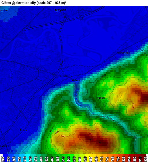
Below is the Elevation map of Gières, which displays elevation range with different colors. Scale of the first map is from 207 to 938 m (679 to 3077 ft) with average elevation of 349.8 meters (=1148 ft) [note 1]
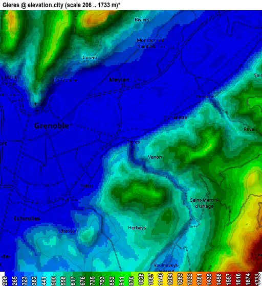
These maps also provides idea of topography and contour of this city, they are displayed at different zoom levels. More info about maps, scale and edge coordinates you can find below images.
| \ | Map #1 | Map #2 | Topo.Map |
| Scale [m] | 207..938 m | 206..1733 m | × |
| Scale [ft] | 679..3077 ft | 676..5686 ft | × |
| Average | 349.8 m = 1148 ft | 456.9 m = 1499 ft | × |
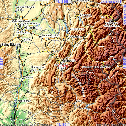
| Width | 6.89 km = 4.3 mi | 13.78 km = 8.6 mi | 220.4 km = 136.9 mi |
| Height | 6.89 km = 4.3 mi | 13.78 km = 8.6 mi | 220.4 km = 136.9 mi |
| ↑Max Latitude | 45.210938° | 45.241889° | 46.16258° |
| Latitude at center | 45.17997° | 45.17997° | 45.17997° |
| ↓Min Latitude | 45.148985° | 45.117984° | 44.1801° |
| ← Min Longitude | 5.745405° | 5.701459° | 4.3831° |
| Longitude center | 5.78935° | 5.78935° | 5.78935° |
| →Max Longitude | 5.833295° | 5.877241° | 7.1956° |
Nearby cities:
Cities around Gières sort by population:
• Grenoble elevation 213 m
5.8 km,  268°
268°
• Saint-Martin-d’Hères 207 m
2.1 km, 266°
• Meylan 233 m
3.4 km,  344°
344°
• Eybens 320 m
4.7 km,  220°
220°
• La Tronche 222 m
4.4 km,  309°
309°
• Domène 238 m
4.3 km,  53°
53°
• Montbonnot-Saint-Martin 263 m
5.1 km,  10°
10°
• Corenc 401 m
4.7 km, 336°
• Biviers 363 m
6 km, 8°
• Poisat 281 m
3.3 km, 223°
• Brié-et-Angonnes 442 m
6.2 km,  184°
184°
• Herbeys 603 m
4.4 km, 176°
Multilingual:
 En español:
Gières elevación 331 m.
 En France:
Gières élévation 331 m.


Sources and notes:
- [note 1] Map square and city borders are not equal. Map elevation data is calculated only from area inside that square.
- [src 1] Elevation data from geonames database provided with same terms of usage.
- [src 2] The elevation map of Gières is generated using elevation data from NASA's 3 arcsec (90m) resolution SRTM data.
- [src 3] Base (background) map © OpenStreetMap contributors tiles are generated by Geofabrik and OpenTopoMap.
Copyright & License:
This Gières Elevation Map is licensed under CC BY-SA. You may reuse any part from this page, if you give a proper credit by linking to this URL:
 More info on terms of use page.