Gisors elevation
Gisors (Normandy, Département de l'Eure), France elevation is 52 meters and Gisors elevation in feet is 171 ft above sea level [src 1]. Gisors is a populated place (feature code) with elevation that is 122 meters (400 ft) smaller than average city elevation in France.
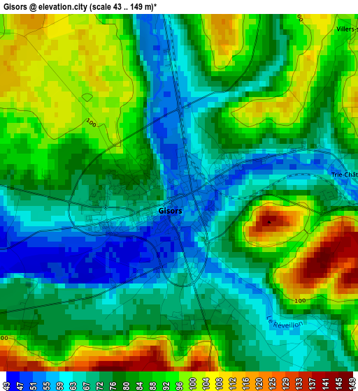
Below is the Elevation map of Gisors, which displays elevation range with different colors. Scale of the first map is from 43 to 149 m (141 to 489 ft) with average elevation of 81.3 meters (=267 ft) [note 1]
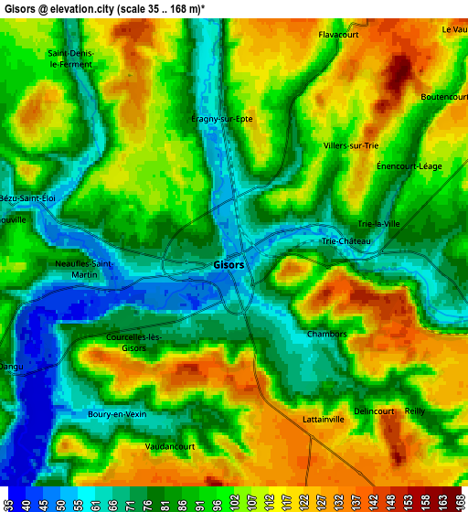
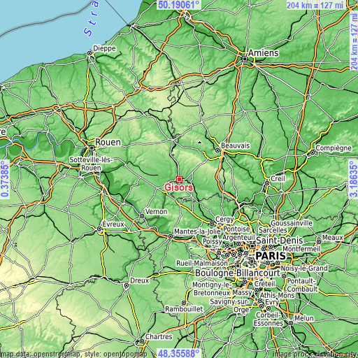
These maps also provides idea of topography and contour of this city, they are displayed at different zoom levels. More info about maps, scale and edge coordinates you can find below images.
| \ | Map #1 | Map #2 | Topo.Map |
| Scale [m] | 43..149 m | 35..168 m | × |
| Scale [ft] | 141..489 ft | 115..551 ft | × |
| Average | 81.3 m = 267 ft | 94 m = 308 ft | × |
| Width | 6.37 km = 4 mi | 12.75 km = 7.9 mi | 204 km = 126.8 mi |
| Height | 6.38 km = 4 mi | 12.75 km = 7.9 mi | 204 km = 126.8 mi |
| ↑Max Latitude | 49.310439° | 49.339081° | 50.19061° |
| Latitude at center | 49.28178° | 49.28178° | 49.28178° |
| ↓Min Latitude | 49.253104° | 49.224412° | 48.35588° |
| ← Min Longitude | 1.736155° | 1.692209° | 0.37385° |
| Longitude center | 1.7801° | 1.7801° | 1.7801° |
| →Max Longitude | 1.824045° | 1.867991° | 3.18635° |
Nearby cities:
Cities around Gisors sort by population:
• Magny-en-Vexin elevation 82 m
14.1 km,  178°
178°
• Étrépagny 86 m
12.5 km,  282°
282°
• Chaumont-en-Vexin 67 m
7.9 km,  102°
102°
• Auneuil 126 m
18.6 km,  57°
57°
• Sérifontaine 70 m
8.1 km,  354°
354°
• Saint-Germer-de-Fly 101 m
17.9 km,  359°
359°
• Chars 64 m
17.7 km,  139°
139°
• Trie-Château 64 m
3 km,  82°
82°
• Ons-en-Bray 122 m
18.2 km,  34°
34°
• Bézu-Saint-Éloi 67 m
5.7 km,  285°
285°
• Saint-Aubin-en-Bray 138 m
17 km,  24°
24°
• Neaufles-Saint-Martin 69 m
3.8 km,  261°
261°
Multilingual:
 En español:
Gisors elevación 52 m.
 En France:
Gisors élévation 52 m.


Sources and notes:
- [note 1] Map square and city borders are not equal. Map elevation data is calculated only from area inside that square.
- [src 1] Elevation data from geonames database provided with same terms of usage.
- [src 2] The elevation map of Gisors is generated using elevation data from NASA's 3 arcsec (90m) resolution SRTM data.
- [src 3] Base (background) map © OpenStreetMap contributors tiles are generated by Geofabrik and OpenTopoMap.
Copyright & License:
This Gisors Elevation Map is licensed under CC BY-SA. You may reuse any part from this page, if you give a proper credit by linking to this URL:
 More info on terms of use page.