Herrlisheim-près-Colmar elevation
Herrlisheim-près-Colmar (Grand Est, Haut-Rhin), France elevation is 193 meters and Herrlisheim-près-Colmar elevation in feet is 633 ft above sea level [src 1]. Herrlisheim-près-Colmar is a populated place (feature code) with elevation that is 19 meters (62 ft) bigger than average city elevation in France.
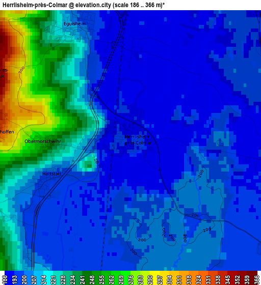
Below is the Elevation map of Herrlisheim-près-Colmar, which displays elevation range with different colors. Scale of the first map is from 186 to 366 m (610 to 1201 ft) with average elevation of 209.1 meters (=686 ft) [note 1]
These maps also provides idea of topography and contour of this city, they are displayed at different zoom levels. More info about maps, scale and edge coordinates you can find below images.
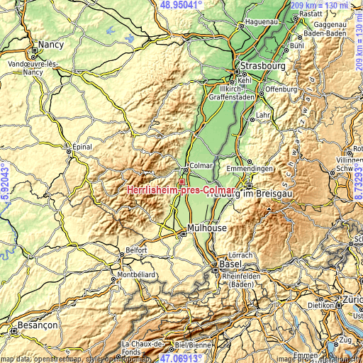
| \ | Map #1 | Topo.Map |
| Scale [m] | 186..366 m | × |
| Scale [ft] | 610..1201 ft | × |
| Average | 209.1 m = 686 ft | × |
| Width | 6.54 km = 4.1 mi | 209.2 km = 130 mi |
| Height | 6.54 km = 4.1 mi | 209.2 km = 130 mi |
| ↑Max Latitude | 48.047736° | 48.95041° |
| Latitude at center | 48.01835° | 48.01835° |
| ↓Min Latitude | 47.988947° | 47.06913° |
| ← Min Longitude | 7.282735° | 5.92043° |
| Longitude center | 7.32668° | 7.32668° |
| →Max Longitude | 7.370625° | 8.73293° |
Nearby cities:
Cities around Herrlisheim-près-Colmar sort by population:
• Colmar elevation 190 m
7.3 km,  17°
17°
• Wintzenheim 230 m
6.6 km,  336°
336°
• Horbourg-Wihr 188 m
8.6 km,  35°
35°
• Rouffach 204 m
7 km,  196°
196°
• Turckheim 240 m
8.5 km,  334°
334°
• Sainte-Croix-en-Plaine 197 m
4.5 km,  103°
103°
• Andolsheim 189 m
8.2 km,  54°
54°
• Sundhoffen 193 m
7 km,  67°
67°
• Wettolsheim 222 m
4.8 km, 334°
• Eguisheim 210 m
3.1 km, 330°
• Pfaffenheim 219 m
4.6 km,  217°
217°
• Oberhergheim 202 m
7.7 km,  138°
138°
Multilingual:
 En español:
Herrlisheim-près-Colmar elevación 193 m.
 En France:
Herrlisheim-près-Colmar élévation 193 m.
 Auf Deutsch:
Herrlisheim-près-Colmar höhe über dem Meeresspiegel ist 193 m.
 На русском:
Эрлисайм-пре-Кольмар высота над уровнем моря 193 м
Sources and notes:
- [note 1] Map square and city borders are not equal. Map elevation data is calculated only from area inside that square.
- [src 1] Elevation data from geonames database provided with same terms of usage.
- [src 2] The elevation map of Herrlisheim-près-Colmar is generated using elevation data from NASA's 3 arcsec (90m) resolution SRTM data.
- [src 3] Base (background) map © OpenStreetMap contributors tiles are generated by Geofabrik and OpenTopoMap.
Copyright & License:
This Herrlisheim-près-Colmar Elevation Map is licensed under CC BY-SA. You may reuse any part from this page, if you give a proper credit by linking to this URL:
 More info on terms of use page.