Lamballe elevation
Lamballe (Brittany, Département des Côtes-d’Armor), France elevation is 50 meters and Lamballe elevation in feet is 164 ft above sea level [src 1]. Lamballe is a populated place (feature code) with elevation that is 124 meters (407 ft) smaller than average city elevation in France.
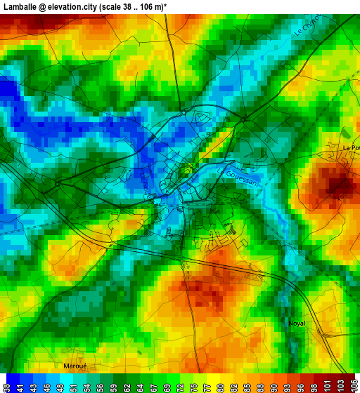
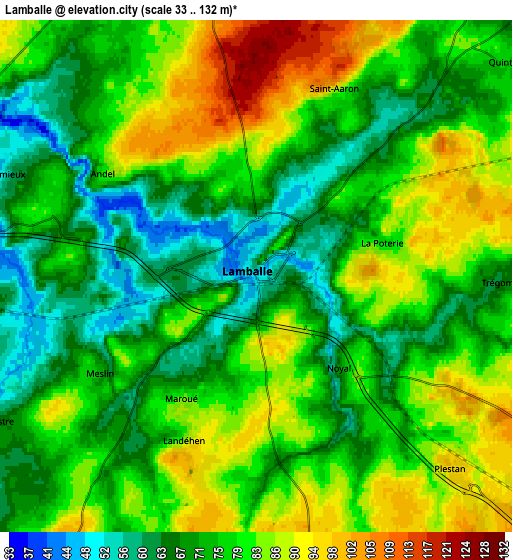
Below is the Elevation map of Lamballe, which displays elevation range with different colors. Scale of the first map is from 38 to 106 m (125 to 348 ft) with average elevation of 67 meters (=220 ft) [note 1]
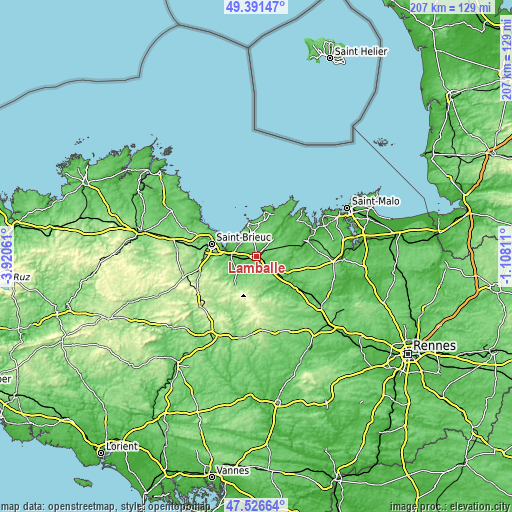
These maps also provides idea of topography and contour of this city, they are displayed at different zoom levels. More info about maps, scale and edge coordinates you can find below images.
| \ | Map #1 | Map #2 | Topo.Map |
| Scale [m] | 38..106 m | 33..132 m | × |
| Scale [ft] | 125..348 ft | 108..433 ft | × |
| Average | 67 m = 220 ft | 76.7 m = 252 ft | × |
| Width | 6.48 km = 4 mi | 12.96 km = 8.1 mi | 207.3 km = 128.8 mi |
| Height | 6.48 km = 4 mi | 12.96 km = 8.1 mi | 207.3 km = 128.8 mi |
| ↑Max Latitude | 48.496749° | 48.525862° | 49.39147° |
| Latitude at center | 48.46762° | 48.46762° | 48.46762° |
| ↓Min Latitude | 48.438474° | 48.409311° | 47.52664° |
| ← Min Longitude | -2.558305° | -2.602251° | -3.92061° |
| Longitude center | -2.51436° | -2.51436° | -2.51436° |
| →Max Longitude | -2.470415° | -2.426469° | -1.10811° |
Nearby cities:
Cities around Lamballe sort by population:
• Yffiniac elevation 11 m
12.1 km,  278°
278°
• Hillion 27 m
12.3 km,  294°
294°
• Pléneuf-Val-André 45 m
14.1 km,  350°
350°
• Quessoy 93 m
11.9 km,  244°
244°
• Pommeret 66 m
8.3 km,  267°
267°
• Saint-Alban 100 m
10 km, 349°
• Planguenoual 80 m
8.6 km,  327°
327°
• Plestan 96 m
7 km,  135°
135°
• Bréhand 84 m
8.4 km,  211°
211°
• Coëtmieux 54 m
6.9 km, 292°
• Plédéliac 89 m
9.9 km,  101°
101°
• Landéhen 84 m
4.6 km,  204°
204°
Multilingual:
 En español:
Lamballe elevación 50 m.
 En France:
Lamballe élévation 50 m.


Sources and notes:
- [note 1] Map square and city borders are not equal. Map elevation data is calculated only from area inside that square.
- [src 1] Elevation data from geonames database provided with same terms of usage.
- [src 2] The elevation map of Lamballe is generated using elevation data from NASA's 3 arcsec (90m) resolution SRTM data.
- [src 3] Base (background) map © OpenStreetMap contributors tiles are generated by Geofabrik and OpenTopoMap.
Copyright & License:
This Lamballe Elevation Map is licensed under CC BY-SA. You may reuse any part from this page, if you give a proper credit by linking to this URL:
 More info on terms of use page.