Quessoy elevation
Quessoy (Brittany, Département des Côtes-d’Armor), France elevation is 93 meters and Quessoy elevation in feet is 305 ft above sea level [src 1]. Quessoy is a populated place (feature code) with elevation that is 81 meters (266 ft) smaller than average city elevation in France.
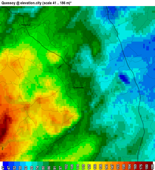
Below is the Elevation map of Quessoy, which displays elevation range with different colors. Scale of the first map is from 41 to 186 m (135 to 610 ft) with average elevation of 94.8 meters (=311 ft) [note 1]
These maps also provides idea of topography and contour of this city, they are displayed at different zoom levels. More info about maps, scale and edge coordinates you can find below images.
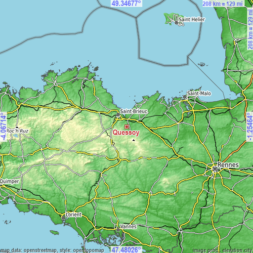
| \ | Map #1 | Map #2 | Topo.Map |
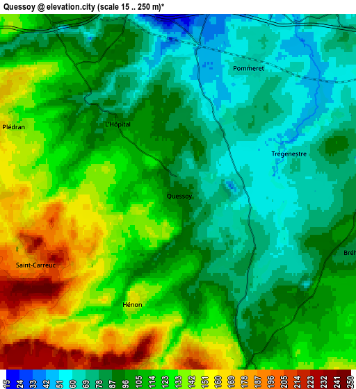
| Scale [m] | 41..186 m | 15..250 m | × |
| Scale [ft] | 135..610 ft | 49..820 ft | × |
| Average | 94.8 m = 311 ft | 107.3 m = 352 ft | × |
| Width | 6.49 km = 4 mi | 12.97 km = 8.1 mi | 207.5 km = 128.9 mi |
| Height | 6.49 km = 4 mi | 12.97 km = 8.1 mi | 207.5 km = 128.9 mi |
| ↑Max Latitude | 48.451235° | 48.480374° | 49.34677° |
| Latitude at center | 48.42208° | 48.42208° | 48.42208° |
| ↓Min Latitude | 48.392908° | 48.363719° | 47.48026° |
| ← Min Longitude | -2.704835° | -2.748781° | -4.06714° |
| Longitude center | -2.66089° | -2.66089° | -2.66089° |
| →Max Longitude | -2.616945° | -2.572999° | -1.25464° |
Nearby cities:
Cities around Quessoy sort by population:
• Langueux elevation 99 m
9.2 km,  332°
332°
• Plédran 153 m
6.9 km,  292°
292°
• Yffiniac 11 m
7 km,  350°
350°
• Hillion 27 m
10.3 km,  357°
357°
• Plœuc-sur-Lié 202 m
10.4 km,  219°
219°
• Pommeret 66 m
5.3 km,  28°
28°
• Hénon 150 m
4.5 km,  201°
201°
• Plémy 233 m
9.7 km,  189°
189°
• Bréhand 84 m
6.7 km,  108°
108°
• Coëtmieux 54 m
8.9 km, 30°
• Saint-Carreuc 196 m
5.8 km,  243°
243°
• Landéhen 84 m
9 km,  84°
84°
Multilingual:
 En español:
Quessoy elevación 93 m.
 En France:
Quessoy élévation 93 m.


Sources and notes:
- [note 1] Map square and city borders are not equal. Map elevation data is calculated only from area inside that square.
- [src 1] Elevation data from geonames database provided with same terms of usage.
- [src 2] The elevation map of Quessoy is generated using elevation data from NASA's 3 arcsec (90m) resolution SRTM data.
- [src 3] Base (background) map © OpenStreetMap contributors tiles are generated by Geofabrik and OpenTopoMap.
Copyright & License:
This Quessoy Elevation Map is licensed under CC BY-SA. You may reuse any part from this page, if you give a proper credit by linking to this URL:
 More info on terms of use page.