Yffiniac elevation
Yffiniac (Brittany, Département des Côtes-d’Armor), France elevation is 11 meters and Yffiniac elevation in feet is 36 ft above sea level [src 1]. Yffiniac is a populated place (feature code) with elevation that is 163 meters (535 ft) smaller than average city elevation in France.
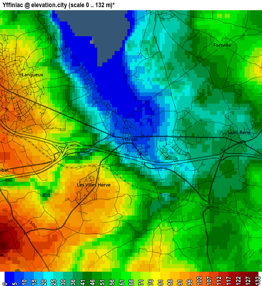
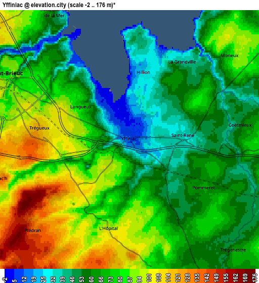
Below is the Elevation map of Yffiniac, which displays elevation range with different colors. Scale of the first map is from 0 to 132 m (0 to 433 ft) with average elevation of 54.4 meters (=178 ft) [note 1]
These maps also provides idea of topography and contour of this city, they are displayed at different zoom levels. More info about maps, scale and edge coordinates you can find below images.
| \ | Map #1 | Map #2 | Topo.Map |
| Scale [m] | 0..132 m | -2..176 m | × |
| Scale [ft] | 0..433 ft | -7..577 ft | × |
| Average | 54.4 m = 178 ft | 73.8 m = 242 ft | × |
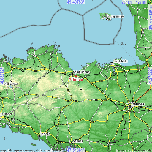
| Width | 6.48 km = 4 mi | 12.96 km = 8.1 mi | 207.3 km = 128.8 mi |
| Height | 6.48 km = 4 mi | 12.96 km = 8.1 mi | 207.3 km = 128.8 mi |
| ↑Max Latitude | 48.5134° | 48.542503° | 49.40783° |
| Latitude at center | 48.48428° | 48.48428° | 48.48428° |
| ↓Min Latitude | 48.455144° | 48.42599° | 47.54361° |
| ← Min Longitude | -2.720415° | -2.764361° | -4.08272° |
| Longitude center | -2.67647° | -2.67647° | -2.67647° |
| →Max Longitude | -2.632525° | -2.588579° | -1.27022° |
Nearby cities:
Cities around Yffiniac sort by population:
• Saint-Brieuc elevation 96 m
7.6 km,  296°
296°
• Plérin 106 m
10 km,  310°
310°
• Ploufragan 128 m
8.7 km,  275°
275°
• Langueux 99 m
3.3 km,  291°
291°
• Plédran 153 m
6.7 km,  230°
230°
• Hillion 27 m
3.4 km,  12°
12°
• Quessoy 93 m
7 km,  170°
170°
• Saint-Julien 161 m
10.7 km,  249°
249°
• Pommeret 66 m
4.3 km,  121°
121°
• Planguenoual 80 m
9.1 km,  53°
53°
• Coëtmieux 54 m
5.6 km,  82°
82°
• Saint-Carreuc 196 m
10.3 km,  202°
202°
Multilingual:
 En español:
Yffiniac elevación 11 m.
 En France:
Yffiniac élévation 11 m.


Sources and notes:
- [note 1] Map square and city borders are not equal. Map elevation data is calculated only from area inside that square.
- [src 1] Elevation data from geonames database provided with same terms of usage.
- [src 2] The elevation map of Yffiniac is generated using elevation data from NASA's 3 arcsec (90m) resolution SRTM data.
- [src 3] Base (background) map © OpenStreetMap contributors tiles are generated by Geofabrik and OpenTopoMap.
Copyright & License:
This Yffiniac Elevation Map is licensed under CC BY-SA. You may reuse any part from this page, if you give a proper credit by linking to this URL:
 More info on terms of use page.