Montescourt-Lizerolles elevation
Montescourt-Lizerolles (Hauts-de-France, Département de l'Aisne), France elevation is 76 meters and Montescourt-Lizerolles elevation in feet is 249 ft above sea level [src 1]. Montescourt-Lizerolles is a populated place (feature code) with elevation that is 98 meters (322 ft) smaller than average city elevation in France.
Below is the Elevation map of Montescourt-Lizerolles, which displays elevation range with different colors. Scale of the first map is from 61 to 114 m (200 to 374 ft) with average elevation of 81.4 meters (=267 ft) [note 1]
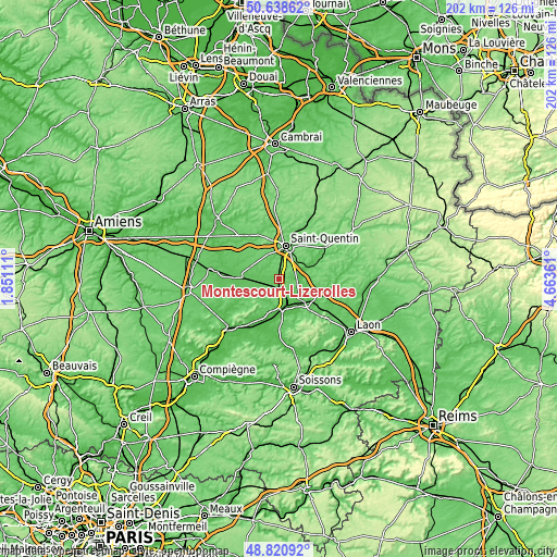
These maps also provides idea of topography and contour of this city, they are displayed at different zoom levels. More info about maps, scale and edge coordinates you can find below images.
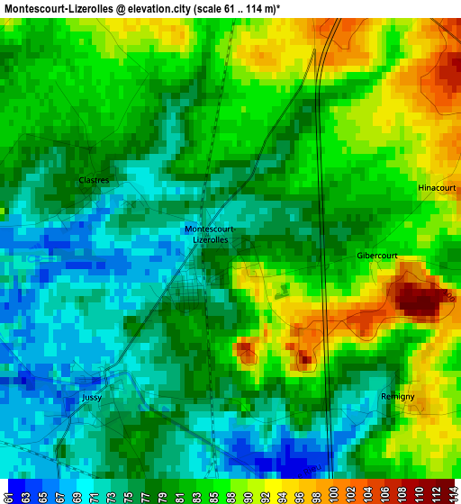
| \ | Map #1 | Topo.Map |
| Scale [m] | 61..114 m | × |
| Scale [ft] | 200..374 ft | × |
| Average | 81.4 m = 267 ft | × |
| Width | 6.32 km = 3.9 mi | 202.1 km = 125.6 mi |
| Height | 6.32 km = 3.9 mi | 202.1 km = 125.6 mi |
| ↑Max Latitude | 49.766673° | 50.63862° |
| Latitude at center | 49.73828° | 49.73828° |
| ↓Min Latitude | 49.709871° | 48.82092° |
| ← Min Longitude | 3.213415° | 1.85111° |
| Longitude center | 3.25736° | 3.25736° |
| →Max Longitude | 3.301305° | 4.66361° |
Nearby cities:
Cities around Montescourt-Lizerolles sort by population:
• Saint-Quentin elevation 106 m
12.5 km,  9°
9°
• Tergnier 55 m
9.7 km,  161°
161°
• Gauchy 76 m
10 km, 6°
• Beautor 51 m
11.5 km,  146°
146°
• La Fère 52 m
11.5 km,  136°
136°
• Viry-Noureuil 54 m
11.8 km,  184°
184°
• Harly 95 m
11.7 km,  18°
18°
• Flavy-le-Martel 71 m
5.5 km,  239°
239°
• Jussy 72 m
2.7 km,  220°
220°
• Essigny-le-Grand 107 m
4.7 km, 18°
• Itancourt 118 m
9.8 km,  39°
39°
• Étreillers 99 m
12.4 km,  325°
325°
Multilingual:
 En español:
Montescourt-Lizerolles elevación 76 m.
 En France:
Montescourt-Lizerolles élévation 76 m.
 Auf Deutsch:
Montescourt-Lizerolles höhe über dem Meeresspiegel ist 76 m.
 На русском:
Montescourt-Lizerolles высота над уровнем моря 76 м
Sources and notes:
- [note 1] Map square and city borders are not equal. Map elevation data is calculated only from area inside that square.
- [src 1] Elevation data from geonames database provided with same terms of usage.
- [src 2] The elevation map of Montescourt-Lizerolles is generated using elevation data from NASA's 3 arcsec (90m) resolution SRTM data.
- [src 3] Base (background) map © OpenStreetMap contributors tiles are generated by Geofabrik and OpenTopoMap.
Copyright & License:
This Montescourt-Lizerolles Elevation Map is licensed under CC BY-SA. You may reuse any part from this page, if you give a proper credit by linking to this URL:
 More info on terms of use page.