Gauchy elevation
Gauchy (Hauts-de-France, Département de l'Aisne), France elevation is 76 meters and Gauchy elevation in feet is 249 ft above sea level [src 1]. Gauchy is a populated place (feature code) with elevation that is 98 meters (322 ft) smaller than average city elevation in France.
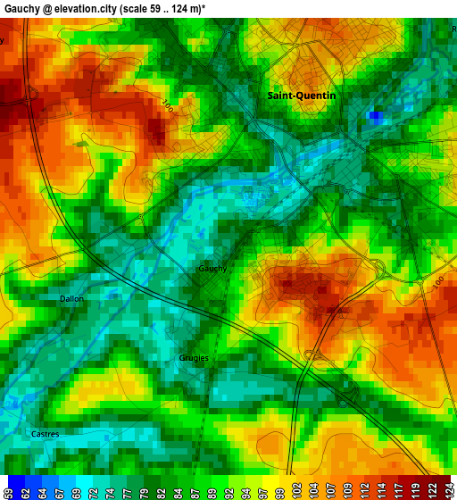
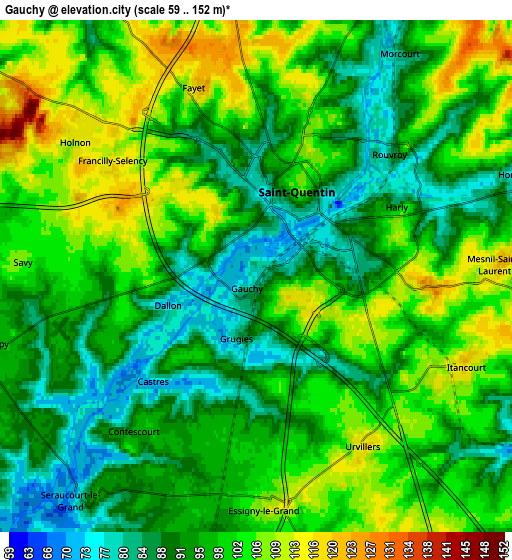
Below is the Elevation map of Gauchy, which displays elevation range with different colors. Scale of the first map is from 59 to 124 m (194 to 407 ft) with average elevation of 90 meters (=295 ft) [note 1]
These maps also provides idea of topography and contour of this city, they are displayed at different zoom levels. More info about maps, scale and edge coordinates you can find below images.
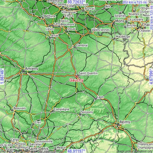
| \ | Map #1 | Map #2 | Topo.Map |
| Scale [m] | 59..124 m | 59..152 m | × |
| Scale [ft] | 194..407 ft | 194..499 ft | × |
| Average | 90 m = 295 ft | 97.3 m = 319 ft | × |
| Width | 6.3 km = 3.9 mi | 12.61 km = 7.8 mi | 201.7 km = 125.3 mi |
| Height | 6.3 km = 3.9 mi | 12.61 km = 7.8 mi | 201.7 km = 125.3 mi |
| ↑Max Latitude | 49.85599° | 49.884314° | 50.72632° |
| Latitude at center | 49.82765° | 49.82765° | 49.82765° |
| ↓Min Latitude | 49.799293° | 49.770919° | 48.91197° |
| ← Min Longitude | 3.229765° | 3.185819° | 1.86746° |
| Longitude center | 3.27371° | 3.27371° | 3.27371° |
| →Max Longitude | 3.317655° | 3.361601° | 4.67996° |
Nearby cities:
Cities around Gauchy sort by population:
• Saint-Quentin elevation 106 m
2.6 km,  22°
22°
• Ribemont 83 m
13.8 km,  105°
105°
• Harly 95 m
2.8 km,  66°
66°
• Montescourt-Lizerolles 76 m
10 km,  186°
186°
• Homblières 82 m
7 km, 68°
• Holnon 115 m
5.6 km,  311°
311°
• Jussy 72 m
12.3 km, 193°
• Essigny-le-Grand 107 m
5.5 km,  176°
176°
• Vermand 89 m
10.4 km,  300°
300°
• Omissy 77 m
6.2 km,  26°
26°
• Itancourt 118 m
5.6 km, 114°
• Étreillers 99 m
8.1 km,  272°
272°
Multilingual:
 En español:
Gauchy elevación 76 m.
 En France:
Gauchy élévation 76 m.


Sources and notes:
- [note 1] Map square and city borders are not equal. Map elevation data is calculated only from area inside that square.
- [src 1] Elevation data from geonames database provided with same terms of usage.
- [src 2] The elevation map of Gauchy is generated using elevation data from NASA's 3 arcsec (90m) resolution SRTM data.
- [src 3] Base (background) map © OpenStreetMap contributors tiles are generated by Geofabrik and OpenTopoMap.
Copyright & License:
This Gauchy Elevation Map is licensed under CC BY-SA. You may reuse any part from this page, if you give a proper credit by linking to this URL:
 More info on terms of use page.