Montmorot elevation
Montmorot (Bourgogne-Franche-Comté, Jura), France elevation is 236 meters and Montmorot elevation in feet is 774 ft above sea level [src 1]. Montmorot is a populated place (feature code) with elevation that is 62 meters (203 ft) bigger than average city elevation in France.
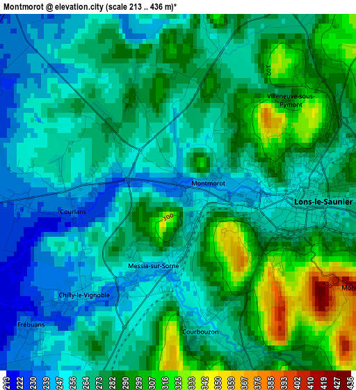
Below is the Elevation map of Montmorot, which displays elevation range with different colors. Scale of the first map is from 213 to 436 m (699 to 1430 ft) with average elevation of 272.6 meters (=894 ft) [note 1]
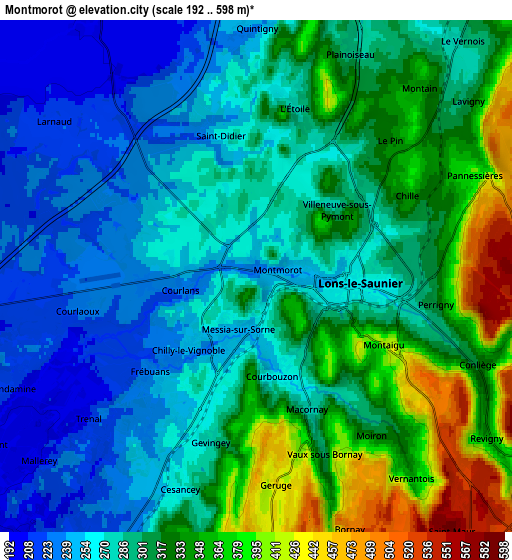
These maps also provides idea of topography and contour of this city, they are displayed at different zoom levels. More info about maps, scale and edge coordinates you can find below images.
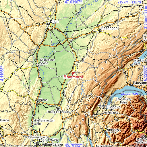
| \ | Map #1 | Map #2 | Topo.Map |
| Scale [m] | 213..436 m | 192..598 m | × |
| Scale [ft] | 699..1430 ft | 630..1962 ft | × |
| Average | 272.6 m = 894 ft | 299.8 m = 984 ft | × |
| Width | 6.71 km = 4.2 mi | 13.41 km = 8.3 mi | 214.6 km = 133.3 mi |
| Height | 6.71 km = 4.2 mi | 13.41 km = 8.3 mi | 214.6 km = 133.3 mi |
| ↑Max Latitude | 46.705554° | 46.735681° | 47.63167° |
| Latitude at center | 46.67541° | 46.67541° | 46.67541° |
| ↓Min Latitude | 46.645249° | 46.615072° | 45.70192° |
| ← Min Longitude | 5.478885° | 5.434939° | 4.11658° |
| Longitude center | 5.52283° | 5.52283° | 5.52283° |
| →Max Longitude | 5.566775° | 5.610721° | 6.92908° |
Nearby cities:
Cities around Montmorot sort by population:
• Lons-le-Saunier elevation 275 m
2.5 km,  90°
90°
• Louhans 180 m
23.4 km,  256°
256°
• Poligny 321 m
22.7 km,  37°
37°
• Saint-Germain-du-Bois 211 m
22.8 km,  292°
292°
• Cuiseaux 283 m
22.5 km,  206°
206°
• Perrigny 309 m
4.8 km,  100°
100°
• Orgelet 507 m
18.4 km,  158°
158°
• Clairvaux-les-Lacs 536 m
20.5 km,  123°
123°
• Bletterans 201 m
9.5 km,  326°
326°
• Cousance 245 m
18.7 km, 212°
• Sagy 202 m
18.2 km,  243°
243°
• Saint-Usuge 200 m
20.7 km,  271°
271°
Multilingual:
 En español:
Montmorot elevación 236 m.
 En France:
Montmorot élévation 236 m.
 Auf Deutsch:
Montmorot höhe über dem Meeresspiegel ist 236 m.

Sources and notes:
- [note 1] Map square and city borders are not equal. Map elevation data is calculated only from area inside that square.
- [src 1] Elevation data from geonames database provided with same terms of usage.
- [src 2] The elevation map of Montmorot is generated using elevation data from NASA's 3 arcsec (90m) resolution SRTM data.
- [src 3] Base (background) map © OpenStreetMap contributors tiles are generated by Geofabrik and OpenTopoMap.
Copyright & License:
This Montmorot Elevation Map is licensed under CC BY-SA. You may reuse any part from this page, if you give a proper credit by linking to this URL:
 More info on terms of use page.