Poligny elevation
Poligny (Bourgogne-Franche-Comté, Jura), France elevation is 321 meters and Poligny elevation in feet is 1053 ft above sea level [src 1]. Poligny is a populated place (feature code) with elevation that is 147 meters (482 ft) bigger than average city elevation in France.
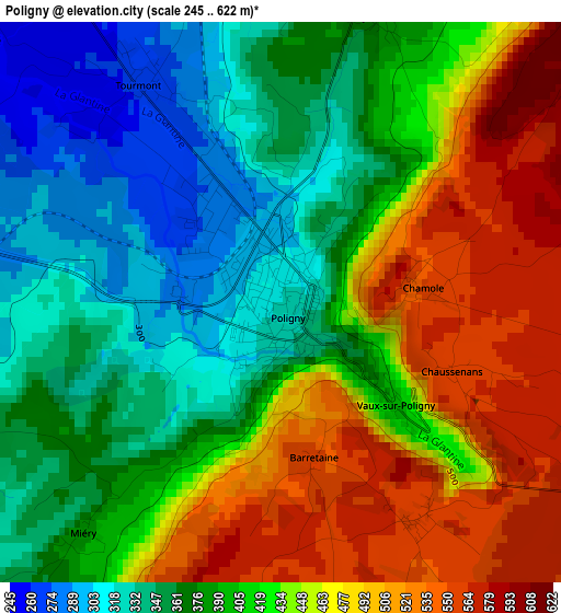
Below is the Elevation map of Poligny, which displays elevation range with different colors. Scale of the first map is from 245 to 622 m (804 to 2041 ft) with average elevation of 415.5 meters (=1363 ft) [note 1]
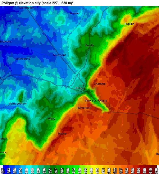
These maps also provides idea of topography and contour of this city, they are displayed at different zoom levels. More info about maps, scale and edge coordinates you can find below images.
| \ | Map #1 | Map #2 | Topo.Map |
| Scale [m] | 245..622 m | 227..630 m | × |
| Scale [ft] | 804..2041 ft | 745..2067 ft | × |
| Average | 415.5 m = 1363 ft | 430.2 m = 1411 ft | × |
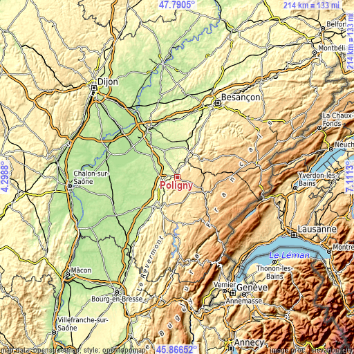
| Width | 6.69 km = 4.2 mi | 13.37 km = 8.3 mi | 213.9 km = 132.9 mi |
| Height | 6.69 km = 4.2 mi | 13.37 km = 8.3 mi | 213.9 km = 132.9 mi |
| ↑Max Latitude | 46.867173° | 46.89721° | 47.7905° |
| Latitude at center | 46.83712° | 46.83712° | 46.83712° |
| ↓Min Latitude | 46.80705° | 46.776963° | 45.86652° |
| ← Min Longitude | 5.661105° | 5.617159° | 4.2988° |
| Longitude center | 5.70505° | 5.70505° | 5.70505° |
| →Max Longitude | 5.748995° | 5.792941° | 7.1113° |
Nearby cities:
Cities around Poligny sort by population:
• Lons-le-Saunier elevation 275 m
21.3 km,  212°
212°
• Champagnole 540 m
18.9 km,  122°
122°
• Arbois 297 m
9 km,  35°
35°
• Montmorot 236 m
22.7 km,  217°
217°
• Salins-les-Bains 326 m
17.9 km,  47°
47°
• Perrigny 309 m
21 km, 205°
• Chaussin 189 m
26.7 km,  302°
302°
• Clairvaux-les-Lacs 536 m
29.4 km,  173°
173°
• Mouchard 278 m
16.6 km,  24°
24°
• Bletterans 201 m
21.6 km,  242°
242°
• Arc-et-Senans 232 m
22.1 km,  12°
12°
• Mont-sous-Vaudrey 217 m
17.6 km,  333°
333°
Multilingual:
 En español:
Poligny elevación 321 m.
 En France:
Poligny élévation 321 m.


Sources and notes:
- [note 1] Map square and city borders are not equal. Map elevation data is calculated only from area inside that square.
- [src 1] Elevation data from geonames database provided with same terms of usage.
- [src 2] The elevation map of Poligny is generated using elevation data from NASA's 3 arcsec (90m) resolution SRTM data.
- [src 3] Base (background) map © OpenStreetMap contributors tiles are generated by Geofabrik and OpenTopoMap.
Copyright & License:
This Poligny Elevation Map is licensed under CC BY-SA. You may reuse any part from this page, if you give a proper credit by linking to this URL:
 More info on terms of use page.