Mouroux elevation
Mouroux (Île-de-France, Seine-et-Marne), France elevation is 76 meters and Mouroux elevation in feet is 249 ft above sea level [src 1]. Mouroux is a populated place (feature code) with elevation that is 98 meters (322 ft) smaller than average city elevation in France.
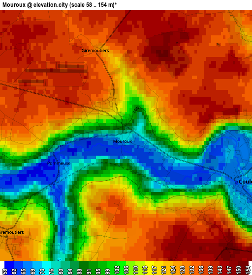
Below is the Elevation map of Mouroux, which displays elevation range with different colors. Scale of the first map is from 58 to 154 m (190 to 505 ft) with average elevation of 117.4 meters (=385 ft) [note 1]
These maps also provides idea of topography and contour of this city, they are displayed at different zoom levels. More info about maps, scale and edge coordinates you can find below images.
| \ | Map #1 | Map #2 | Topo.Map |
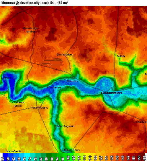
| Scale [m] | 58..154 m | 54..159 m | × |
| Scale [ft] | 190..505 ft | 177..522 ft | × |
| Average | 117.4 m = 385 ft | 125.1 m = 410 ft | × |
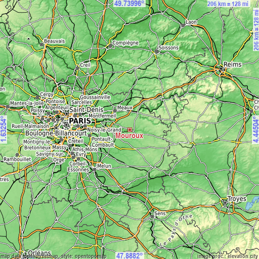
| Width | 6.43 km = 4 mi | 12.87 km = 8 mi | 205.9 km = 127.9 mi |
| Height | 6.43 km = 4 mi | 12.87 km = 8 mi | 205.9 km = 127.9 mi |
| ↑Max Latitude | 48.851555° | 48.880463° | 49.73996° |
| Latitude at center | 48.82263° | 48.82263° | 48.82263° |
| ↓Min Latitude | 48.793688° | 48.76473° | 47.8882° |
| ← Min Longitude | 2.994845° | 2.950899° | 1.63254° |
| Longitude center | 3.03879° | 3.03879° | 3.03879° |
| →Max Longitude | 3.082735° | 3.126681° | 4.44504° |
Nearby cities:
Cities around Mouroux sort by population:
• Coulommiers elevation 79 m
3.5 km,  104°
104°
• La Chapelle-sur-Crécy 62 m
9.2 km,  295°
295°
• Boissy-le-Châtel 116 m
7.2 km,  91°
91°
• Pommeuse 70 m
1.7 km,  247°
247°
• Faremoutiers 126 m
4 km,  230°
230°
• Guérard 71 m
5.8 km,  268°
268°
• Saint-Augustin 123 m
4.4 km,  188°
188°
• Chailly-en-Brie 141 m
7.2 km,  119°
119°
• Mortcerf 123 m
9.7 km, 247°
• Saints 120 m
6.9 km,  175°
175°
• La Celle-sur-Morin 81 m
5.2 km,  256°
256°
• Touquin 113 m
9.9 km, 191°
Multilingual:
 En español:
Mouroux elevación 76 m.
 En France:
Mouroux élévation 76 m.


Sources and notes:
- [note 1] Map square and city borders are not equal. Map elevation data is calculated only from area inside that square.
- [src 1] Elevation data from geonames database provided with same terms of usage.
- [src 2] The elevation map of Mouroux is generated using elevation data from NASA's 3 arcsec (90m) resolution SRTM data.
- [src 3] Base (background) map © OpenStreetMap contributors tiles are generated by Geofabrik and OpenTopoMap.
Copyright & License:
This Mouroux Elevation Map is licensed under CC BY-SA. You may reuse any part from this page, if you give a proper credit by linking to this URL:
 More info on terms of use page.