Coulommiers elevation
Coulommiers (Île-de-France, Seine-et-Marne), France elevation is 79 meters and Coulommiers elevation in feet is 259 ft above sea level [src 1]. Coulommiers is a populated place (feature code) with elevation that is 95 meters (312 ft) smaller than average city elevation in France.
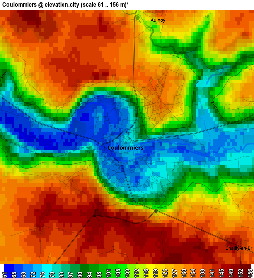
Below is the Elevation map of Coulommiers, which displays elevation range with different colors. Scale of the first map is from 61 to 156 m (200 to 512 ft) with average elevation of 115 meters (=377 ft) [note 1]
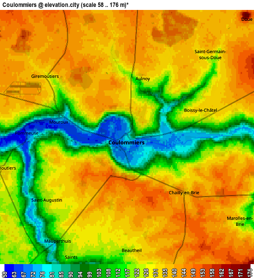
These maps also provides idea of topography and contour of this city, they are displayed at different zoom levels. More info about maps, scale and edge coordinates you can find below images.
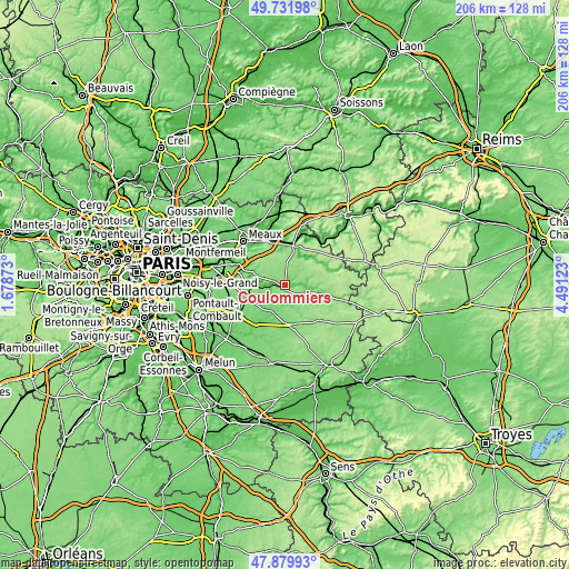
| \ | Map #1 | Map #2 | Topo.Map |
| Scale [m] | 61..156 m | 58..176 m | × |
| Scale [ft] | 200..512 ft | 190..577 ft | × |
| Average | 115 m = 377 ft | 126.3 m = 414 ft | × |
| Width | 6.44 km = 4 mi | 12.87 km = 8 mi | 205.9 km = 127.9 mi |
| Height | 6.44 km = 4 mi | 12.87 km = 8 mi | 205.9 km = 127.9 mi |
| ↑Max Latitude | 48.84344° | 48.872352° | 49.73198° |
| Latitude at center | 48.81451° | 48.81451° | 48.81451° |
| ↓Min Latitude | 48.785564° | 48.756601° | 47.87993° |
| ← Min Longitude | 3.041035° | 2.997089° | 1.67873° |
| Longitude center | 3.08498° | 3.08498° | 3.08498° |
| →Max Longitude | 3.128925° | 3.172871° | 4.49123° |
Nearby cities:
Cities around Coulommiers sort by population:
• Mouroux elevation 76 m
3.5 km,  284°
284°
• Boissy-le-Châtel 116 m
3.8 km,  79°
79°
• Pommeuse 70 m
5 km,  272°
272°
• Faremoutiers 126 m
6.7 km,  255°
255°
• Guérard 71 m
9.2 km, 274°
• Rebais 155 m
11.4 km,  71°
71°
• Saint-Augustin 123 m
5.3 km,  229°
229°
• Chailly-en-Brie 141 m
4 km,  133°
133°
• Saints 120 m
6.6 km,  205°
205°
• La Celle-sur-Morin 81 m
8.5 km, 267°
• Touquin 113 m
10.3 km, 211°
• Doue 144 m
8.1 km,  44°
44°
Multilingual:
 En español:
Coulommiers elevación 79 m.
 En France:
Coulommiers élévation 79 m.
 Auf Deutsch:
Coulommiers höhe über dem Meeresspiegel ist 79 m.

Sources and notes:
- [note 1] Map square and city borders are not equal. Map elevation data is calculated only from area inside that square.
- [src 1] Elevation data from geonames database provided with same terms of usage.
- [src 2] The elevation map of Coulommiers is generated using elevation data from NASA's 3 arcsec (90m) resolution SRTM data.
- [src 3] Base (background) map © OpenStreetMap contributors tiles are generated by Geofabrik and OpenTopoMap.
Copyright & License:
This Coulommiers Elevation Map is licensed under CC BY-SA. You may reuse any part from this page, if you give a proper credit by linking to this URL:
 More info on terms of use page.