La Chapelle-sur-Crécy elevation
La Chapelle-sur-Crécy (Île-de-France, Seine-et-Marne), France elevation is 62 meters and La Chapelle-sur-Crécy elevation in feet is 203 ft above sea level [src 1]. La Chapelle-sur-Crécy is a populated place (feature code) with elevation that is 112 meters (367 ft) smaller than average city elevation in France.
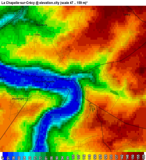
Below is the Elevation map of La Chapelle-sur-Crécy, which displays elevation range with different colors. Scale of the first map is from 47 to 159 m (154 to 522 ft) with average elevation of 112.9 meters (=370 ft) [note 1]
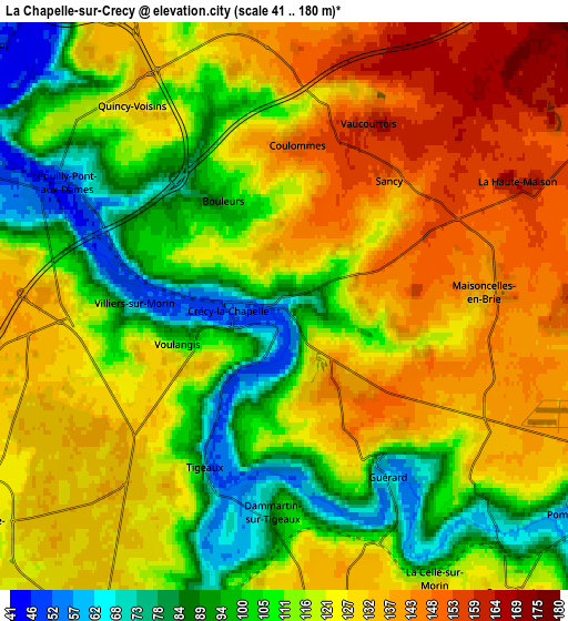
These maps also provides idea of topography and contour of this city, they are displayed at different zoom levels. More info about maps, scale and edge coordinates you can find below images.
| \ | Map #1 | Map #2 | Topo.Map |
| Scale [m] | 47..159 m | 41..180 m | × |
| Scale [ft] | 154..522 ft | 135..591 ft | × |
| Average | 112.9 m = 370 ft | 119 m = 390 ft | × |
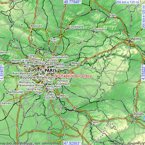
| Width | 6.43 km = 4 mi | 12.86 km = 8 mi | 205.7 km = 127.8 mi |
| Height | 6.43 km = 4 mi | 12.86 km = 8 mi | 205.7 km = 127.8 mi |
| ↑Max Latitude | 48.887694° | 48.916581° | 49.77545° |
| Latitude at center | 48.85879° | 48.85879° | 48.85879° |
| ↓Min Latitude | 48.829869° | 48.800932° | 47.92503° |
| ← Min Longitude | 2.882025° | 2.838079° | 1.51972° |
| Longitude center | 2.92597° | 2.92597° | 2.92597° |
| →Max Longitude | 2.969915° | 3.013861° | 4.33222° |
Nearby cities:
Cities around La Chapelle-sur-Crécy sort by population:
• Quincy-Voisins elevation 130 m
6 km,  321°
321°
• Bailly-Romainvilliers 136 m
7.6 km,  260°
260°
• Montry 59 m
7.6 km,  291°
291°
• Saint-Germain-sur-Morin 48 m
6.1 km,  295°
295°
• Guérard 71 m
4.9 km,  149°
149°
• Couilly-Pont-aux-Dames 48 m
5.8 km, 299°
• Villiers-sur-Morin 52 m
3.5 km,  273°
273°
• Condé-Sainte-Libiaire 76 m
7.6 km, 303°
• Mortcerf 123 m
7.8 km,  184°
184°
• Voulangis 93 m
2.3 km,  252°
252°
• Bouleurs 99 m
2.9 km,  331°
331°
• La Celle-sur-Morin 81 m
6.1 km, 148°
Multilingual:
 En español:
La Chapelle-sur-Crécy elevación 62 m.
 En France:
La Chapelle-sur-Crécy élévation 62 m.
 Auf Deutsch:
La Chapelle-sur-Crécy höhe über dem Meeresspiegel ist 62 m.
 На русском:
La Chapelle-sur-Crécy высота над уровнем моря 62 м
Sources and notes:
- [note 1] Map square and city borders are not equal. Map elevation data is calculated only from area inside that square.
- [src 1] Elevation data from geonames database provided with same terms of usage.
- [src 2] The elevation map of La Chapelle-sur-Crécy is generated using elevation data from NASA's 3 arcsec (90m) resolution SRTM data.
- [src 3] Base (background) map © OpenStreetMap contributors tiles are generated by Geofabrik and OpenTopoMap.
Copyright & License:
This La Chapelle-sur-Crécy Elevation Map is licensed under CC BY-SA. You may reuse any part from this page, if you give a proper credit by linking to this URL:
 More info on terms of use page.