Néville elevation
Néville (Normandy, Seine-Maritime), France elevation is 71 meters and Néville elevation in feet is 233 ft above sea level [src 1]. Néville is a populated place (feature code) with elevation that is 103 meters (338 ft) smaller than average city elevation in France.
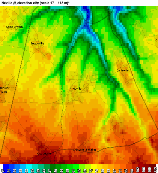
Below is the Elevation map of Néville, which displays elevation range with different colors. Scale of the first map is from 17 to 113 m (56 to 371 ft) with average elevation of 75 meters (=246 ft) [note 1]
These maps also provides idea of topography and contour of this city, they are displayed at different zoom levels. More info about maps, scale and edge coordinates you can find below images.
| \ | Map #1 | Topo.Map |
| Scale [m] | 17..113 m | × |
| Scale [ft] | 56..371 ft | × |
| Average | 75 m = 246 ft | × |
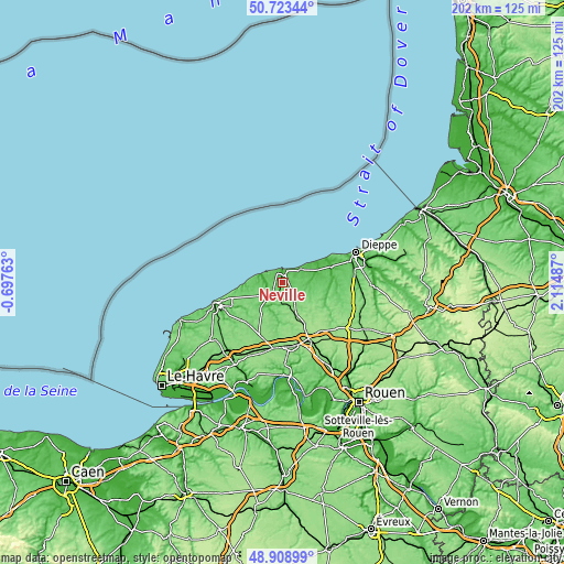
| Width | 6.3 km = 3.9 mi | 201.7 km = 125.3 mi |
| Height | 6.3 km = 3.9 mi | 201.7 km = 125.3 mi |
| ↑Max Latitude | 49.853062° | 50.72344° |
| Latitude at center | 49.82472° | 49.82472° |
| ↓Min Latitude | 49.796361° | 48.90899° |
| ← Min Longitude | 0.664675° | -0.69763° |
| Longitude center | 0.70862° | 0.70862° |
| →Max Longitude | 0.752565° | 2.11487° |
Nearby cities:
Cities around Néville sort by population:
• Saint-Valery-en-Caux elevation 68 m
5 km,  20°
20°
• Cany-Barville 17 m
6.5 km,  232°
232°
• Doudeville 122 m
12.6 km,  154°
154°
• Yerville 161 m
22.1 km,  142°
142°
• Luneray 76 m
14.9 km,  88°
88°
• Fauville-en-Caux 129 m
20.9 km,  203°
203°
• Bacqueville-en-Caux 97 m
21.3 km,  101°
101°
• Sainte-Marie-des-Champs 149 m
23.2 km,  167°
167°
• Varengeville-sur-Mer 94 m
22.4 km,  66°
66°
• Grainville-la-Teinturière 37 m
9.9 km,  209°
209°
• Ourville-en-Caux 118 m
13 km, 214°
• Fontaine-le-Dun 53 m
10.3 km, 97°
Multilingual:
 En español:
Néville elevación 71 m.
 En France:
Néville élévation 71 m.


Sources and notes:
- [note 1] Map square and city borders are not equal. Map elevation data is calculated only from area inside that square.
- [src 1] Elevation data from geonames database provided with same terms of usage.
- [src 2] The elevation map of Néville is generated using elevation data from NASA's 3 arcsec (90m) resolution SRTM data.
- [src 3] Base (background) map © OpenStreetMap contributors tiles are generated by Geofabrik and OpenTopoMap.
Copyright & License:
This Néville Elevation Map is licensed under CC BY-SA. You may reuse any part from this page, if you give a proper credit by linking to this URL:
 More info on terms of use page.